
A line of strong thunderstorms develop along a cold front late on Saturday night with widespread showers and thunderstorms along and ahead of the front.
The storms brought severe weather to most of our area with numerous reports of wind damage from NW Arkansas into the River Valley & beyond.
Was it a tornado? Probably not. The National Weather Service currently has no plans to survey the damage since the photos and the radar data both strongly support straight-line-winds.
This is a look at the storms as they moved into our area. The typical storms that produced the tornadoes in Spring are often individual storms called "supercells" which occur ahead of the main line of storms. They have unrestricted access to moisture, instability, & lift and produce the most violent tornadoes. Supercells usually have one updraft and one downdraft. The tornado forms at the bottom of the updraft.
Storms that form in a line are known for their damaging wind potential. These storms have updrafts that form on the leading edge as cool air undercuts warm air and forces air to the level at which it continues to rise on its own.
Squall lines usually do no produce strong-violent tornadoes.
The exception is usually weak "squall line tornadoes" that form on the leading edge of the line where low-level shear is strongest. These tornadoes are often very brief (sometimes even occurring between scans) and are weak EF-0 or sometimes EF-1 tornadoes. Normally the winds are between 60-110mph.
A precursor to squall line tornadoes are usually forward surges in the line which causes pockets of broad rotation. This usually results in an enhanced area of damaging winds.
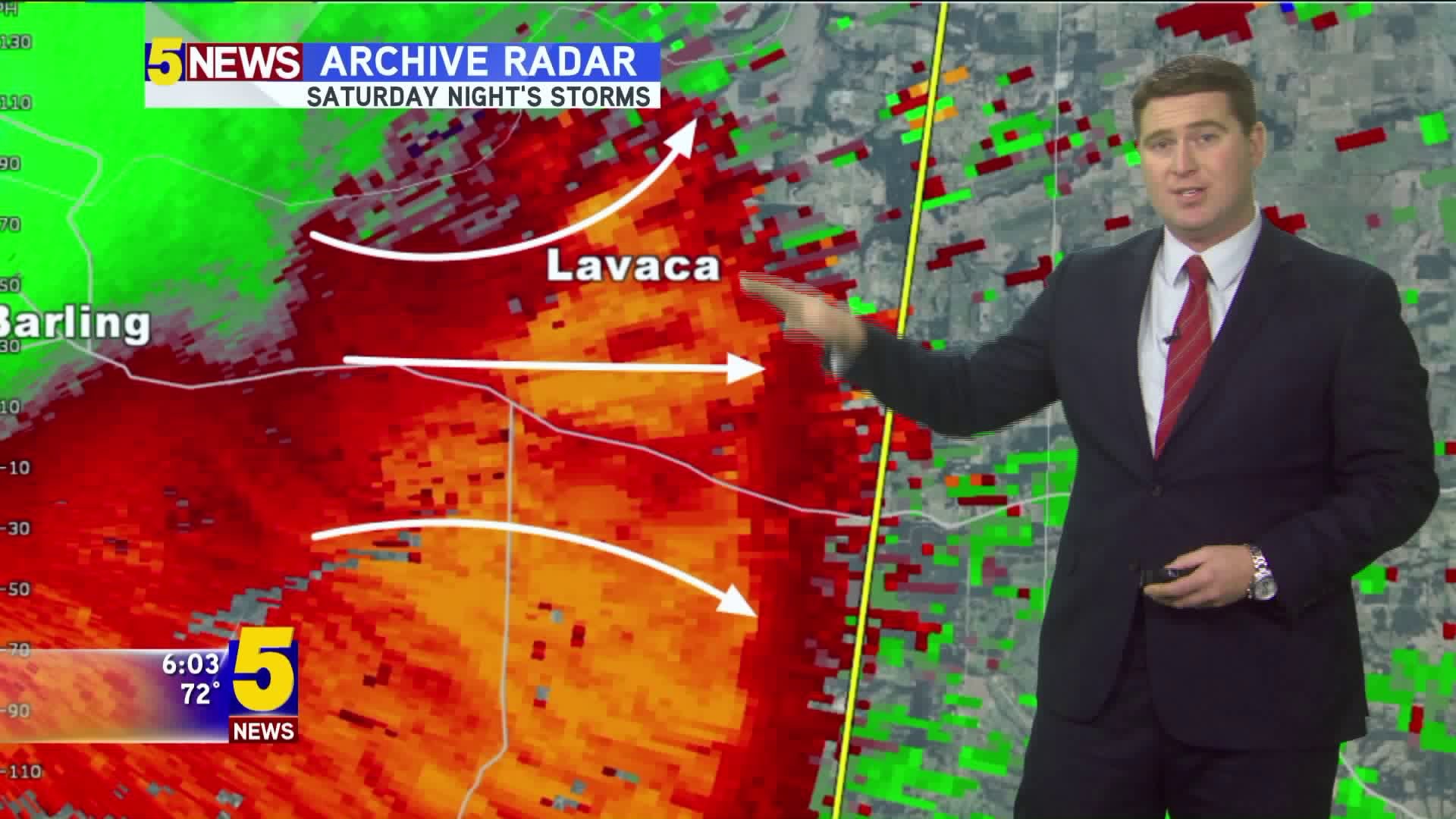
This is a look at the storms as they neared Lavaca and Charleston late on Saturday night.
The red colors show the forward surge of winds; I would expect damage all down Hwy 22.
There are some pixels in this radar image over 80mph. These are wind speeds consistent with what you would expect from a weak tornado.
Some people simply cannot believe that wind alone can do widespread damage; I would argue that the damage wind was worse than a tornado because it was over a much larger area. Tornado damage is usually confined to a small area. This is why some houses get damage and others don't. In an even like Saturday the damage was over a very large area and consistent with damaging winds from the line.
As the wind surges there will be changes in direction (we refer to as perturbations) in the mean flow.
This is why debris and trees can be twisted or placed in different directions.
-Garrett