
The weather pattern going into the upcoming winter season shows a colder and snowier winter than last year. The next few months will be influenced by a weak La Nina pattern in the Pacific which could in-turn alter the path of the jet stream across the United States.
While this winter will likely be colder than last year, it may still trend above normal as an average. There are no signals for sustained cold across our area for the next four months. Instead it's likely the cold will set-up for several days at a time followed by a warming trend with many swings back and forth into February.
There are some signals for a wetter pattern and late-season cold spell somewhere towards the end of February and early March which could also lead to (at least the chance) for an accumulating snow occurring late in the season.
Here are the main points for our upcoming winter season:
- Colder than last year but still somewhat above the normal
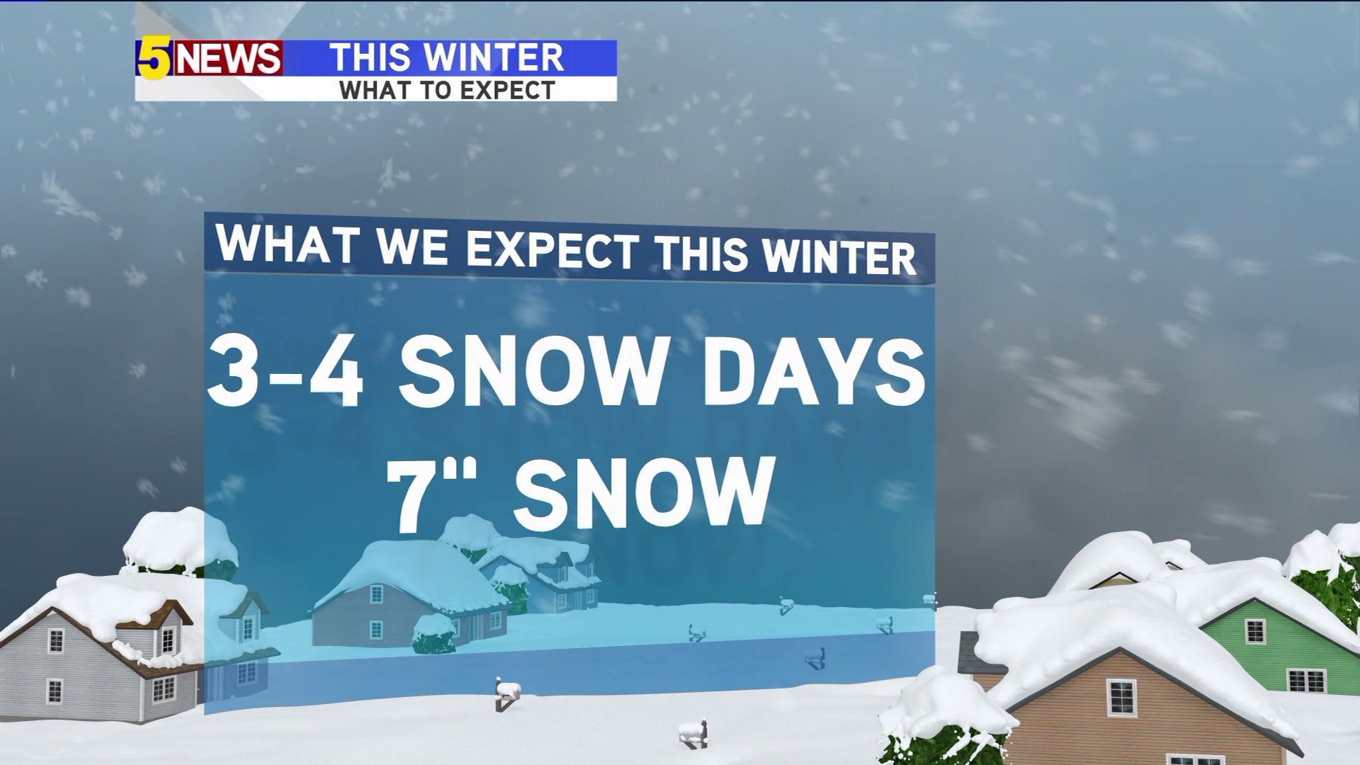
- 3-4 days with measurable snow; likely in January
- A combined accumulated snow near 7" from flake-to-flake instead of the 2" we had last year
- A late season cold spell or late February snow is possible
We're watching several things as the upcoming season unfolds. This season appears to be coldest in the Northeast United States but the amount of snow-pack in the northern plains of the Dakotas will affect how the air mass modifies with each cold blast.
There's already a heavy snow back in Siberia, this is usually a signal for a -AO (Arctic Oscillation) which usually signifies a cold winter. However, last year this was offset by El Niño so the strength of La Niña will need to be monitored in the coming months.
-Garrett