
A large area of rain will move across all of our area Tuesday evening into Wednesday morning. Most of the heavier rain should be shifting east by sunrise on Wednesday but the cloud cover will be slow to clear.

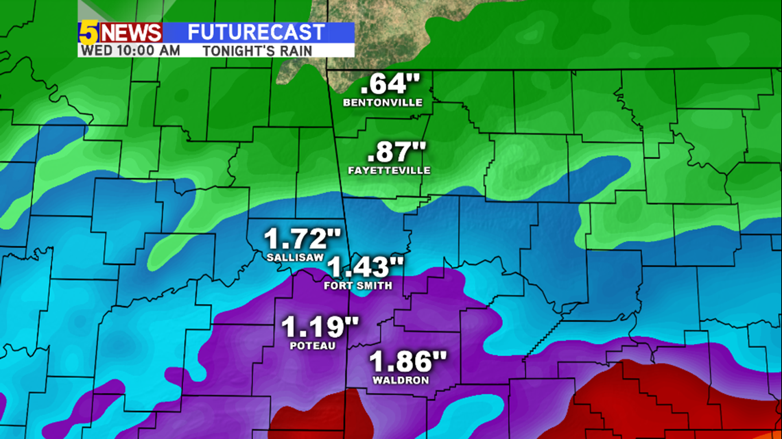
Generally, rainfall totals will be highest from Fort Smith and south. This should be the first widespread soaking rain our area has seen since October 22nd. The best chance for 2"+ rainfall totals will be in SE Oklahoma and SW Arkansas.
Here's how it looks hour-by-hour....

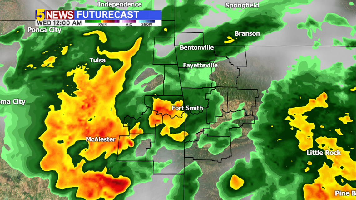
MIDNIGHT: Rain continues with heavier rain moving in from Oklahoma.

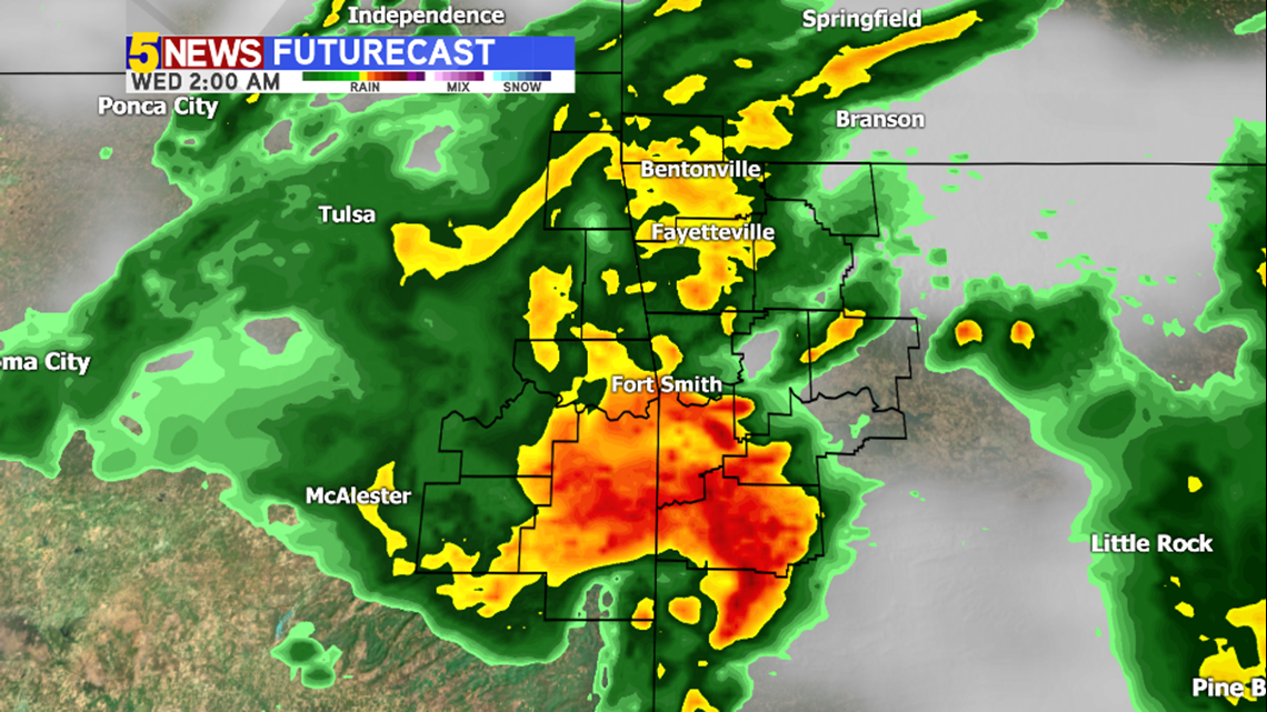
WEDNESDAY 2AM: Showers likely. Some rain could be heavy. A few thunderstorms are possible but no severe weather is likely.

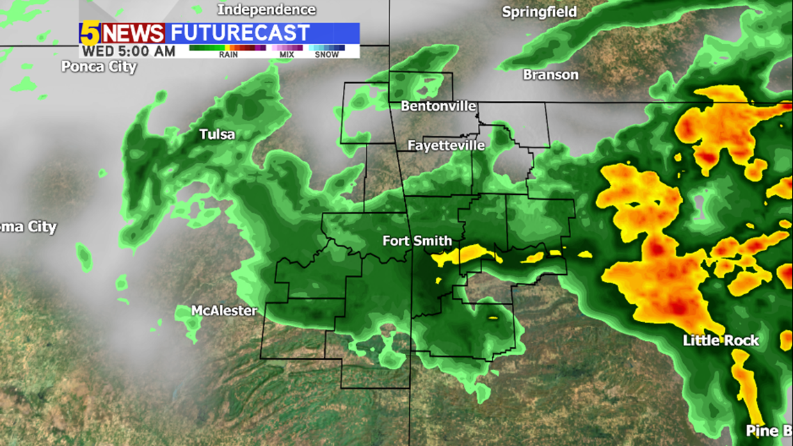
WEDNESDAY 5AM: Rain slowly ends from west to east.

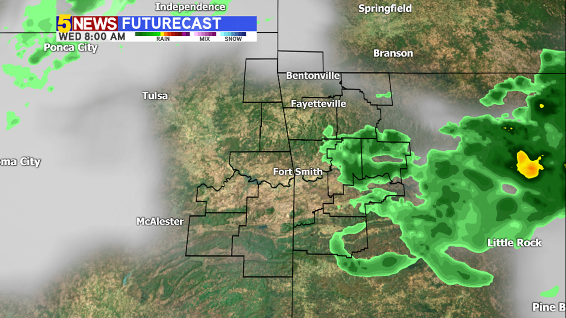
WEDNESDAY 8AM: Most rain should be out of the area with cloud cover remaining.

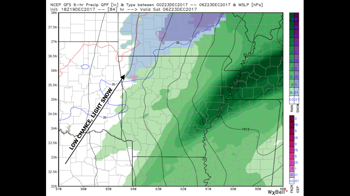
We continue to monitor trends for wintry weather this weekend. It looks like we'll have a low chance for light snow on both Friday night into Saturday morning and then Saturday night into Sunday morning. Christmas Day is trending sunny and cold.
-Garrett