
Warm temperatures will continue into the weekend with highs in the 60s. Cloud cover will be abundant on Saturday with mostly dry weather.
On Sunday, a cold front will move into the area with a chance for showers and thunderstorms in the late-evening or early overnight.
It continues to look like the best rain chances will focus across Central Arkansas with most storms developing east of our area.
Here's a look...

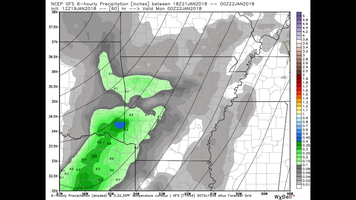
6PM SUNDAY: Scattered showers and thunderstorms across SE Oklahoma and West Central Arkansas

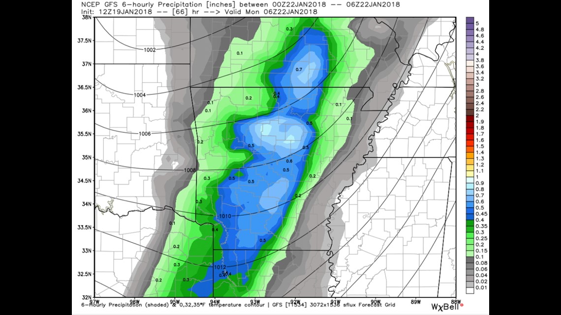
MIDNIGHT LATE-SUNDAY/EARLY-MONDAY: Rain moves out of our area with cooler air filtering in from the northwest.
Most showers should be over by the Monday morning drive to work/school.
-Garrett