
A cold front is barreling its way through Oklahoma Sunday (Jan 21st), and will spark showers and storms across parts of Arkansas and Oklahoma. Here is what you need to know this evening where you live.
WHERE?
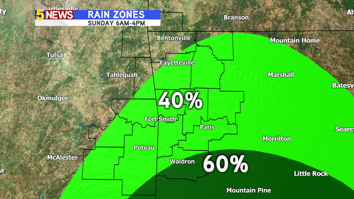
Moisture has been funneling northward from the Gulf the past two days, priming the environment. There is more liquid in the air over extreme SE Oklahoma and parts of west-central Arkansas. Until 4PM, there is a chance for a passing shower or sprinkle in the River Valley. Everyone in NW Arkansas and the River Valley will see the potential for showers and storms after 4PM Sunday. The heaviest rain and the strongest storms will stay south of the Boston Mountains, especially south and east of the greater Fort Smith area.
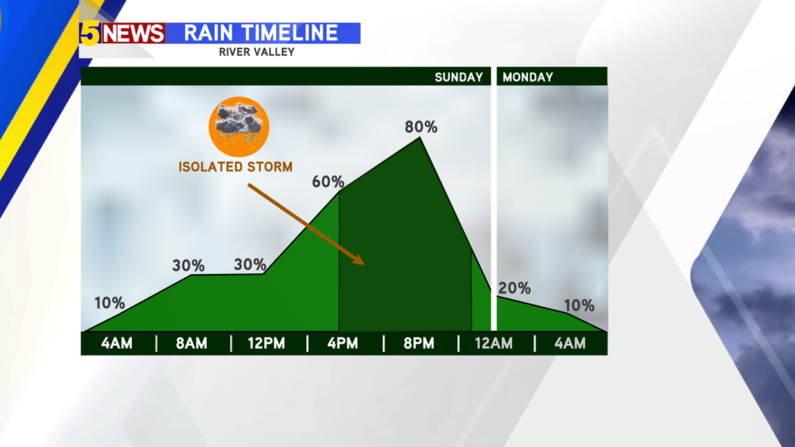
Sunday AM - 4PM | River Valley has the best chance for a passing shower.

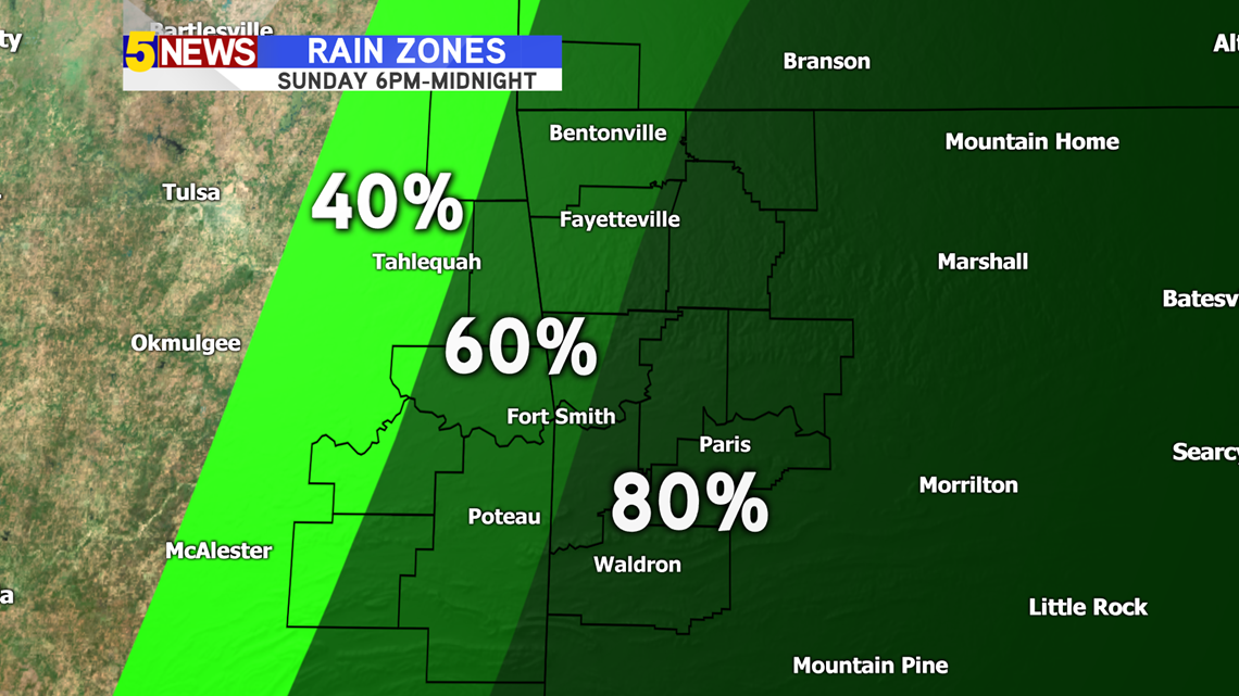
Sunday 4PM - Midnight | Everyone gets a chance for the rain, but especially areas south and east of Fort Smith.

WHEN?
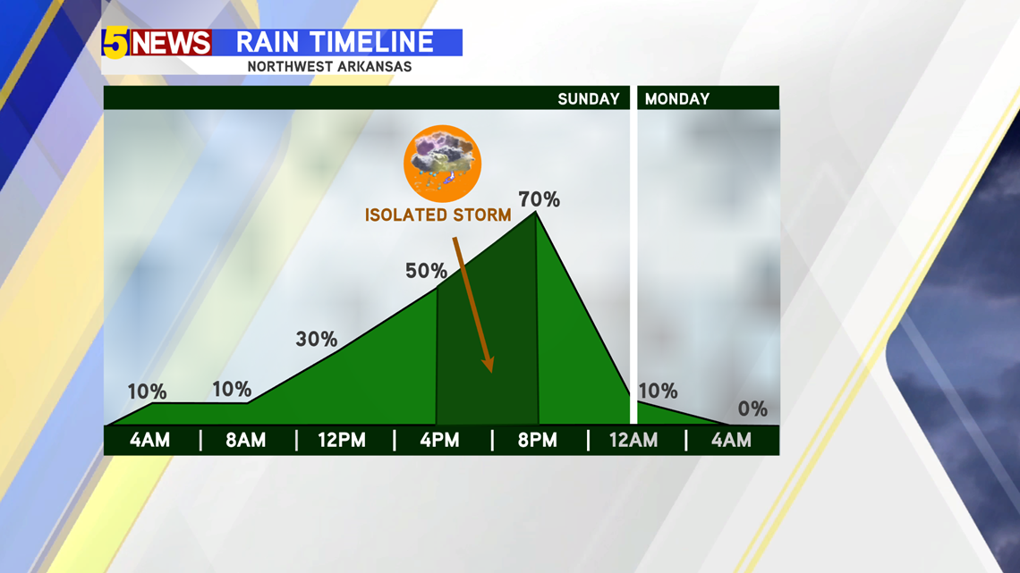
Northwest Arkansas (4-8PM: Only a slight chance for a passing sprinkle exists for the morning. Chances ramp up after 6PM with the greatest threat around 6-8PM.

River Valley (showers 9AM-4PM, storms 4PM-10PM): There is a better potential for a few showers throughout the day with the heaviest showers and strongest storms moving in after 4PM.

STATE OF THE ATMOSPHERE (IN-DEPTH)
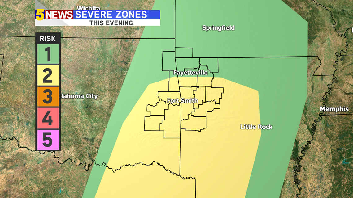
Because of the environment, the Storm Prediction Center has issued a Level 2 Threat for the River Valley, and a Level 1 Threat for NW Arkansas.

Instability: ehhhhh
The atmosphere will NOT be too explosive today for a major outbreak of storms (for January it's pretty decent though...). As clouds slide in from the south, our temperatures will mostly only warm due to strong southerly winds. Instability is a measure of how buoyant the atmosphere is and related equations can help meteorologists determine how strong updrafts can be, which help grow t-storms and sustain hail cores. Not so great today...
Timing: could be better
Because of early sunsets (5:35PM), the daytime heating is quickly shut off. Storms will be sparking and arriving by sunset. Storms will have to rely more on upper-level features to sustain themselves after 6PM.
Veering (turning of winds): decent
As the atmosphere's winds turn, updrafts of convective storms are supported. The winds will stop veering so well by 8PM, which means severe chances will go down dramatically. This means the best chance for isolated storms will be from 4PM-8PM. Otherwise the storms will turn into just heavy rain showers with some rumbles of thunder.
The Cold Front: decent
We've seen better, especially in January. The air behind the front will be in the upper 30s and low 40s, so the gradient is definitely there, but its not as sharp as we've seen in the past in terms of distance. The change in temperature is good, but we'd like to see a bit tighter. This cold front is strong enough to spark storms, but what's different about this is that there should be a surface convergence zone ahead of the front so not all of the front's potential will be tapped at first.
WHAT KINDS OF THREATS?

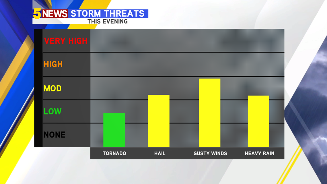
With a bit of veering in the winds close to sunset, tornado chances are extremely low, but not zero. The chance will for a twister will be dramatically reduced by 7-8PM. However, with lower freezing levels, small hail is possible (large hail isn't as likely thanks to low instability).
Tornado: Low (mostly likely south of I-40)
Hail: Small hail possible
Heavy Rain: River Valley - east of AR/OK state line; NW Arkansas - east of I-49
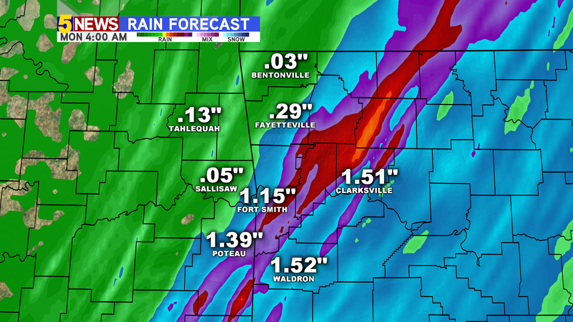
HOW MUCH RAIN?
Everyone should at least get close to a tenth of an inch of rain. However, if a stronger storm passes over your neighborhood, a quick inch (or a bit more) is possible.

We will have more updates throughout the day!
-Matt