Still plenty of uncertainty heading into the weekend regarding the precipitation type. The cold surge late Saturday will be our first chance and then a quick upper level system will be our second chance. Right now, it appears to be light snow (if it even happens). Here’s a look at the latest thinking as of Tuesday afternoon. I would fully expect more changes to be made to the forecast before this weekend. This is a low confidence/high uncertainty forecast at this point.
———————————————————————-
There are two things that could bring us snow:
- Surface Low: The surface low will track to our south Saturday night into Sunday morning, with cold air spilling into our area. Right now… this looks like a rain event for us… there could be a little sleet or snow mixed in, but it doesn’t look like much (if any accumulation) If you want a big snowstorm you would want to see the surface low throw gobs of moisture over the cold air. This does not appear likely.
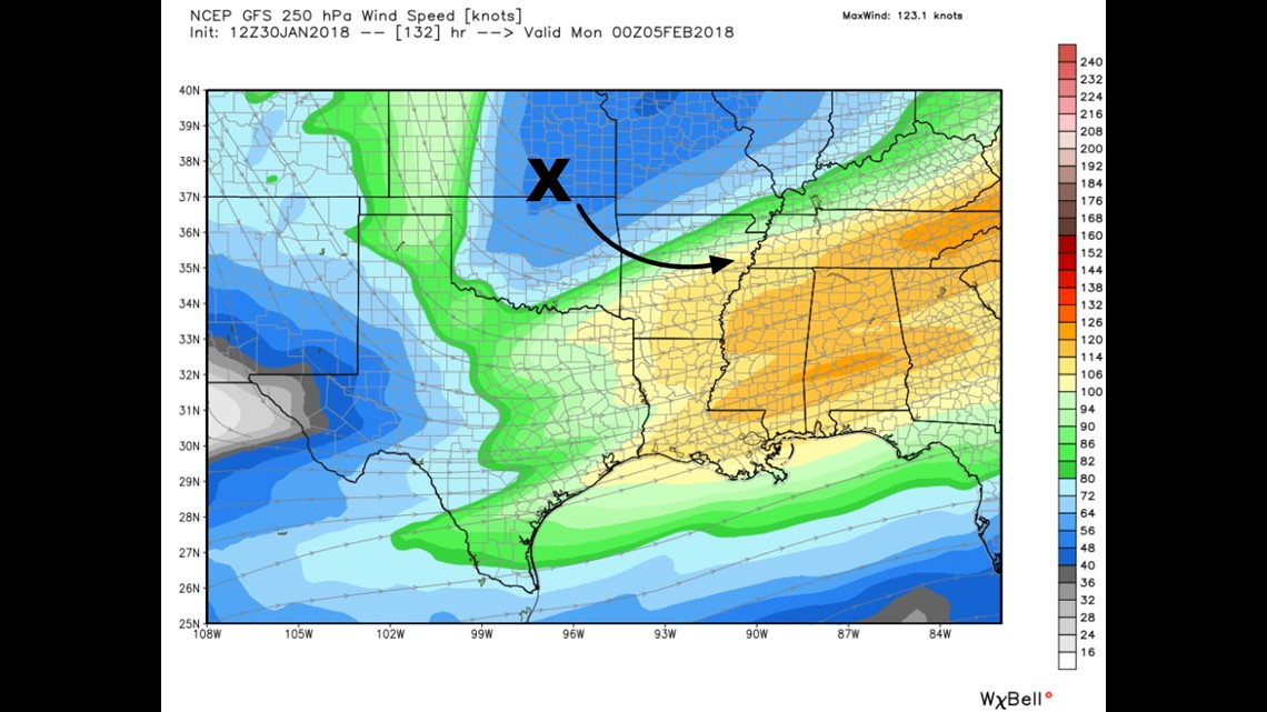
- Upper Low: The track of the upper level wave probably determines whether or not we get any snow on Sunday. (I drew an “X” to show you where it’s centered). This is zipping across the area quickly with snow possible just ahead-of/underneath the low’s track. IF it occurs, it would be light snow… probably in the 1-2″ range. Not sure if NWA or RV or both? Historically, NWA has a better chance of accumulating snow than FSM area.
As of today, there could be travel impacts for Super Bowl parties and/or school closings on Monday morning.
It’s just too soon to know how much humidity will be in place and available for wintry weather.
Watching it…
-Garrett