
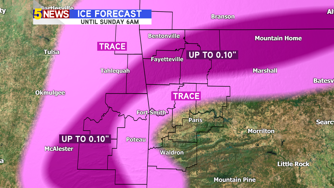
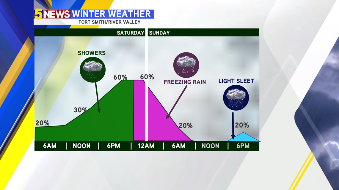
As of 12PM: Winter Weather Advisories posted for the possibility of light ice accumulation (under 1/10").

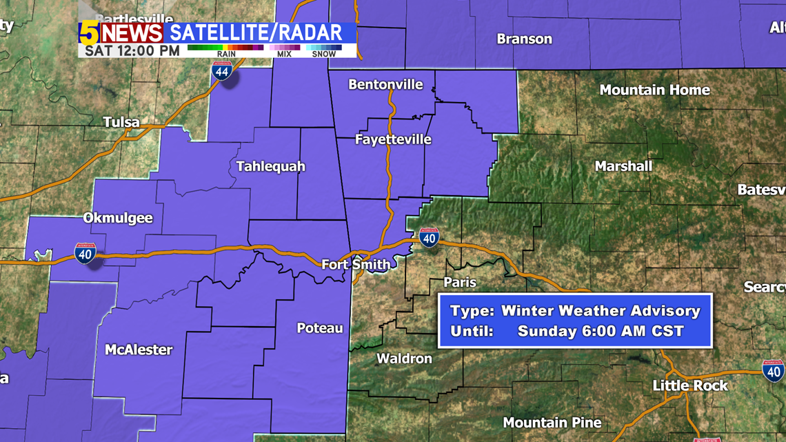
Ice Totals: Best chances will be in NWA and in eastern Oklahoma as colder temperatures reside in some of the higher elevations, helping the freezing process take place more quickly. NOT EXPECTING AN ICE STORM. Things may get a big slicker than they were earlier this week.

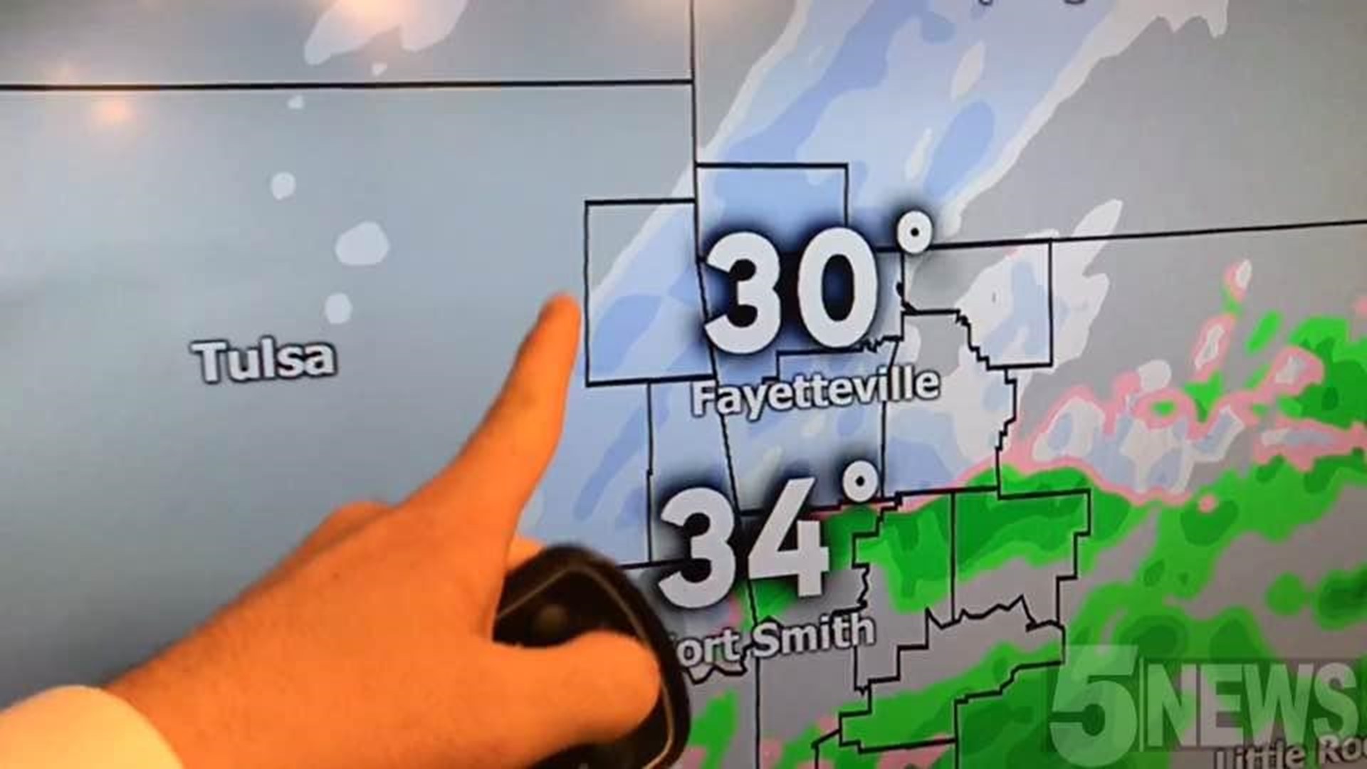
Northwest Arkansas Timeline: It will stay cold enough all day to allow freezing drizzle and sleet. Expect a ramp up in intensity and accumulation close to sunset.

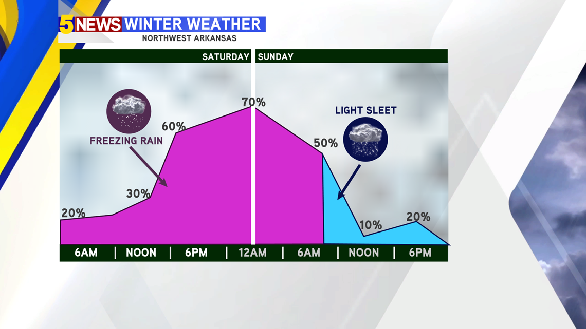
River Valley Timeline: The change-over from a cold, rainy mist to freezing drizzle won't happen until later this evening as temperatures drop. However, in parts of eastern Oklahoma, this change-over may happen closer to lunchtime.

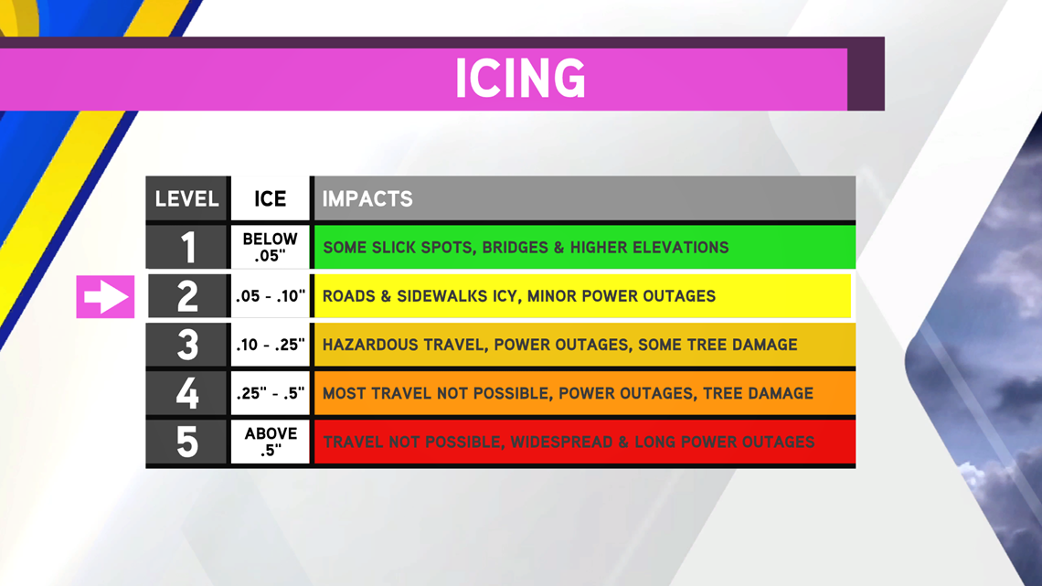
Icing Impacts will remain a Level 1 to a Level 2 in some spots.

-Matt