

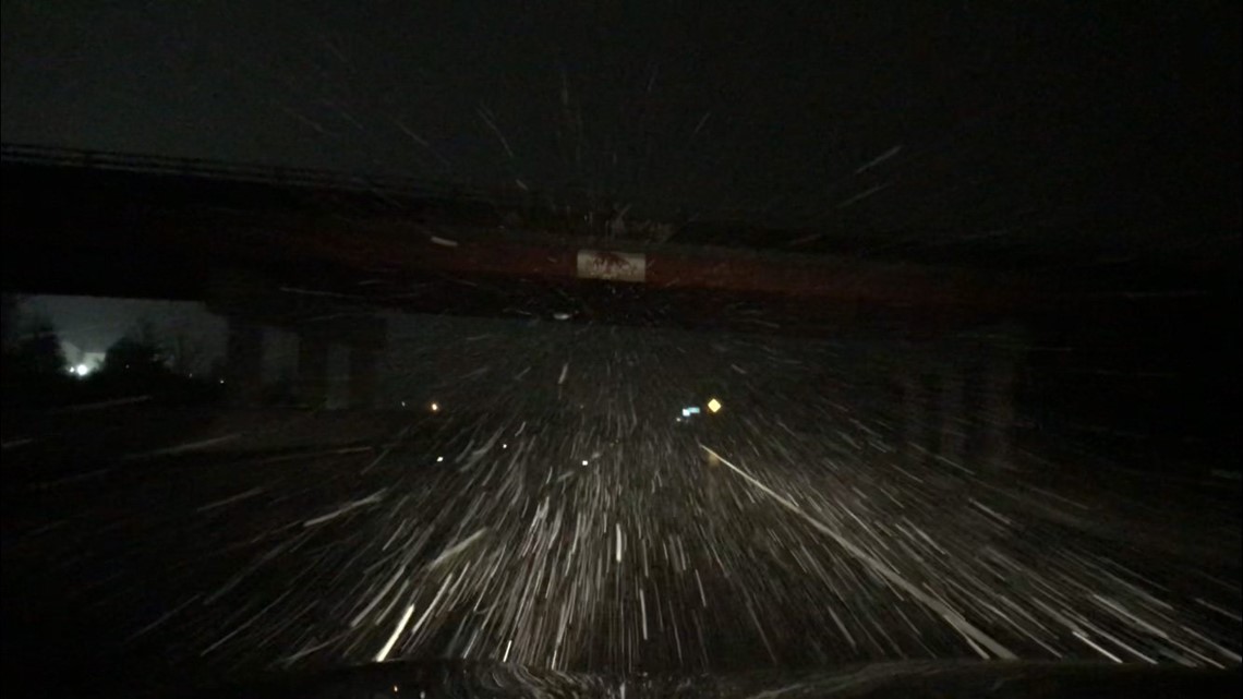
During the winter, many strong storms systems form and travel along the Polar Jet that dives south, making travel difficult.
Did your local interstate make the list? Check it out below:
*The following are some of the worst interstates to travel on during the winter based on climate data. (Other studies factor in accident statistics but those can greatly be deterred by traffic volume and patterns, and the time of day.)*
Categories In Order: Snowy, Lake-Effect, Icy, and Windy

SNOWY
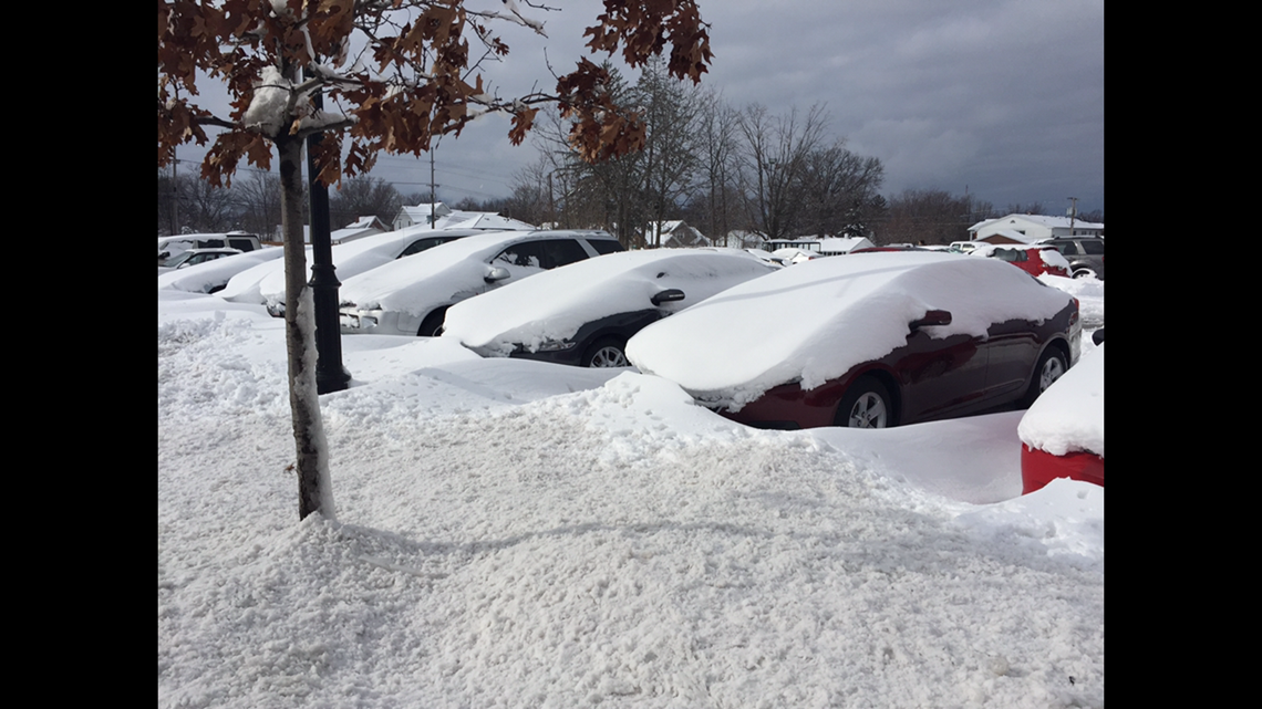
Conditions can quickly deteriorate as snowfall rates pick up. Tires are not able to grip as well to the road, reducing traction and stability. Visibilities will also become poor as the snowflakes fly.

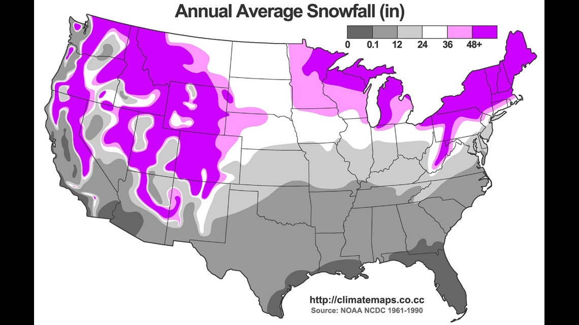
Two major areas of snowy travel concerns are the Rocky Mountains and the Northern Tier from the Plains to the Northeast. Storms coming in from the Pacific will dump several inches of snow in the higher elevation mountain passes. Snow tires are required during some of the worst snow storms as conditions become dangerous for rescue crews. In the Northeast, the strongest storms that feed off of the low static stability of the warm Atlantic waters are called Nor'easters. They can drop several inches of snow in their deformation bands that can cause heavy snow to fall for several hours over the same locations.

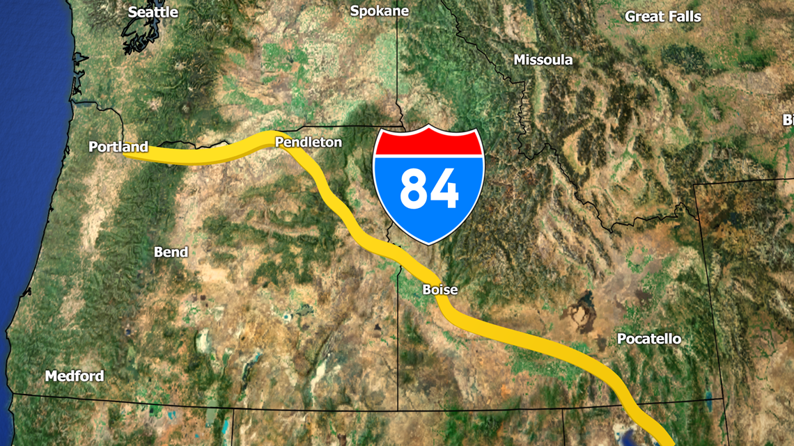
- I-84 (Oregon/Idaho)
E/W Mountain passes become treacherous, especially as freezing levels fall, bringing east-west traffic to a standstill.

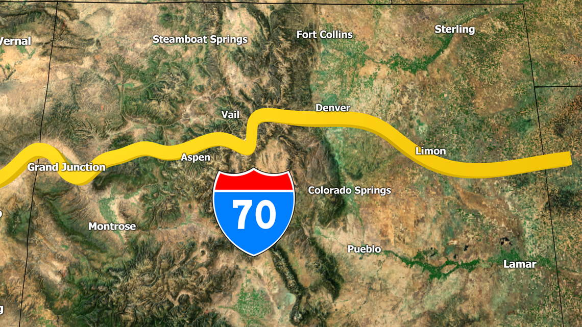
- I-70 (Colorado)
Snowstorms coming from the Pacific many times will still have enough energy to provide decent snowfall in parts of Colorado. In addition, many snowstorms can from on the lee side of the Front Range, bringing blizzards to the Denver area.

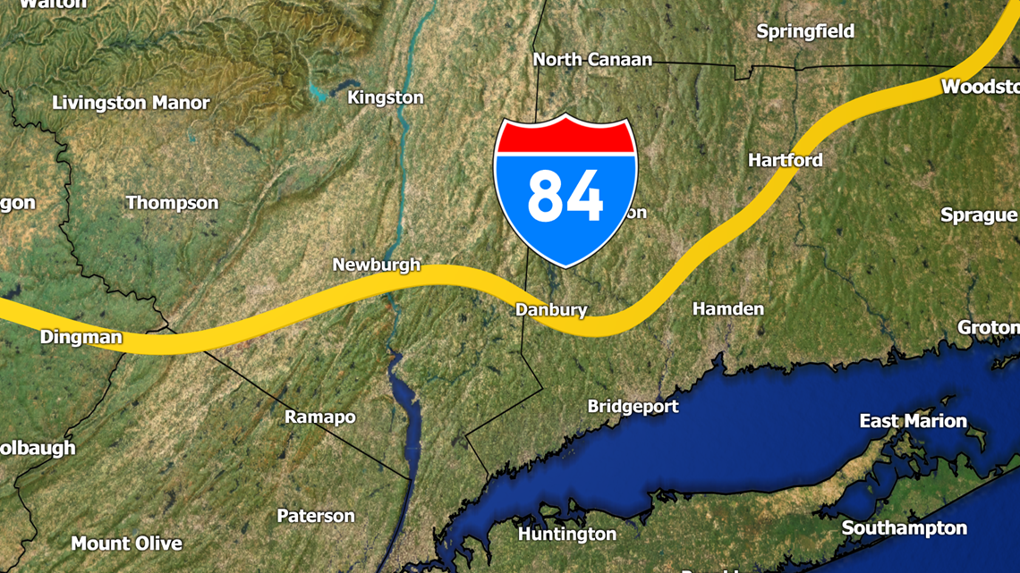
- I-84 (New York/Connecticut/Massachusetts)
Nor'easters will dump several inches of snow along many of the interstates of New England, including I-84. Heavy snowfall rates over an inch-per-hour can last for several hours.
LAKE-EFFECT

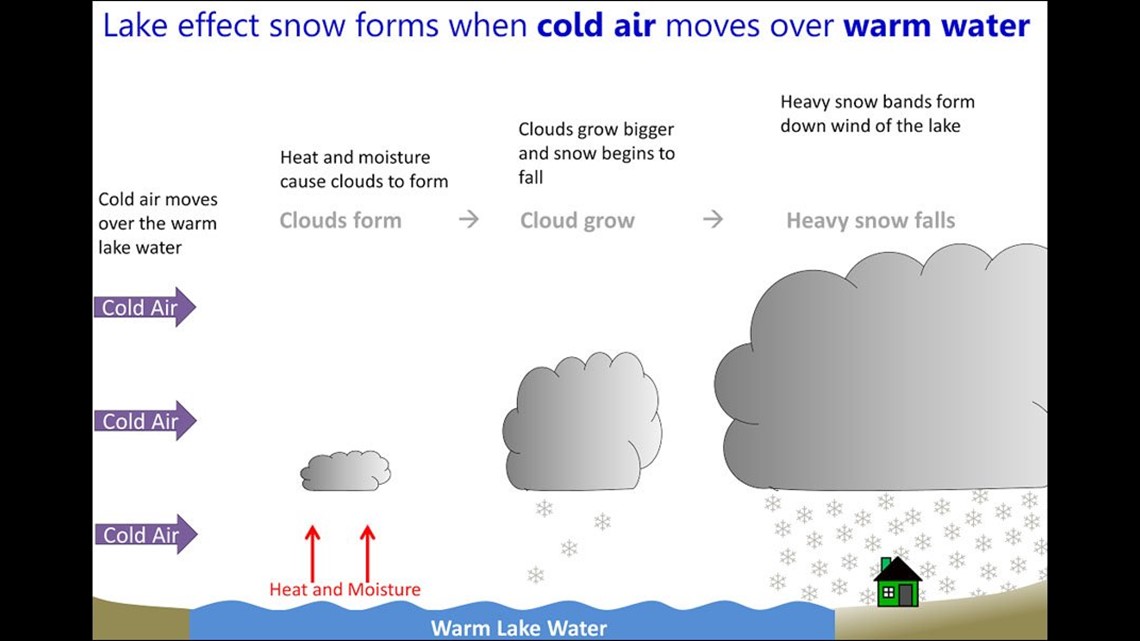
When the Great Lakes remain ice-free, they are open for business for some intense lake-effect snow (LES). When the temperature between the water is about 13 degrees Celcius or more warmer than the air above (850mb). These snowstorms can drop a few feet in a matter of a day. Visibilities are reduced to nothing, making travel impossible in the worst of the LES bands. LES is most common on the east and southern sides of the Great Lakes.


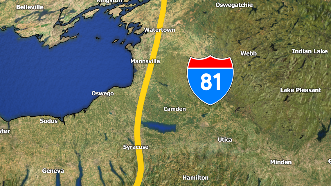
- I-81 (New York)
Lake Ontario will dump several inches of snow for Upstate New York, making travel between Watertown and Syracuse difficult.

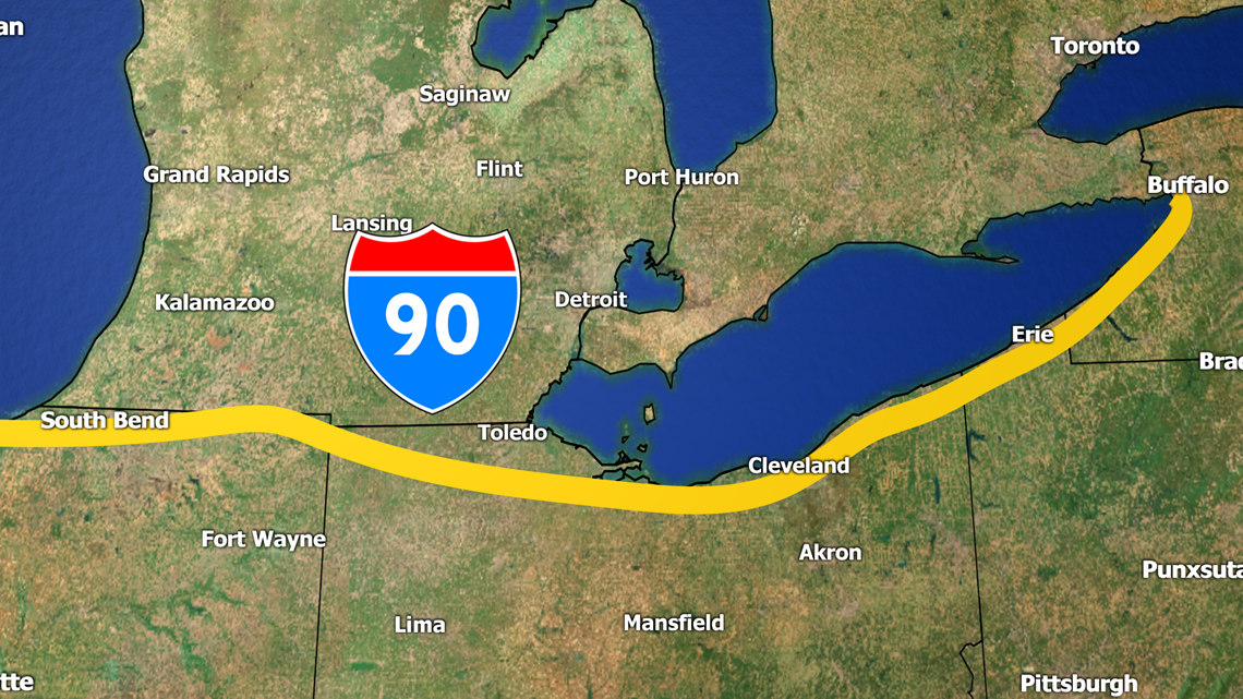
- I-90 (Indiana/Ohio/Pennsylvania/New York
Lake Effect snow from Lake Michigan and Lake Erie will make some of the toll roads difficult to travel on.

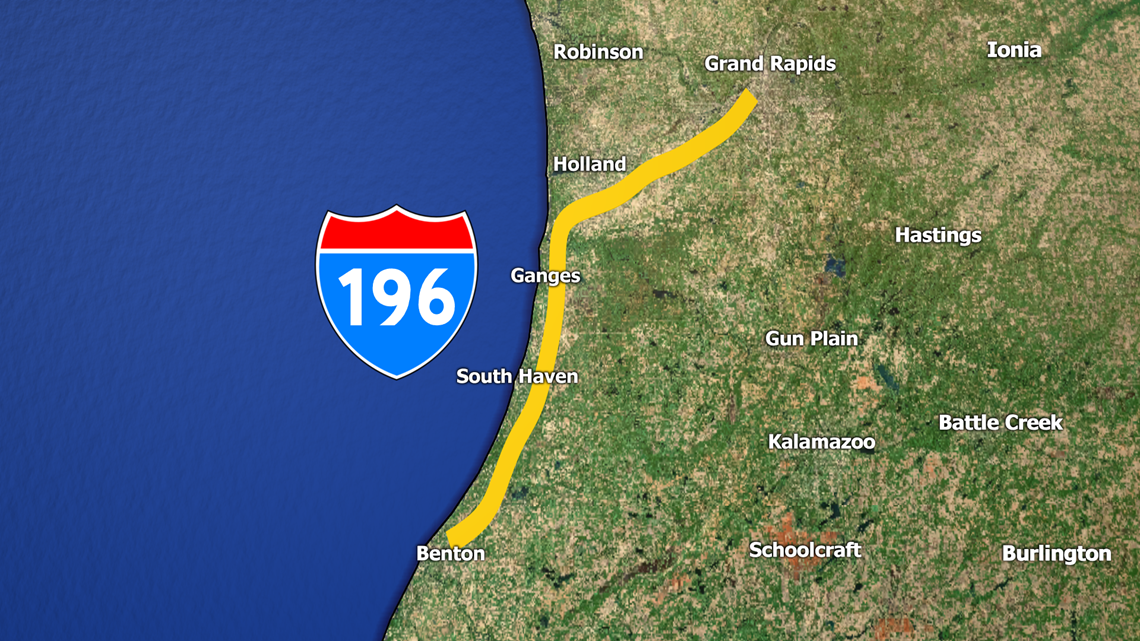
- I-196 (Michigan)
This interstate hugs Lake Michigan as you head into Grand Rapids (a city notorious for its lake effect snow in the winter).

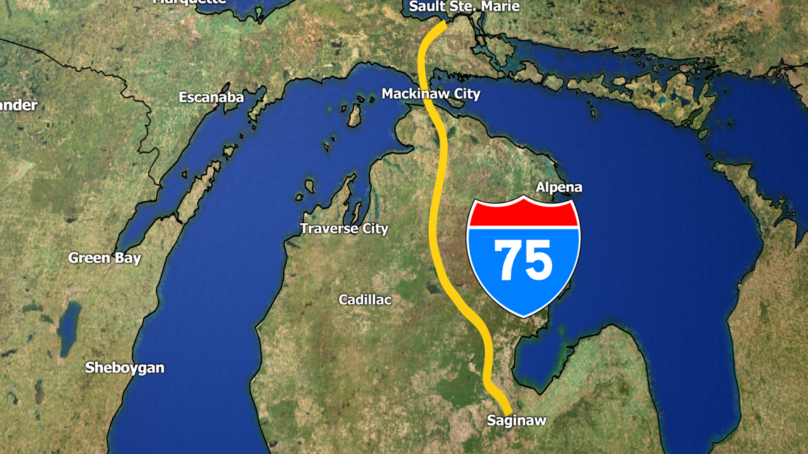
- I-75 (Michigan)
The northern parts of the LP of Michigan are surrounded by water on most sides, which makes it a prone area for LES.
ICY

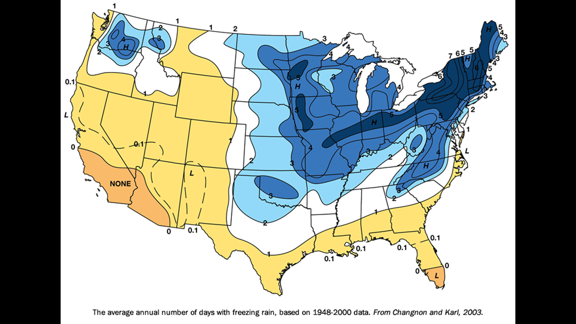

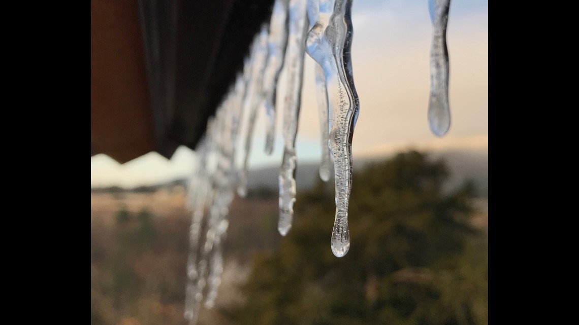
Many times ice storms are considered the worst for travel because ice can eliminate traction for your tires, often times causing drivers to lose control of their vehicles. Ice storms take place many times along a boundary between warm and cold air where there is a pocket of warm air a couple thousand feet above the ground. This melts the snowflakes that form aloft. However, cold air is able to hover close to the ground, freezing any of the water droplets that fall.

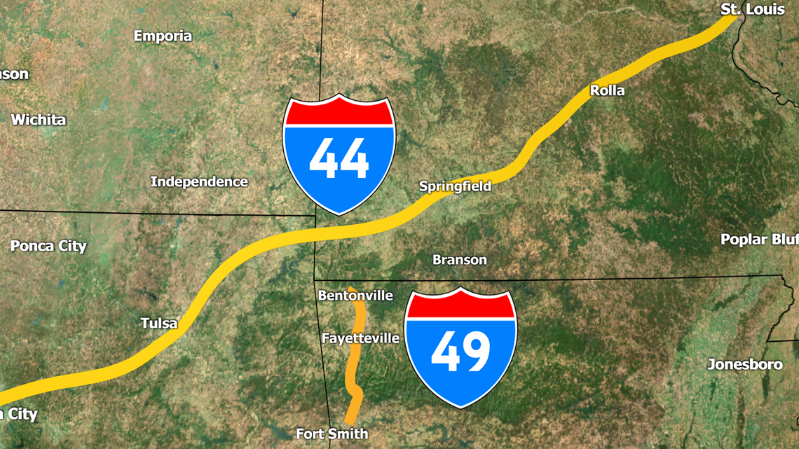
- I-44 (Missouri/Oklahoma) & I-49 (Arkansas)
The south-central Plains are notorious for bad ice storms that can cause many accidents, crippling travel through the region, especially in the Ozarks. Many times the air is completely below-freezing this far south, so when systems pass through, it can cause a wide array of wintry precipitation.

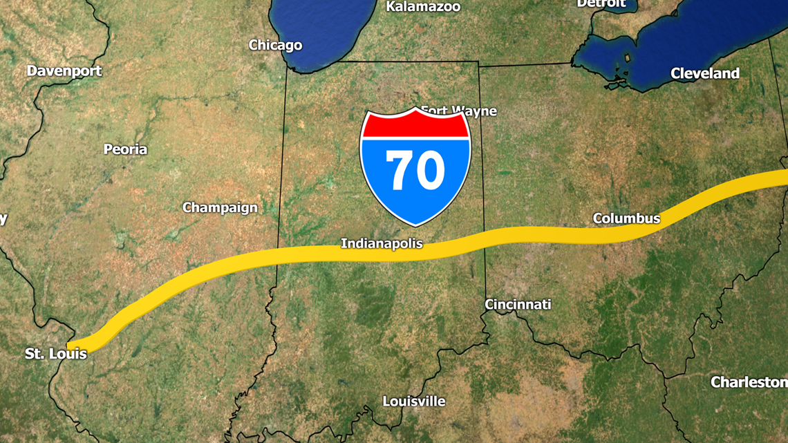
I-70 (Illinois/Indiana/Ohio)
Winter storms that move north from the south-central Plains can continue to move northward along I-70, causing major traffic problems when the boundary between warm and cold air sits over the Ohio River Valley.

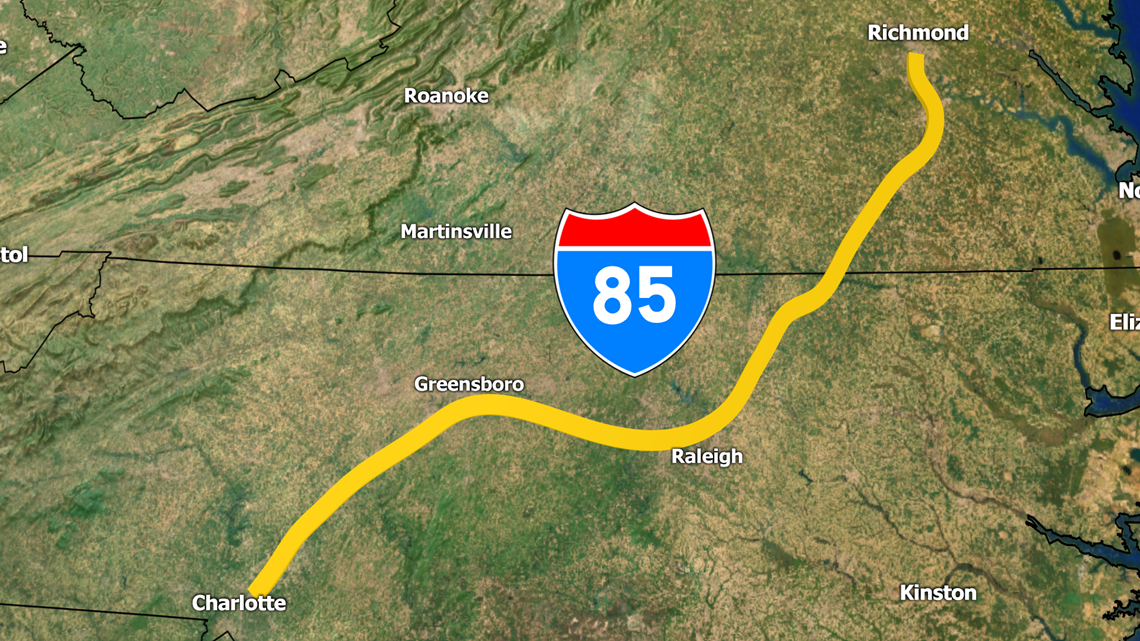
- I-85 (Virginia/North Carolina)
Another major area prone to ice storms is the Piedmont of the Southeast and Mid-Atlantic. Cold-air-damming (CAD) keeps cold air nestled along the eastern edge of the Appalachians. Because cold air is more dense than warm air, it is hard to remove the cold air out of the region. Even warm weather systems that move in can create freezing rain because the surface temperatures will remain below-freezing due to CAD.
WINDY

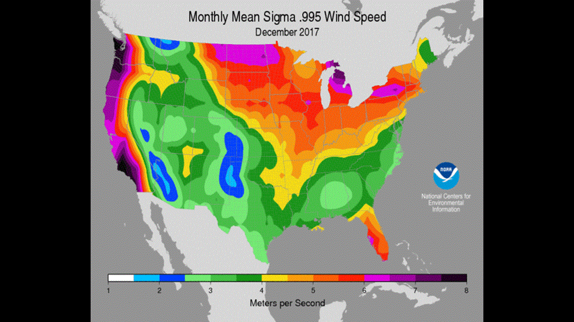
Temperature gradients between the North and the South are the greatest during Winter. When the temperature of the air quickly changes from one place to another, the atmosphere responds with wind! Windy conditions can make travel treacherous, especially when coupled with precipitation.

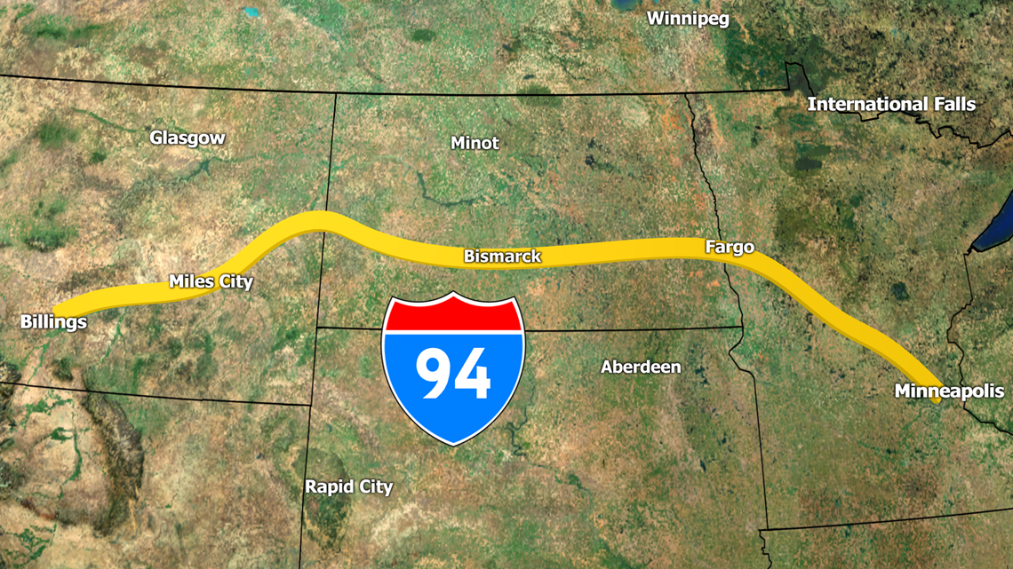
I-94 (Montana/North Dakota/Minnesota)
The Northern Plains are infamous for some of the harshest winter weather in the United States. Sub-freezing temperatures and frequent snowstorms makes travel difficult many months of the year. Because of the flat, prairie lands of the Dakotas and central Canada, nothing is able to stop fierce winds blowing in from the north. This can cause blizzard conditions throughout the winter, as winds will pick up the existing snow and blow it around, greatly reducing visibility and vehicle stability.

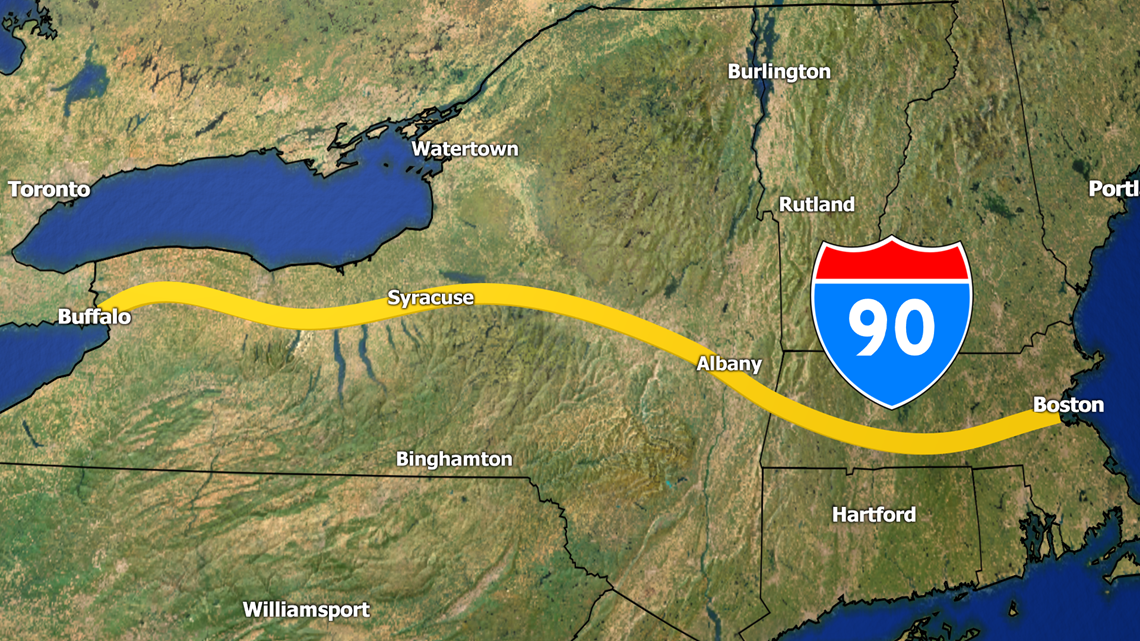
I-90 (New York/Massachusetts)
Arctic upper-level lows will push south across the Midwest but the strongest winds, usually out of the Northwest can quickly blustery conditions in New England. When this is coupled with any winter weather, travel becomes extremely difficult.
If you think your local interstate should be added, let us know!
-5NEWS Weather: Meteorologist Matt Standridge