Another push of rain will move across NW Arkansas & the River Valley late Friday into Saturday morning. The heaviest showers will occur overnight from midnight to 3am.
There’s a chance rain mixes with sleet but temperatures above freezing at the surface should preclude any traffic hazards this weekend.
Here’s the latest timing with HD Futurecast…

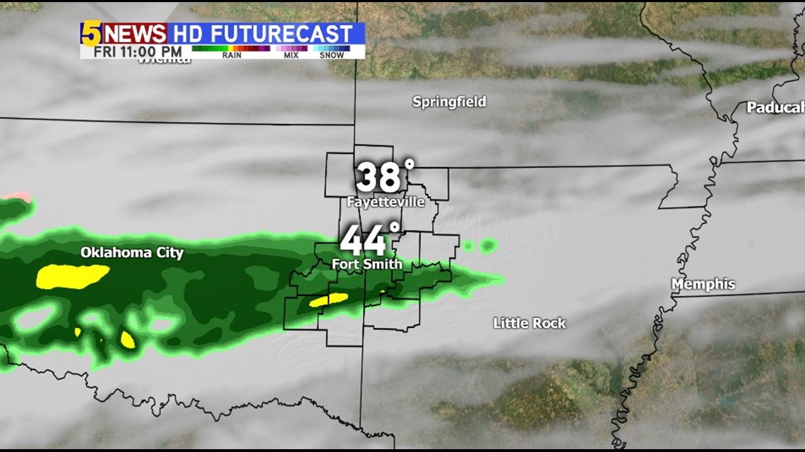
11PM FRIDAY: Rain will continue to expand to the north. There are some spots in SE Oklahoma where rain was already underway on Friday. These showers will reach NW Arkansas late Friday evening and pick up in intensity.


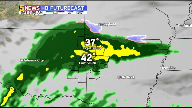
3AM SATURDAY: Rain is likely area-wide. You can see patch areas of sleet on the leading edge of the rain. Temperatures locally will be above freezing.

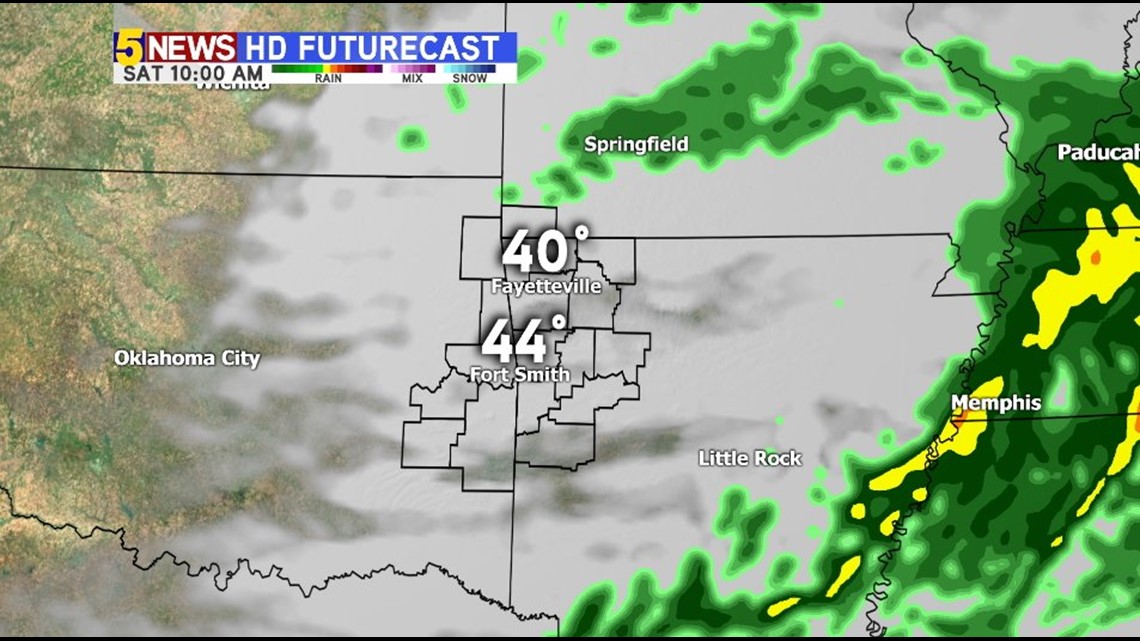
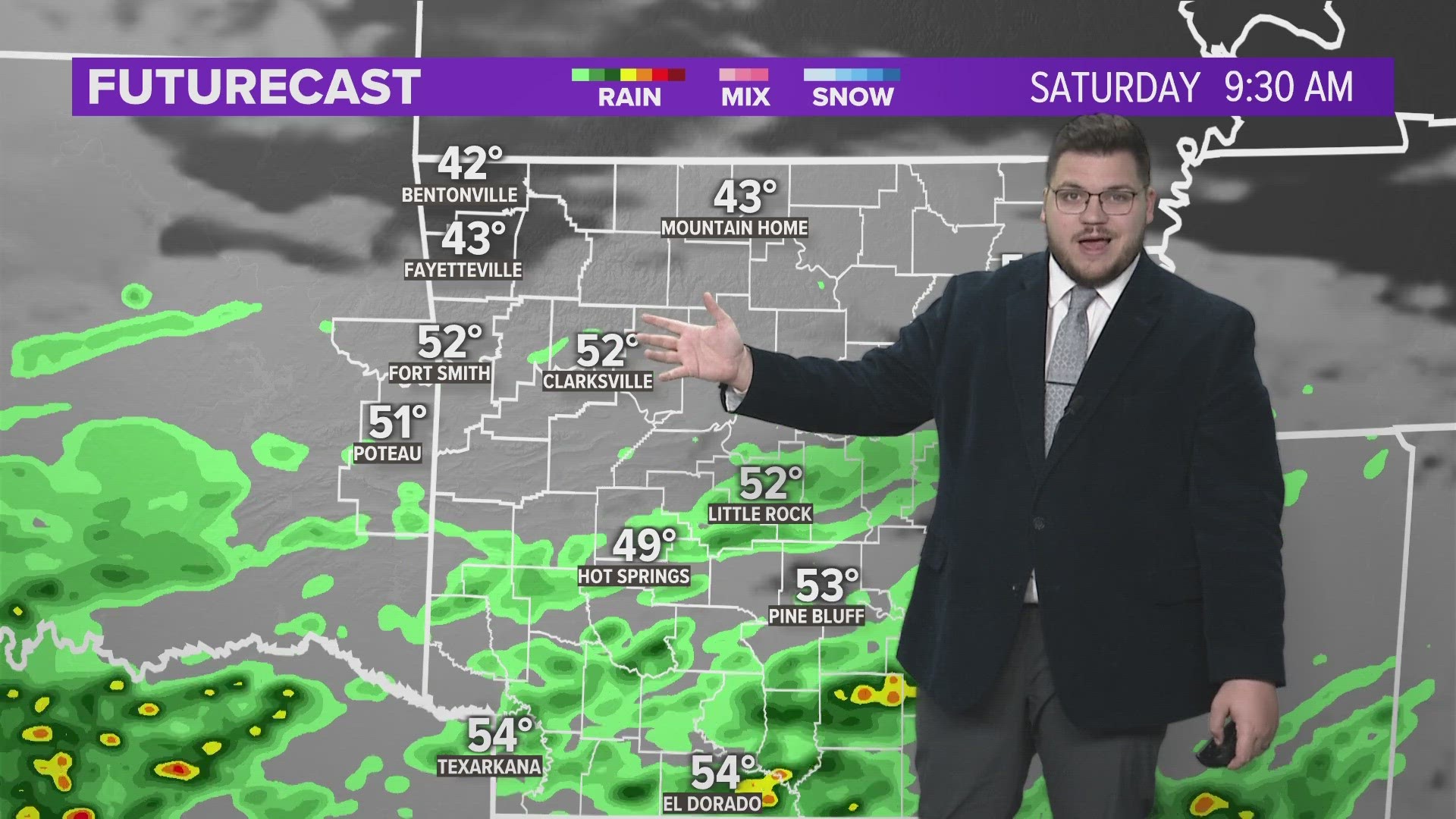
10AM SATURDAY: Most of the rain will be exiting to the east although areas of light drizzle could continue into the early afternoon with chilly temperatures.

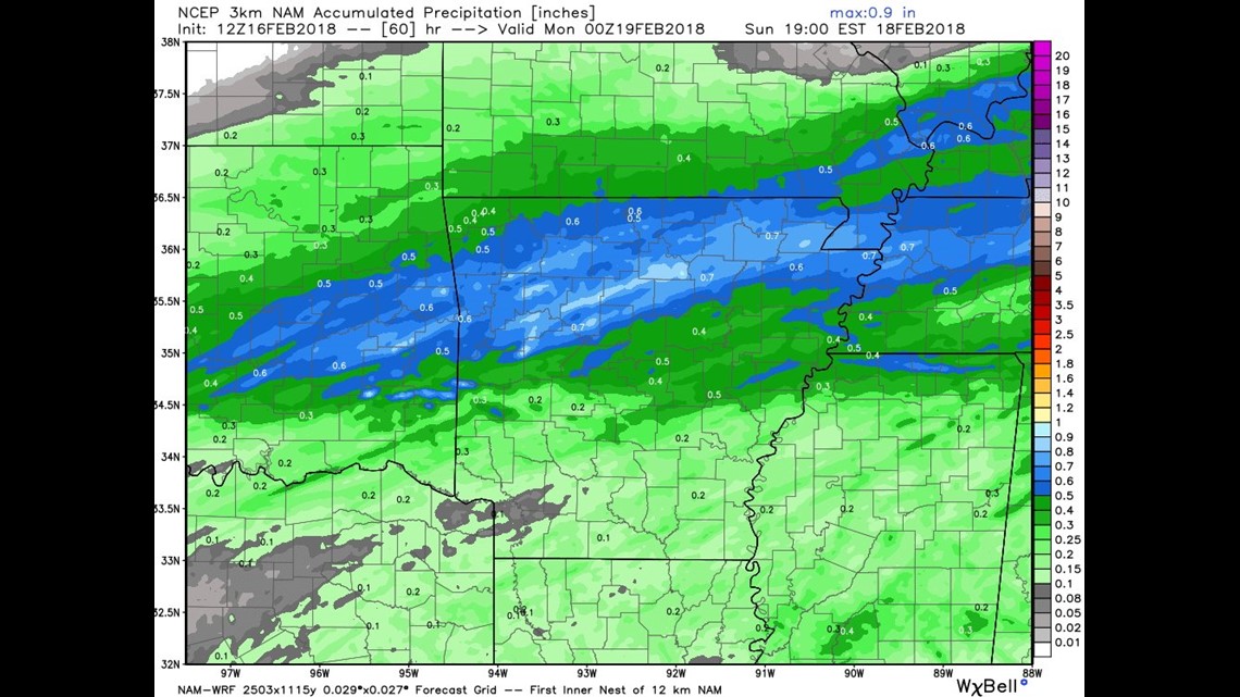
RAIN ACCUMULATION: This should be a decent rain for us, many locations will pick up around 1/2″ of rainfall from Friday night into Saturday.
Additional, heavier rain, is likely early next week.
-Garrett