

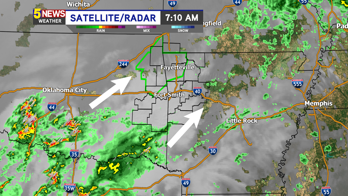
Our last round of rain is incoming and will move in by 8-10AM. Some of the showers will have embedded thunderstorms as they push through our region.

Futurecast:

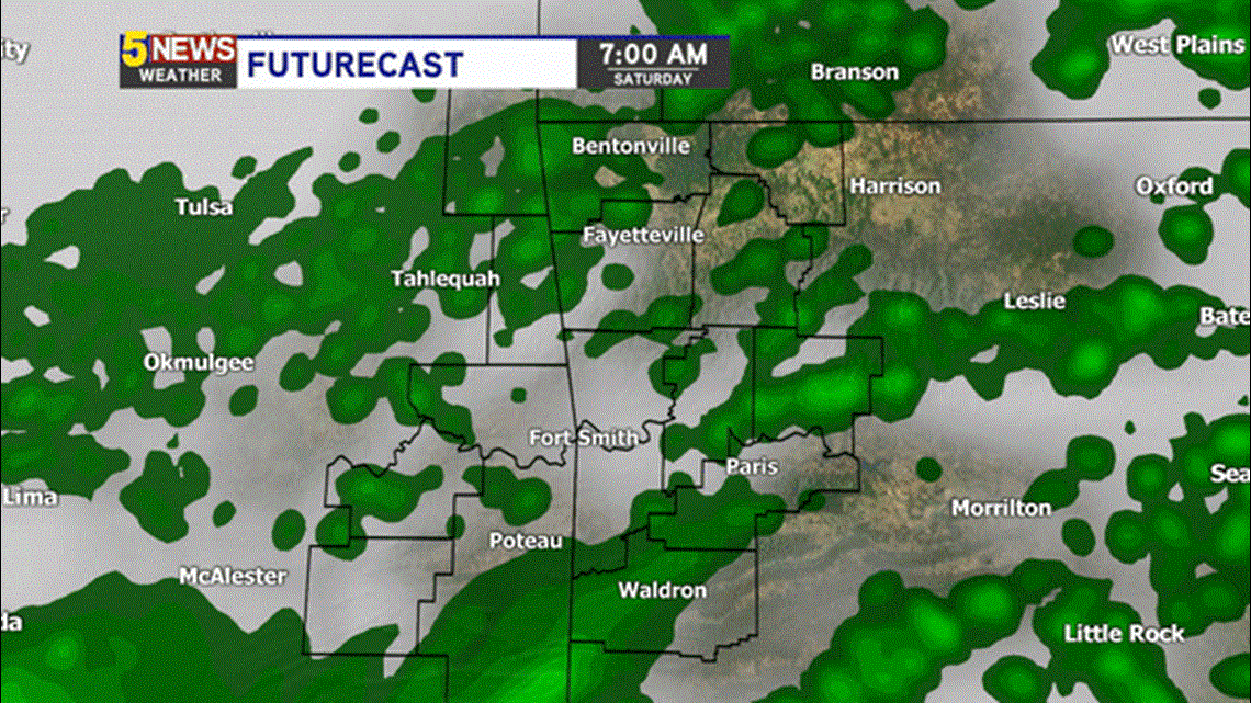
The heaviest rain will move in around lunchtime: 11AM-2PM. Most of the showers will be gone by sunset.


Some of these storms could be severe. Severe T-Storm warnings were issued with this band of rain earlier this morning in North Texas. The best chance for the development of severe storms will be towards our east in central Arkansas. We will still probably get some storms moving in too.


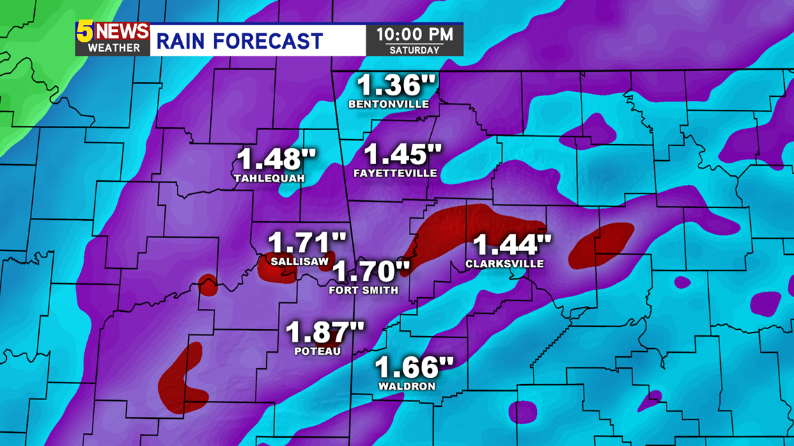
The main threats today will be wind and heavy rain. Flash flooding will be another concern on Saturday. Our region's river forecast center says that we only need another half inch of rain to see more flash flooding today, as the ground is already soaked.


Another one to two inches will be possible through 10PM Saturday evening. Most of the rain should be gone by 3-5PM, with leftover sprinkles possible past sunset.

-Matt