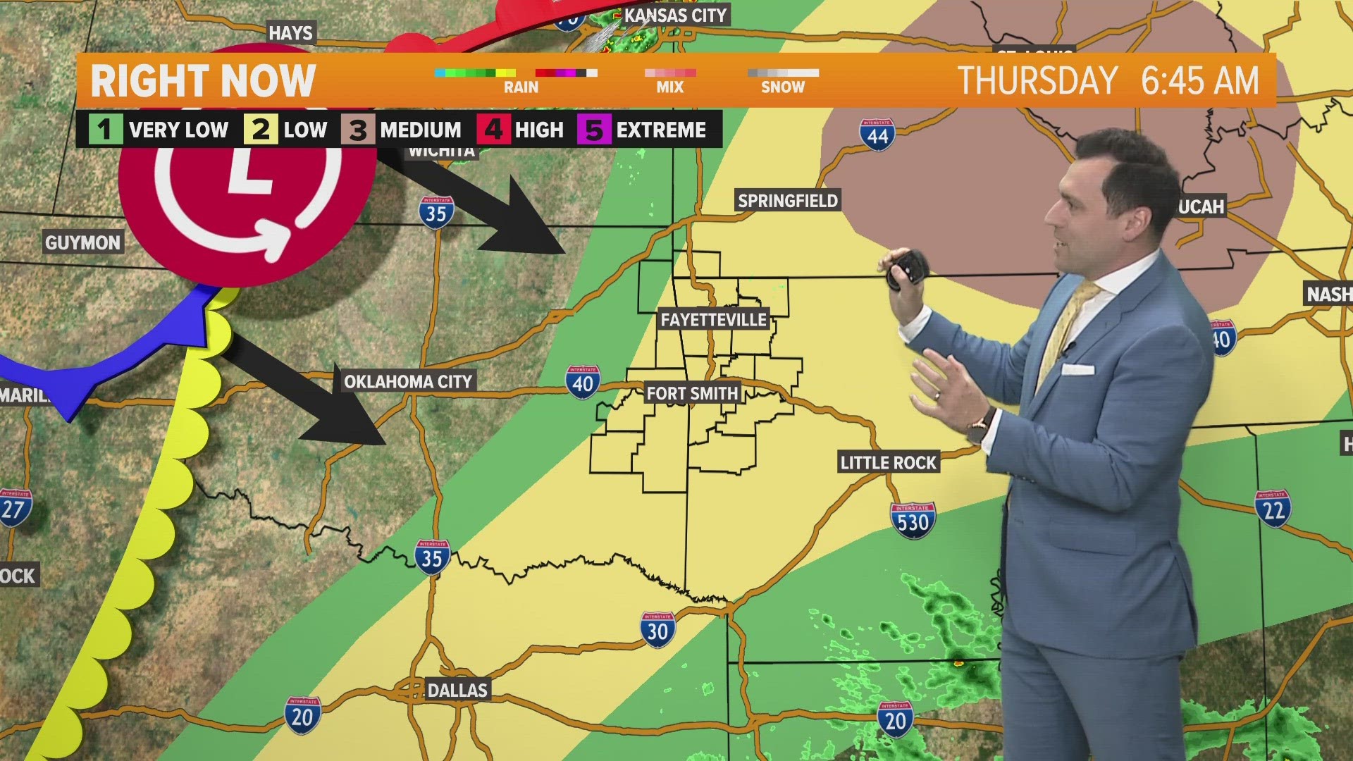
A strong cold front will move across the area on Friday with showers and thunderstorms in the afternoon and then falling temperatures into the evening.
The risk of severe weather will be greatest from 11am – 4pm on Friday with large hail being the primary concern.

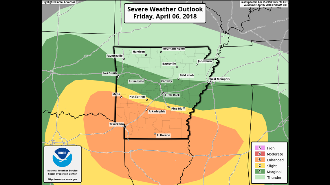
This is the highest risk area for severe storms. NW Arkansas is in a lower risk than the Fort Smith area which is in a lower risk than SW Arkansas.

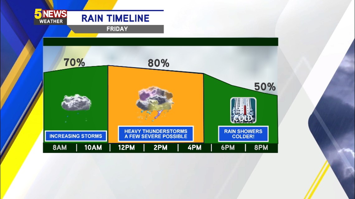
Showers and thunderstorms will be possible all day on Friday but the most likely time for strong to severe storms will be in the late morning or early afternoon.

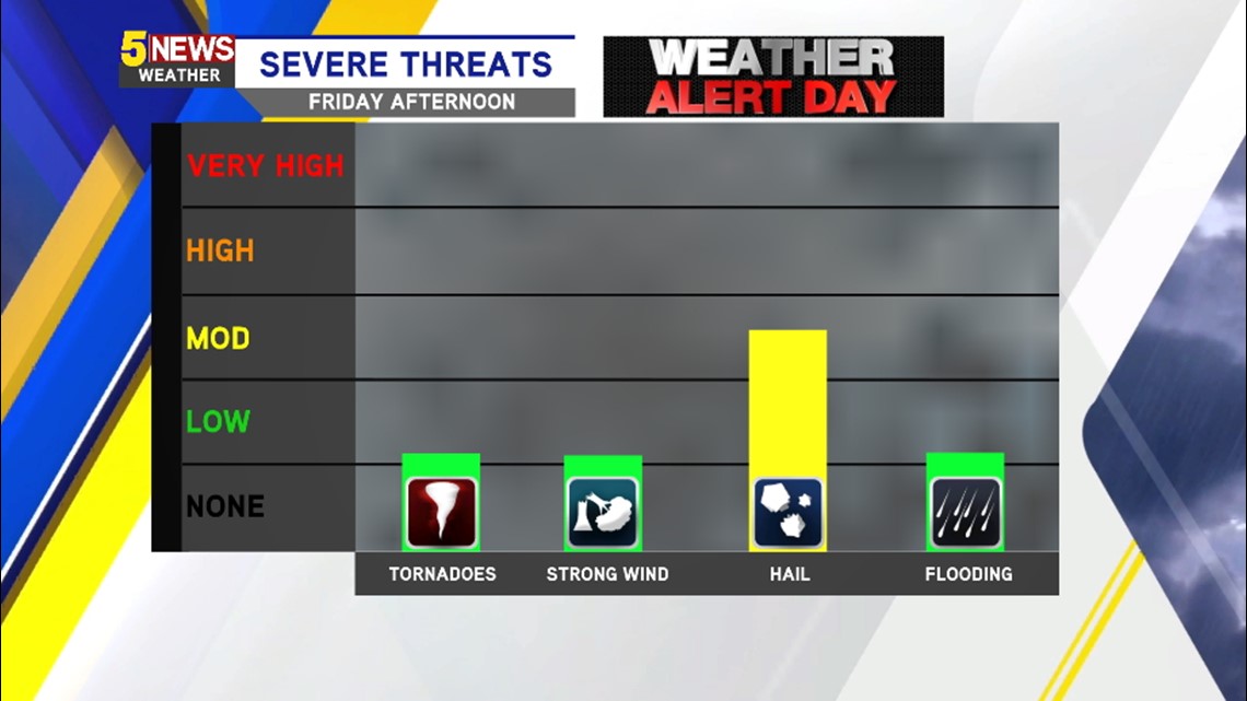
The main severe weather threat will be hail.


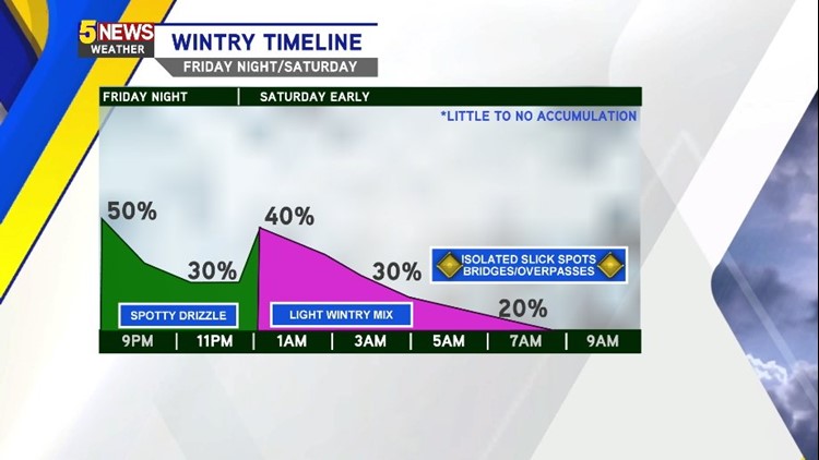
Rain chances will be lower overnight with a small chance of a wintry mix from around midnight into the early morning hours.
Most of the rain or wintry mix will be out of our area early in the day on Saturday.

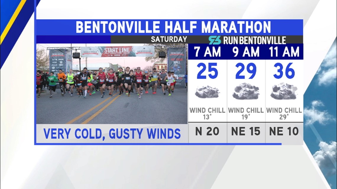
Very cold weather is likely for the Bentonville Half Marathon with gusty north winds.

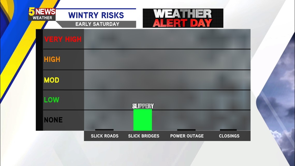
Any road hazards will be minimal and confined to bridges and overpasses around sunrise on Saturday and mostly in NW Arkansas where temperatures will be coldest.

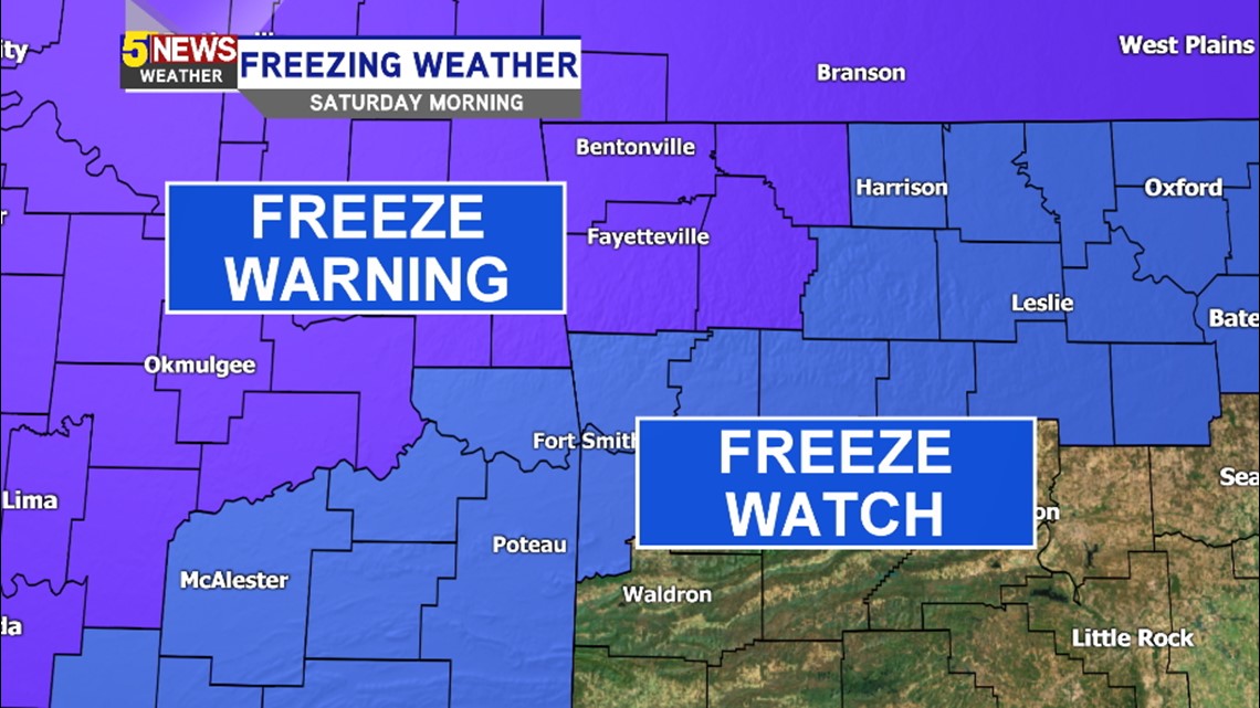
Freeze Warnings are already in effect on Saturday with very cold weather likely for most of the day.
-Garrett