
Numerous rounds of thunderstorms - some severe - are expected tonight into Thursday. The first wave to affect our area will move in late tonight around midnight and continue into the early morning hours.
On Thursday, we'll likely start the day off with showers and thunderstorms for the morning drive.
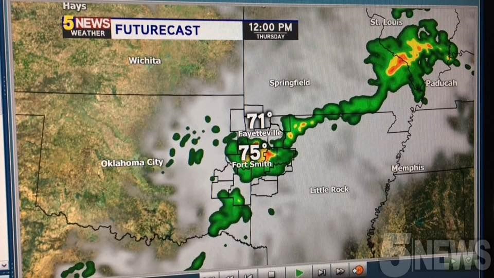
Another round of thunderstorms will arrive mid-morning around Noon.
The strongest round of storms likely develops late-evening across Eastern Oklahoma. These storms could track into NW Arkansas. The tornado risk will be highest with this round of storms.

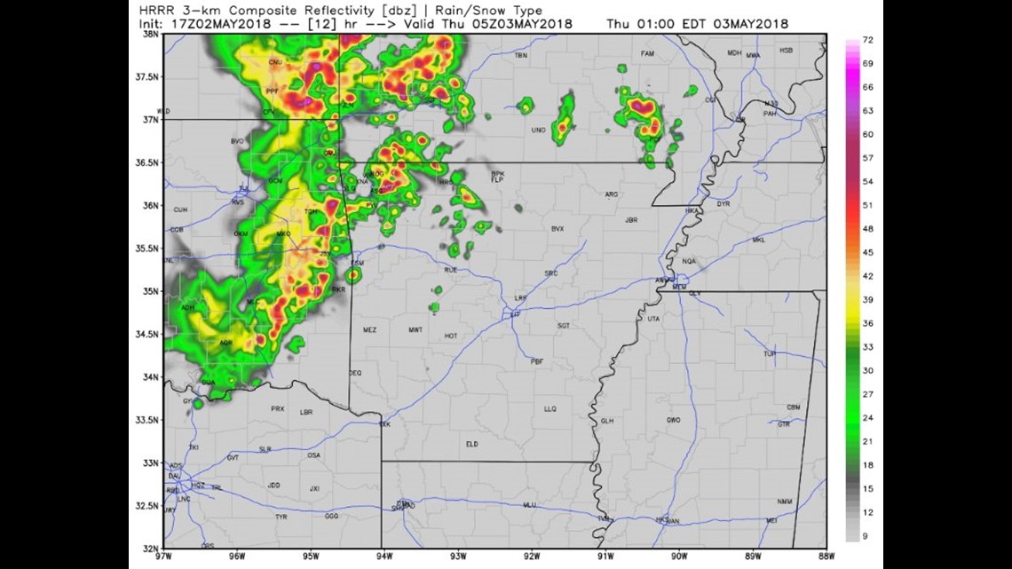
This is a look at the high-resolution data for 12am Thursday. (Late Wednesday/Early Thursday) Storms will be already on going on radar for our 10pm newscast Wednesday night.


This outlook map runs from 11:30am Wednesday and expires at 7am Thursday. Notice that most of the severe weather tonight occurs outside of our area and into Central Oklahoma.


This outlook map is for Thursday. NW Arkansas is included in the "Enhanced Risk"; this is the area where tornado risk is maximized.
Stay tuned for updates...
-Garrett