

Active weather is expected for Saturday with a cold front nearing the region.
There will be two chances for rain
- Early Saturday a storm complex in Kansas and Missouri will make a run at NW Arkansas before fading.
- As the front arrives from 2pm-6pm, scattered thunderstorms are expected to develop. A few could be severe.
This is how the hour-by-hour forecast currently looks...

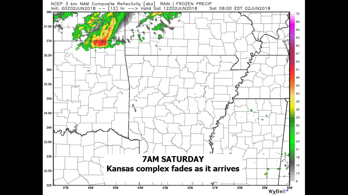
The storms will be most robust in Kansas but should start to fall off by the morning hours. A few could make it in.

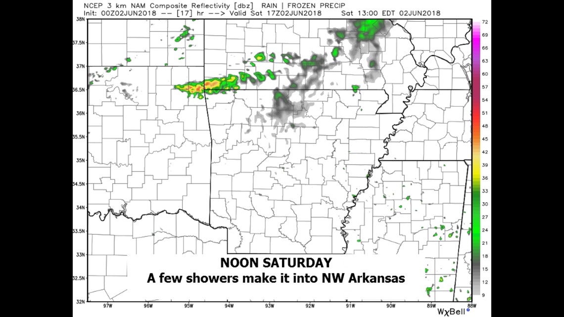
As the boundary sags a lingering shower or thunderstorms is possible in the morning but most of the storms should begin to fade.

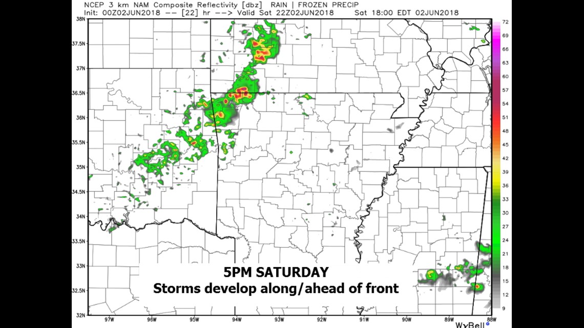
Scattered storms will develop along and ahead of the front on Saturday. These will be the storms with the severe potential.

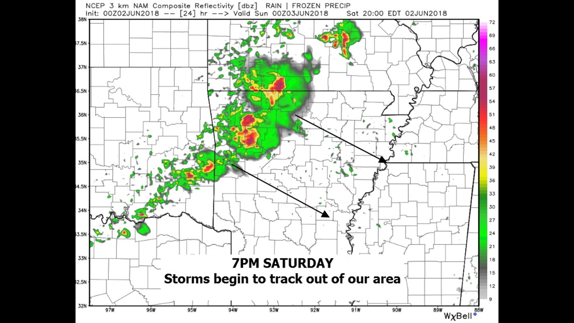
As the front sweeps east, most of the thunderstorms will clear our area in the evening with drier and more comfortable weather setting up for Sunday.

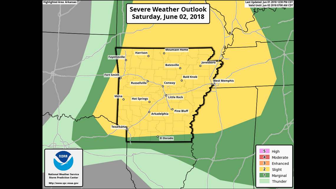
There is a risk of severe thunderstorms on Saturday with the primary threat being damaging winds from the strongest storms in the late afternoon or early evening.
-Garrett