
The pattern becomes even more amplified early in the week (huge trough out west, huge ridge out east). As a slug of upper level winds round the base of the trough it’ll force the jet stream south and eventually dig something into our area. There are two big questions for next week’s weather: 1) Will the low pressure be cut off? or 2) Will the low be carried by the jet stream?
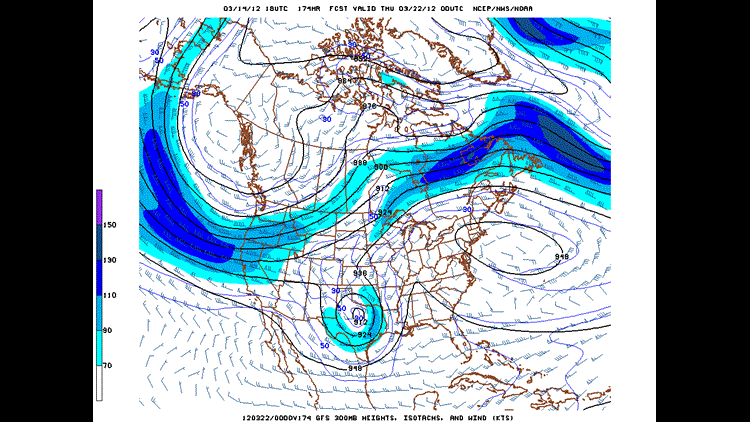
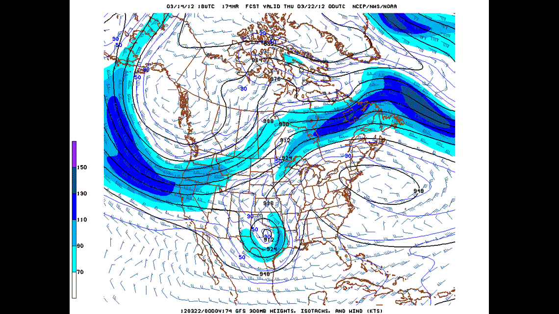
A cut off low pressure system has been the most recent trend on the computer models. (See image above for Wednesday night. A low that is spinning like a top over Texas with a constant conveyor belt of warm moist rain. If this verifies, we’ll see a constant non-stop rain for several days from Tuesday into Saturday of next week.
If the energy manages to stay with the jet stream, it’ll likely move swiftly into the area on Tuesday with a potent and widespread severe weather event. We wouldn’t see as much rain, but we would see the higher risk for tornadoes and damaging winds.
It’s too early to know for certain how this is going to go down. But right now, I would plan on something starting around Tuesday of next week. Either the beginning of a severe weather episode or the start of a soaking or flooding rain event.
-Garrett