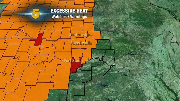
Excessive Heat Advisories have been issued for our entire area this weekend into Monday. The heat index is expected to reach 105º with some locations as high as 110º. An Excessive Heat Warning is in effect for Sebastian County where 110º+ will be common into the weekend.
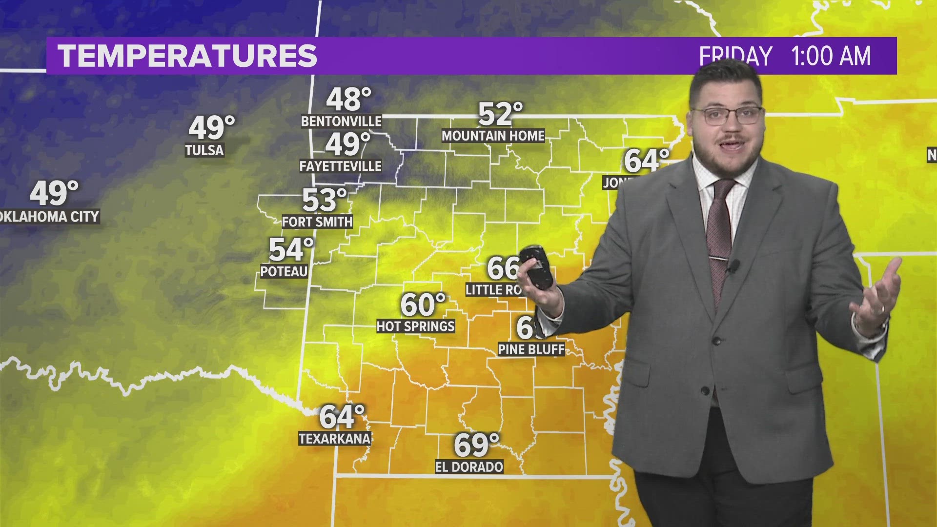
Although heavy rainfall totals affected some of us, the recent rains were not enough to eliminate a nearly 10″ deficit of rain which started around the late Spring. Brush Fires will once again be common into the next week. The rain will increase the humidity near the surface with blistering heat index values.
The upcoming week doesn’t hold much in the way of storms. The heat ridge will continue to strengthen as low 100s continue. An isolated storm will be possible but widespread coverage is not anticipated.
-Garrett
Here are a few of the rainfall totals you emailed in from local reporting sites, Facebook, Twitter, & iPIX:
.02″ Siloam Springs
.18″ NWA Regional Airport
.26″ Pea Ridge
.31″ Bentonville
.51″ Clifty
.63″ Springdale
.64″ Little Flock
.71″ Rogers
.76″ West Fork
1.75″ Graphic
2.00″ Fort Smith
2.00″ Winslow
2.00″ Muldorw
2.00″ Paris
2.00″ Clarksville
2.25″ Waldron
2.25″ Cecil
2.40″ Van Buren
2.80″ Hackett
4.00″ Booneville