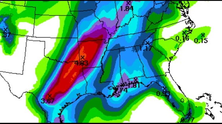
Flash flooding with be the dominant risk factor for early this week. A widespread 1-3″ of rain will fall across our area with some locations receiving as much as 5″ or more of rainfall. Recent rains have already saturated the ground and excessive runoff will lead to additional flooding. A Flash Flood Watch is in effect for the entire area.
The risk of tornadoes, hail, & damaging wind is low and limited due to the tropical airmass in place. The thunderstorms should be multicell instead of supercell which does include at least some chance of damaging winds (rain cooled air will descend quickly causing wind damage) Overall, the severe risk is low (not zero) and the rain risk is high.
Rain that begins Monday evening will continue into Tuesday with yet another heavy rain possible on Wednesday before the drier air cuts off the moisture and ushers in colder than normal temperatures.
The usual flood prone areas will likely flood early this week. Be especially cautious on rural roads that could become washed out. Flash flooding (not hurricanes or tornadoes) account for the majority of severe weather deaths.
-Garrett