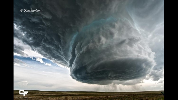
Check out this video from BaseHunters Chasing storm chasers in Wyoming over the weekend. It’s not Photoshop or special effect graphics, it’s a picturesque “low precipitation supercell”.
Across Arkansas, we typically get HP Supercells or “High Precipitation” which generally shields most of the internal storm structure from view.
LP Supercells can occur this far southeast but it’s typically uncommon due to the close proximity of the Gulf of Mexico & rich Gulf moisture. The tornado that struck Bentonville and Centerton, AR in 2006 started as an LP and then morphed into an HP Hybrid Supercell as it encountered better moisture.
LP supercells produce little rainfall and generally have weak tornadoes although they’ve been known to produce large hail and a few strong tornadoes from time-to-time.
They’re known for their outstanding structure. Without all of the rain, you can generally see the entire mesocyclone & updraft and often the spinning “striations” along the side of the updraft wall that resembles a corkscrew.
A beautiful display of the incredible power within the atmosphere.
-Garrett
Update: On Monday May, 19th storm chasers intercepted another low precipitation supercell in Nebraska. Here’s a picture that was Tweeted from Ian Livingston.