Two fast moving systems will bring the chance for wintry weather to our area on both Saturday and Sunday. The first system will feature the potential for sleet, freezing rain, & snow while the 2nd system will feature a better possibility for snow. Both have limited moisture and accumulation is expected to be light; however, given the cold airmass, roads (especially bridges and overpasses) are expected to become slick and hazardous at times.
The first system:
Clouds will be increasing on Saturday. It appears the best chance for a wintry mix will be from Noon to 4pm with some clouds clearing by evening.

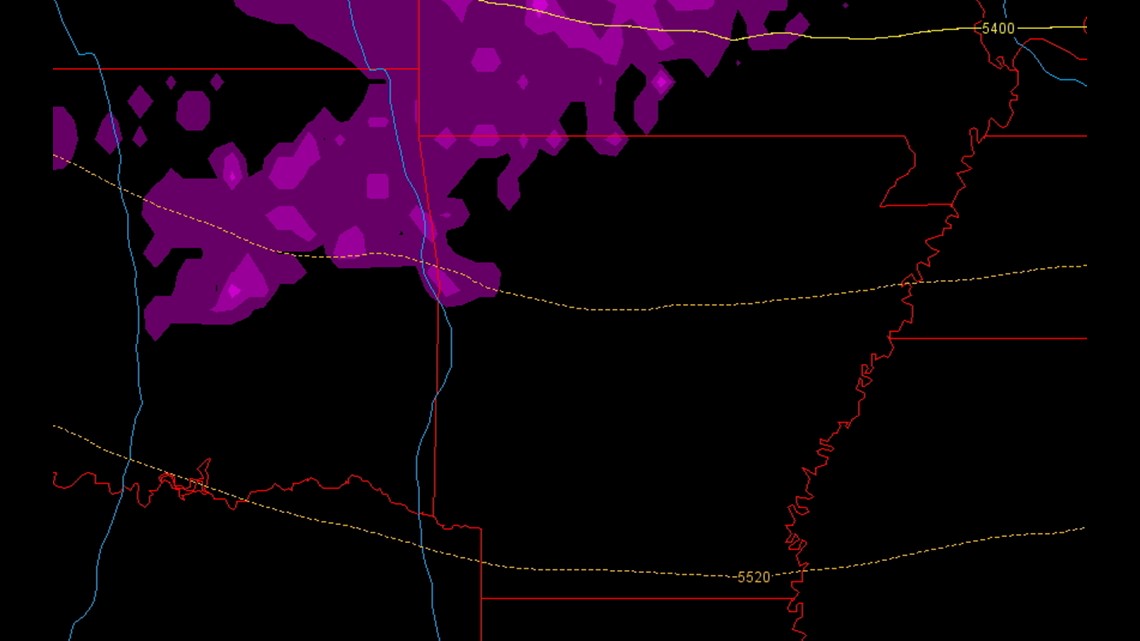
This image shows Noon on Saturday with the pink colors representing precipitation which is expected to be light and fall as a mix of ice pellets, freezing rain, & snow grains.


By 4pm on Saturday, there will still be some light wintry precipitation in the area but the majority will shift to the east.

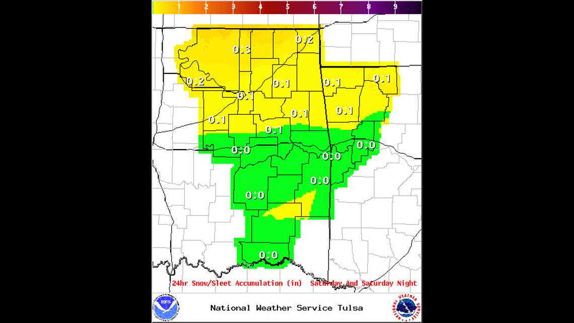
This image from the National Weather Service shows the forecast accumulated snowfall and it could be around .10″ or so. Again, very light but with temperatures at or below freezing, roads are expected to become slick in spots.
The next system arrives on Sunday.

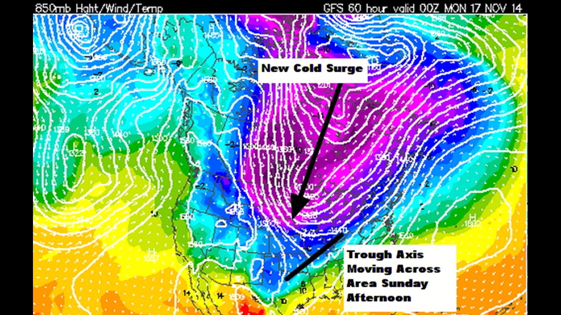
A secondary cold surge will be moving in from Canada and will advance a trough of low pressure across Arkansas and Oklahoma in the afternoon and evening on Sunday. Because of the increasing depth of the cold air, all of the precipitation is expected to fall as snow on Sunday.


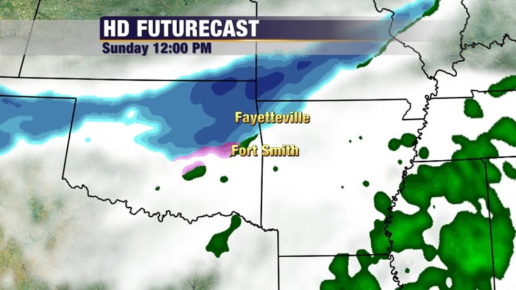
By Noon on Sunday, snow is expected to be falling across Northwest Arkansas and moving southeast into the area through the afternoon.

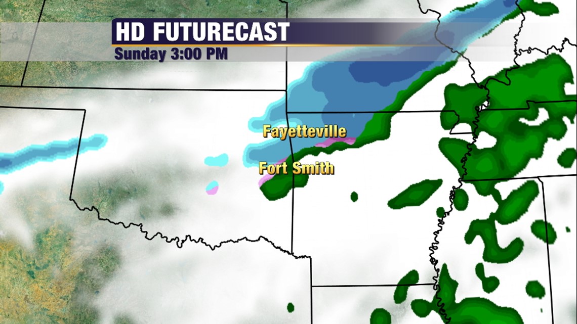
By 3pm on Sunday, most of the heavy snow will be out of the area. It does not look like the River Valley will see much wintry weather but some light amounts and few slick roads could be possible. The highest impact appears to be across Benton County.


The Meteogram is for Fayetteville. The combined model average is around 1.10″ of snowfall which seems to fit the data. Notice on Saturday not much snow at all is generated. (Image via Iowa State)

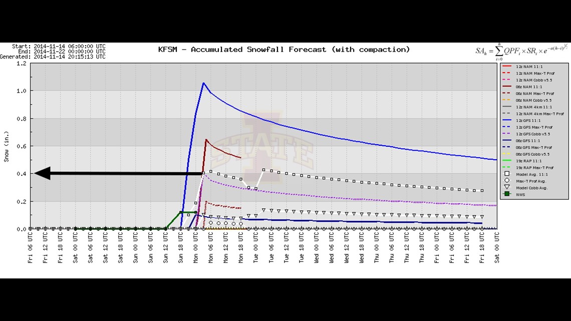
This image is for Fort Smith with the model average around 0.40″ of snow.


Both of these model trends appear to line up with the National Weather Service assessment of snow forecasts for Sunday.

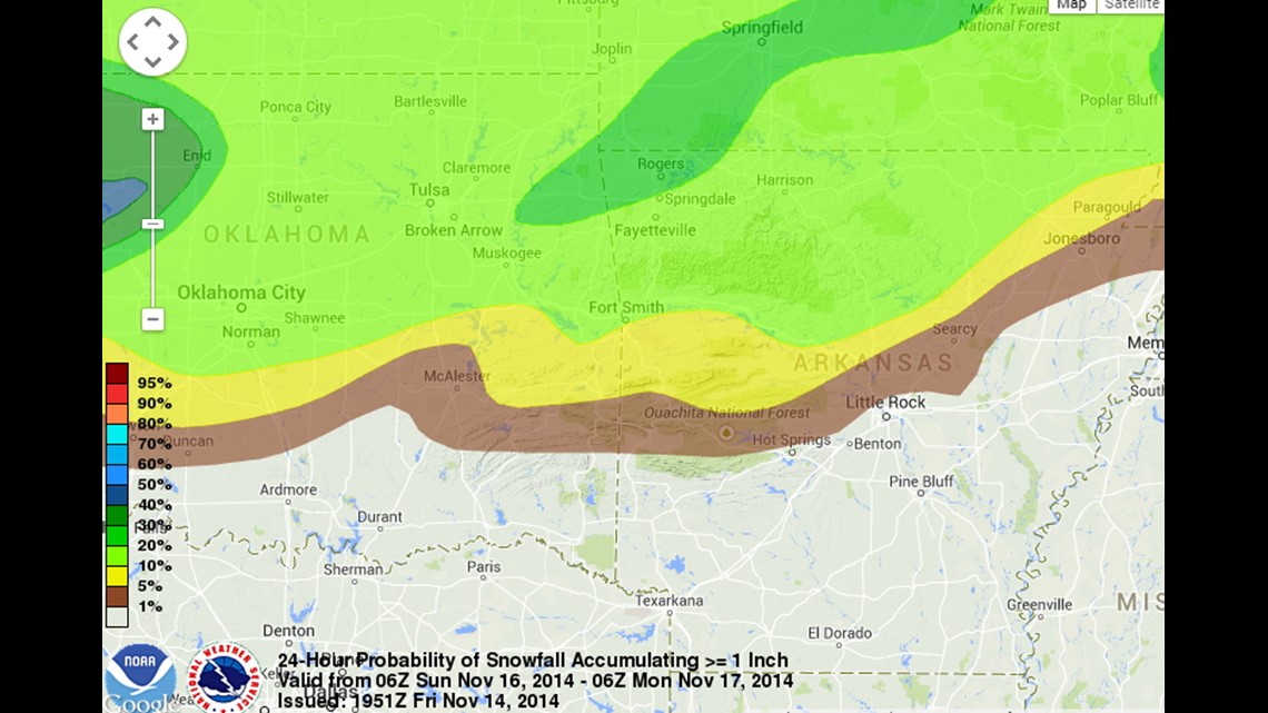
This image is from The Weather Prediction Center and shows the highest probability of 1″ of snow. Notice that the highest chance for snow is in Rogers, Bella Vista, & Siloam Springs.
*For the Arkansas-LSU Game, it appears most of the wintry weather will have shifted east but temperatures at kickoff are expected to be near 30º with mid 20s by the end of the game. There will be a chance for flurries during the game.
In Summary:
- Expect light wintry weather on Saturday afternoon with very little accumulation but the potential for road problems given the cold airmass
- Expect light snow on Sunday afternoon with around 1-2″ in Bentonville and around 1″ in Fayetteville. Not much will fall in Fort Smith but around 0.50″ is possible if melting is minimal. Due to cold ground temperatures roads will become slick and hazardous — especially while the snow is falling.
- Roads could continue to be slick in spots on Monday morning.
-Garrett