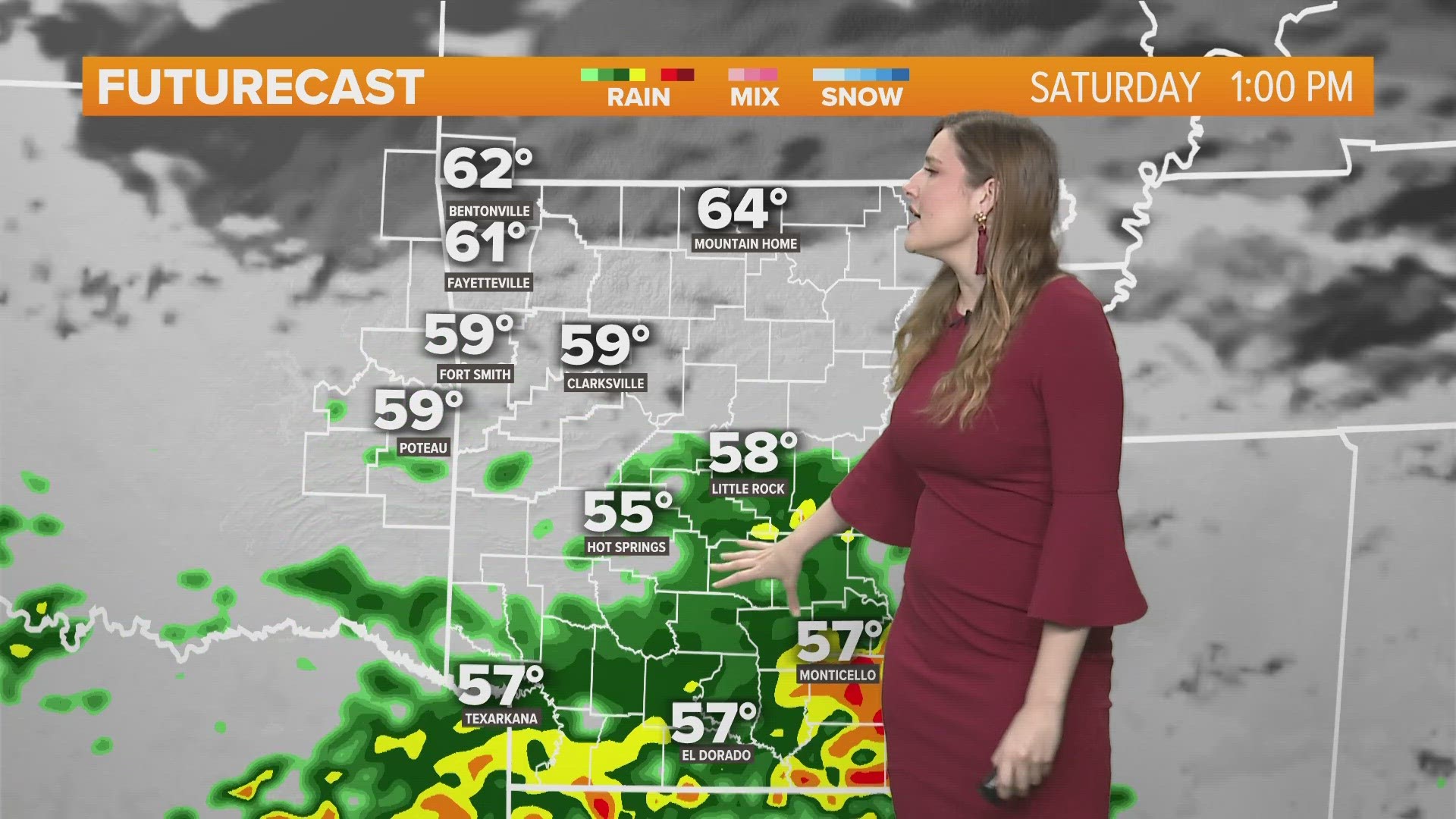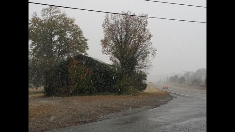
Snow continues to make it’s way across much of the area. The polar front continues to advance to the southeast and will quickly turn any liquid on the ground to ice. Around 1-2″ of snow is expected for most of the area with locally higher amounts.

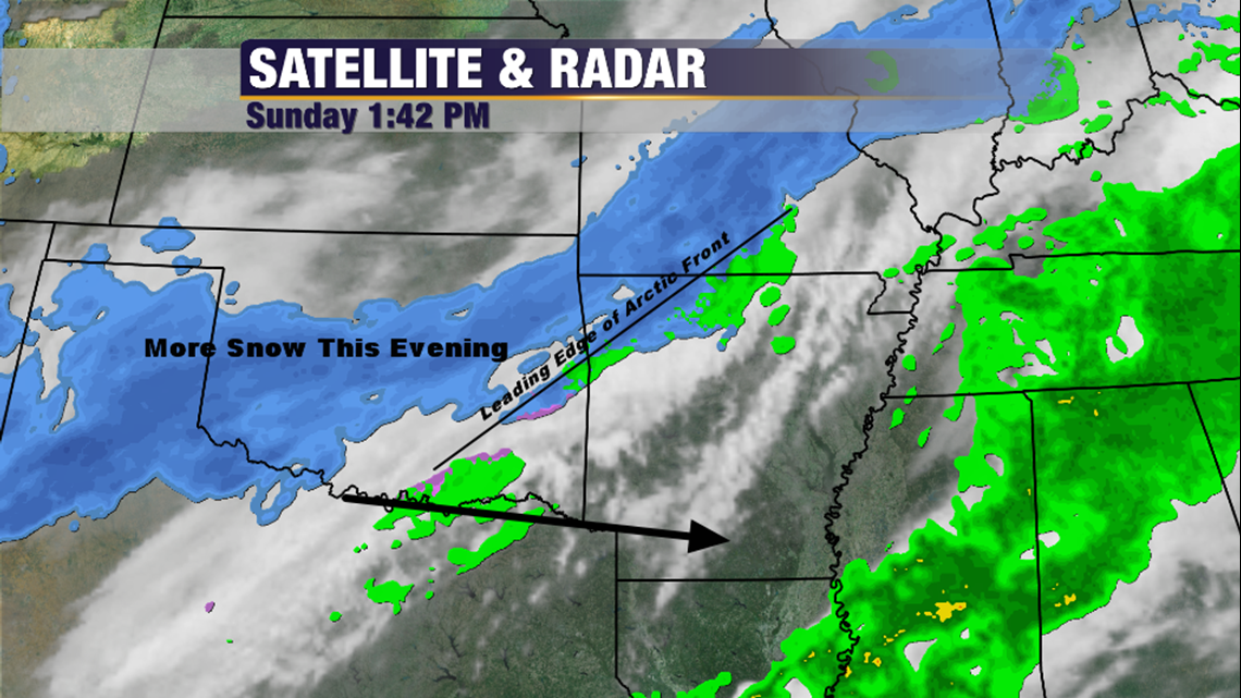
You can see how the snow has develop farther south in Oklahoma. The first wave was along the front and included a mix of sleet and snow. The second wave will be all snow and will occur with colder temperatures which should lead to more traffic issues by sunset.

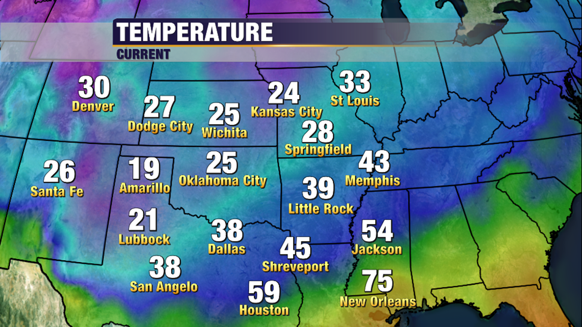
Temperatures behind this cold surge are only in the 20s behind the front. Most of our area will be in the 20s around sunset tonight with snow still falling. Lows tonight will be down in the teens with windchill values near 0º.

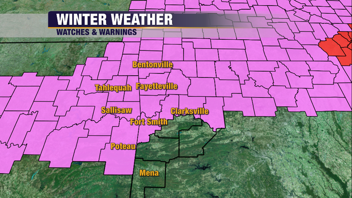
Because of the more south track, the National Weather Service has expanded the Winter Weather Advisory to the south to now include Fort Smith, Clarksville, & Poteau. Like Northwest Arkansas, around 1-2″ are expected on average.
Here’s the timeline from the latest Futurecast:

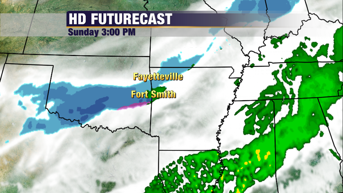
3pm: With the help of the colder air, more snow will move into West Central Arkansas

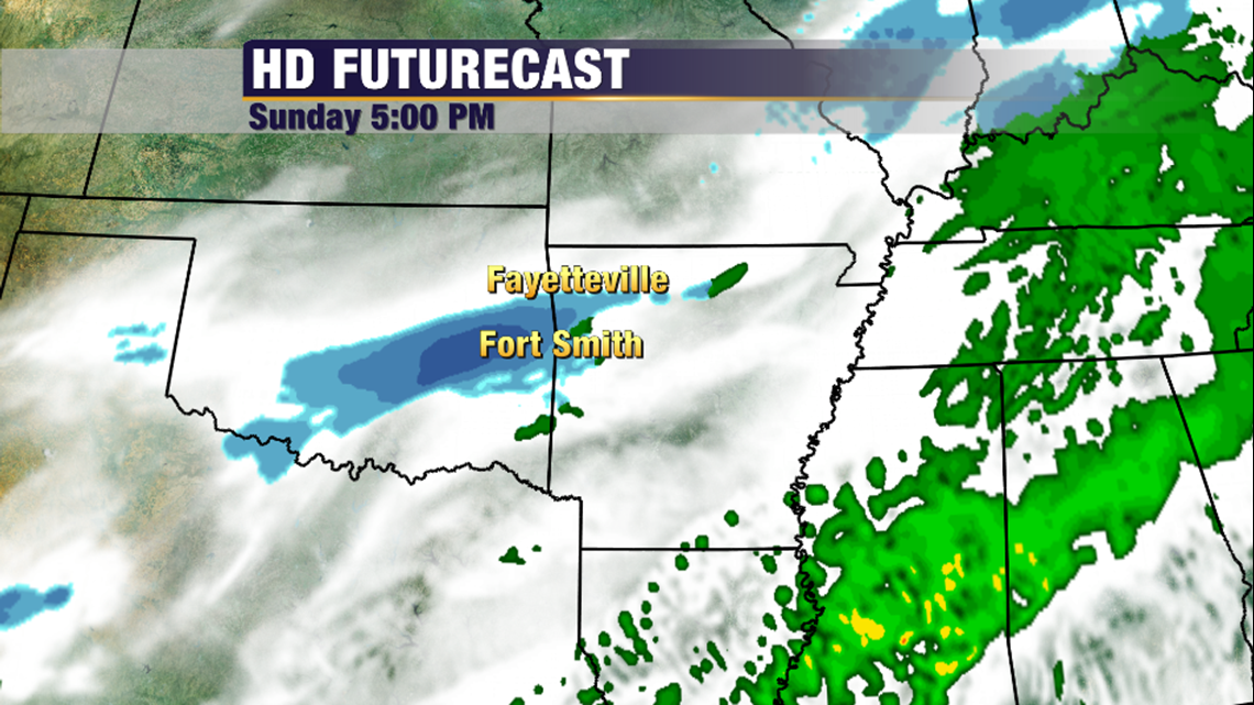
5pm: As the sun goes down with snow fall, we’ll see more road conditions develop. Snow could still be falling in Fort Smith and Fayetteville through 5pm.

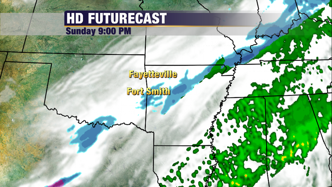
9pm: This is a quick system, it’ll be exiting the area around 9 with some snow lingering in Clarksville and Booneville until midnight.

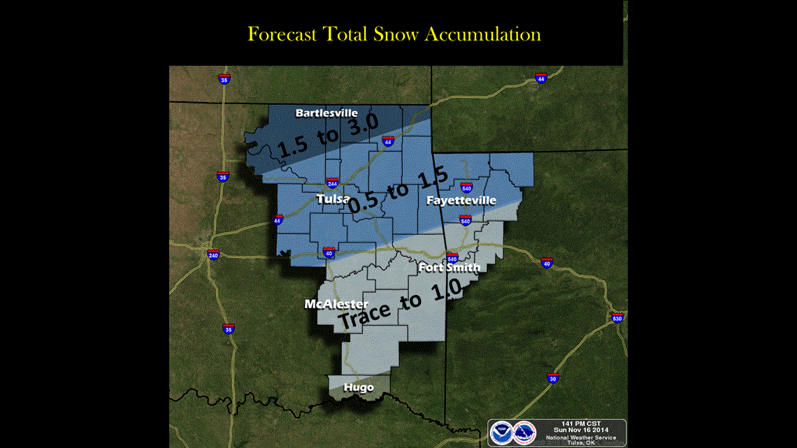
The latest snow accumulation forecast from the NWA suggest around 1-2″ with a little more or a little less in localized areas.

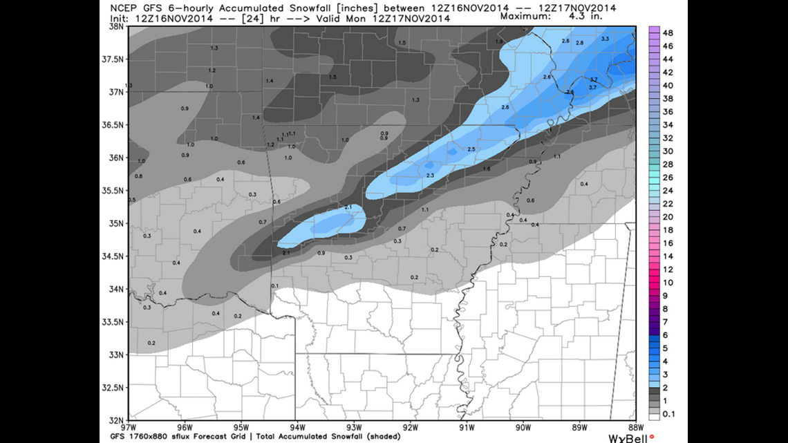
This is in line with the GFS Model (via WxBell Analytics) which also shows around 1/2″ to an 1″ for the area. Notice the interesting band of snow over Waldron & Yell County. If that materializes it could be around 3″ in that area.
Due to the very cold airmass, snow that falls after dark will stick to roads and remain around heading into the first part of the day on Monday.
-Garrett