
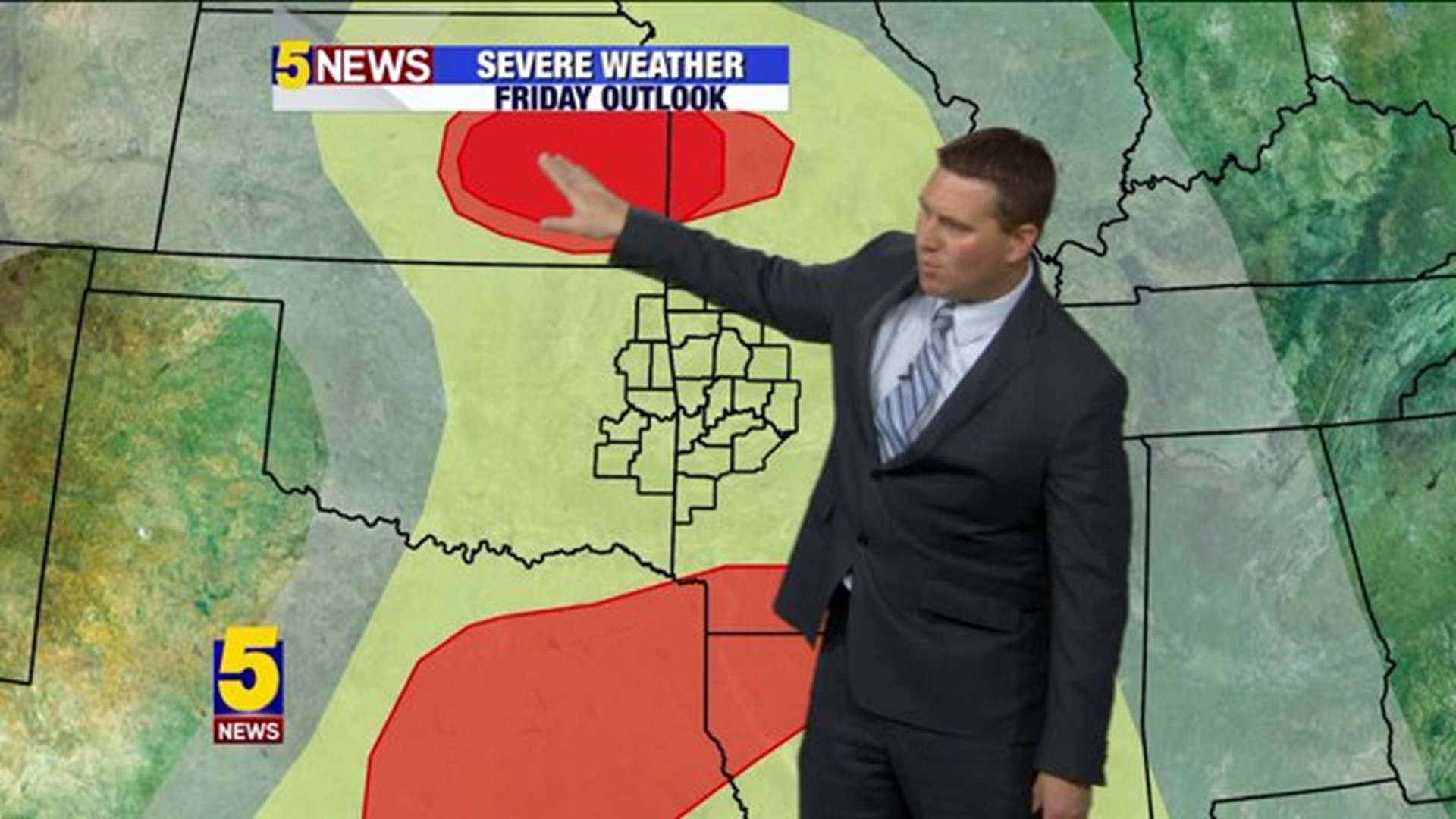
Lots if ingredients coming together for severe weather on Friday with the extent of morning rain & cloud cover the "bang or bust" factor for whether we get general thunderstorms or supercells with tornadoes.
Here's a look at what I'm currently evaluating...

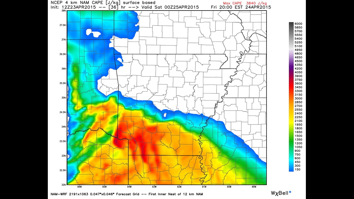
Forecasts for instability (CAPE values) are low for most of our area with the exception being SW Arkansas and SE Oklahoma. This scenario will play out as long as the atmosphere does not recover from morning storms. If we do see clearing skies the instability will be far greater. Right now, the trend has been for low instability. But uncertainty is high and the threat is conditional... if instability changes, big storms could move in from Oklahoma.

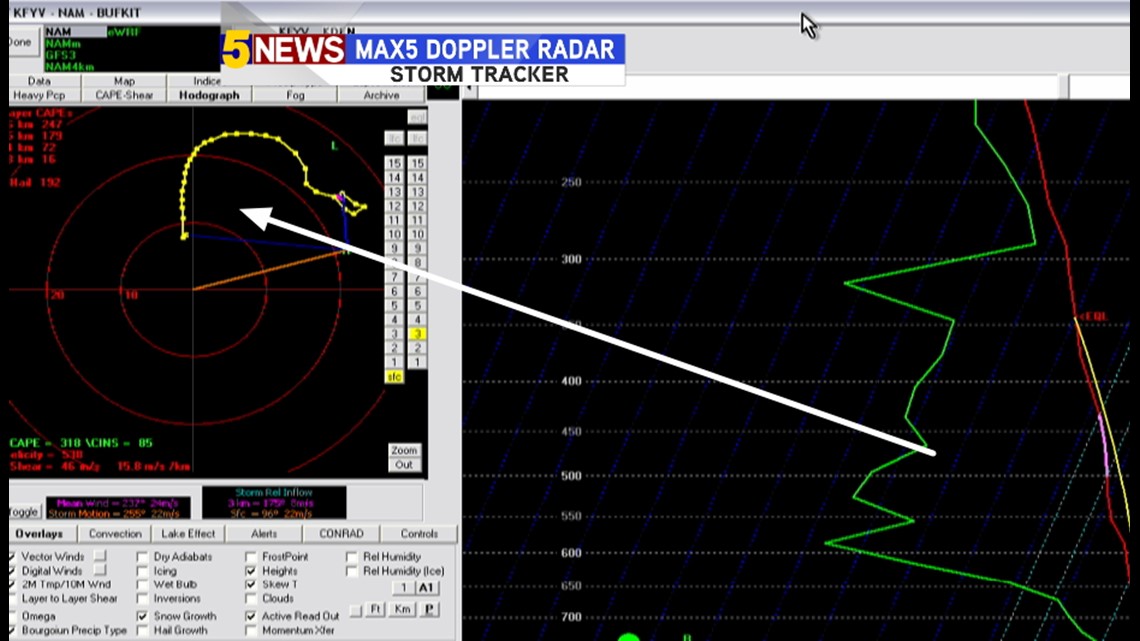
The arrow is pointing to the low level wind fields. A horseshoe shape usually occurs with big tornadoes. This is about 3/4 of a horseshoe with a straight line on the right side. If storms can become surfaced based the low level wind fields are highly supportive of tornadoes. For the weather geeks, the hodograph has strong 0-1km & 0-3km helicity with an evolution to a linear convection as the parcel climbs the hodograph. Movement could be fairly quick ENE around 40mph. Probably faster than normal supercells if they occur.

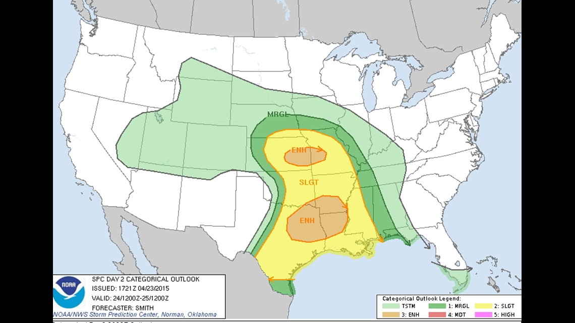
Because the atmosphere may not recover... the Storm Prediction Center has highlighted 2 areas. One near the low pressure in SE Kansas, and another along/south of warm front in NE Texas/S Arkansas.
Based on the data this afternoon the southern most ENH may need to be readjusted north a tad and also west to maybe as far as I35 in Oklahoma
Here is how Futurecast handles the convection...

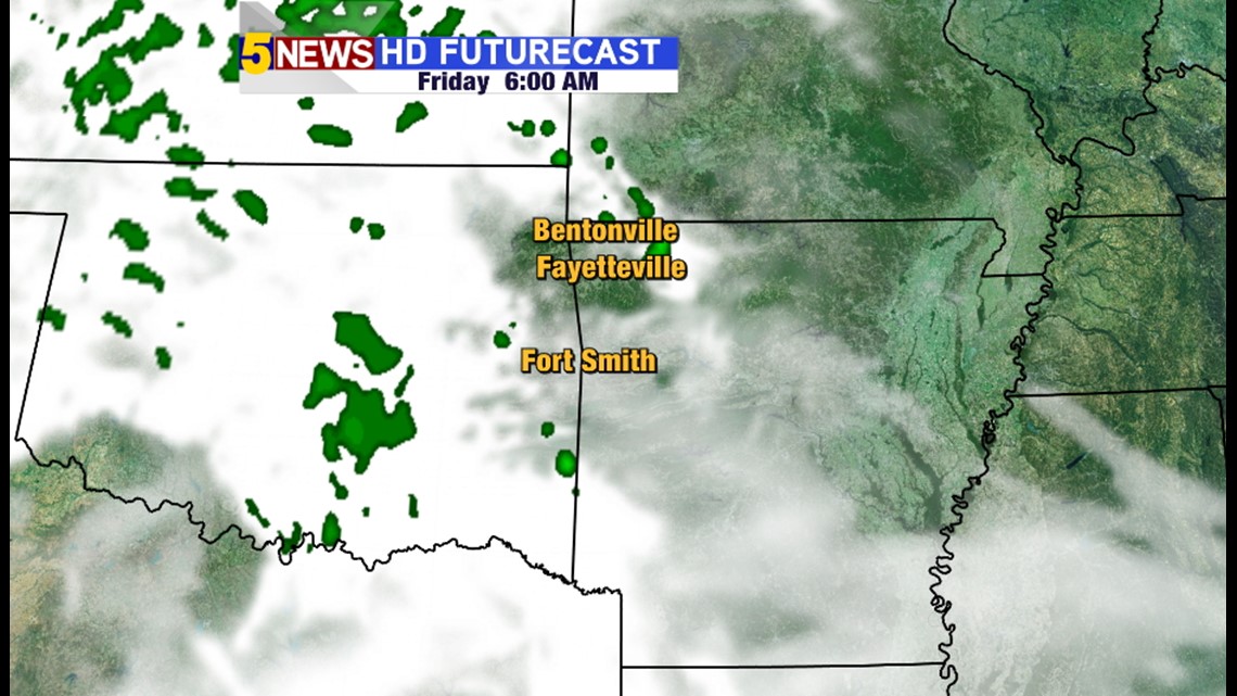
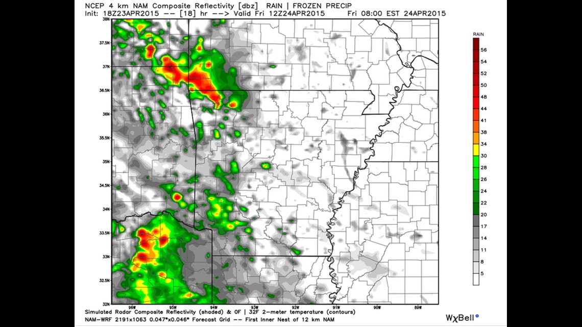
6am: We wake up to some scattered rain

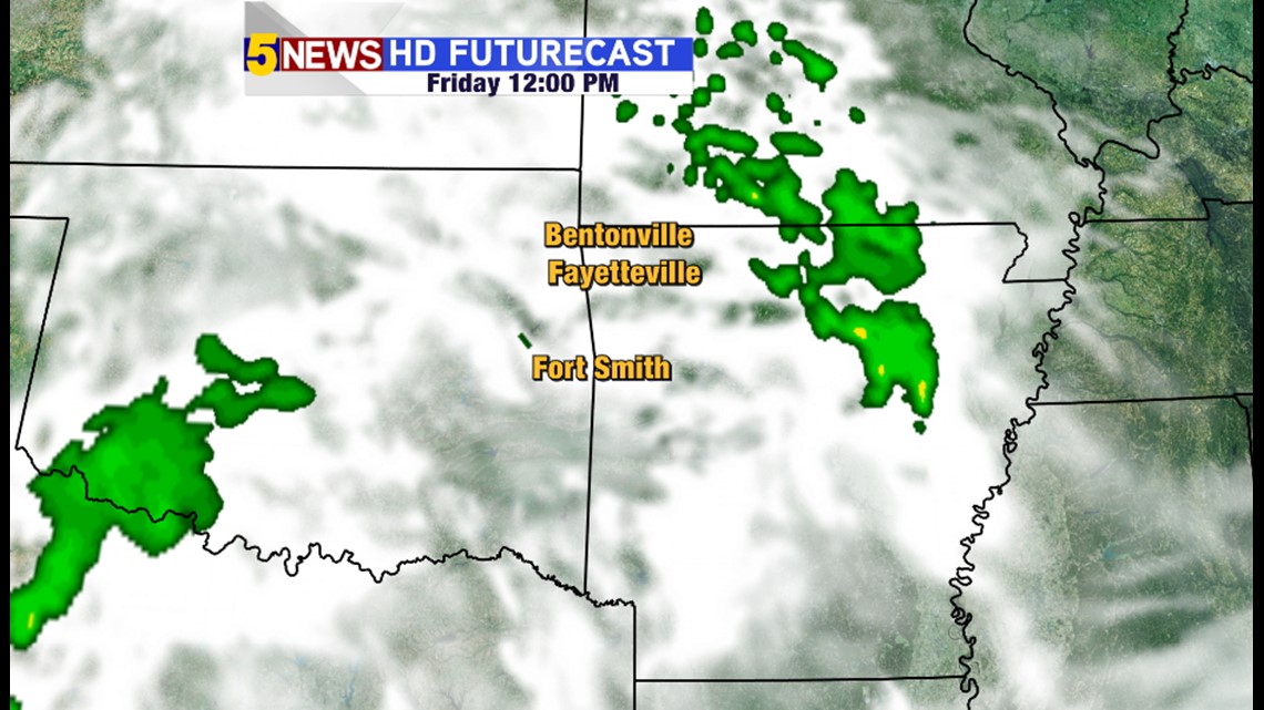
Noon: Scattered rain in Arkansas, still cloudy skies in our area.

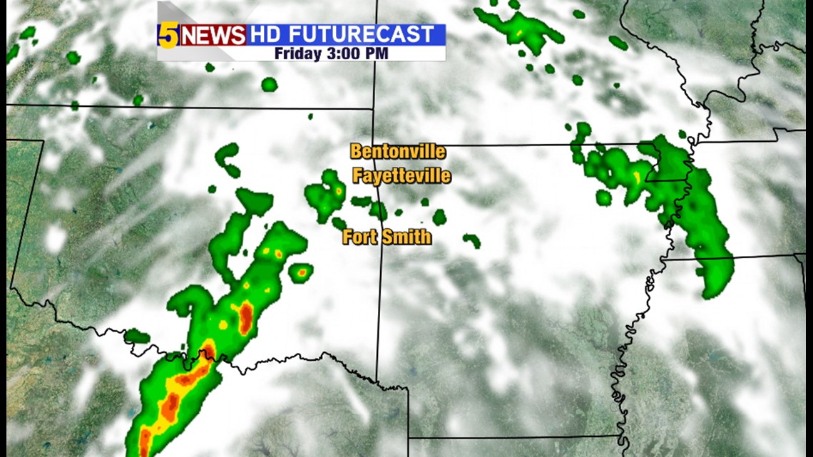
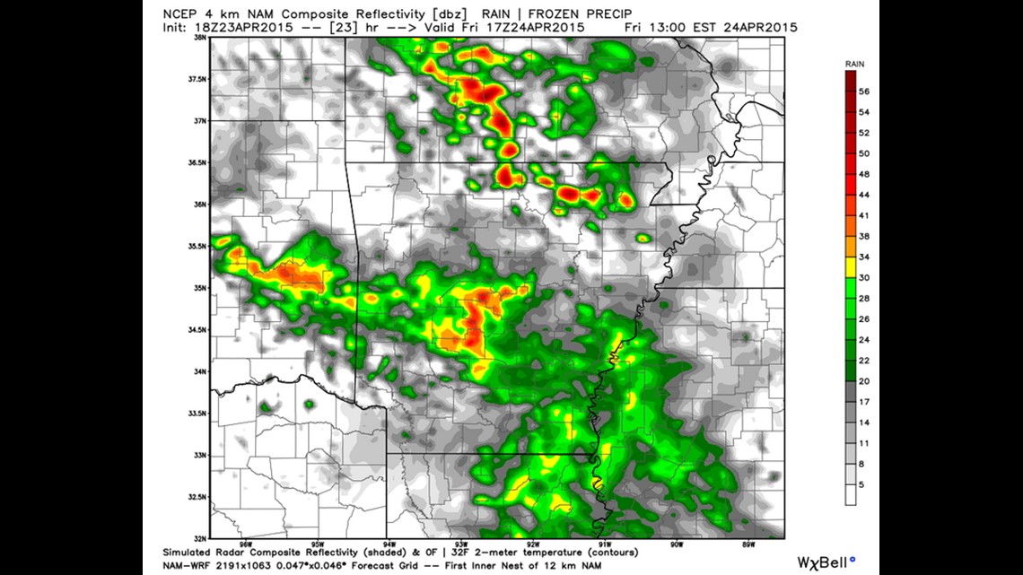
At 3pm: Severe storms will be developing from McAlester to Dallas.

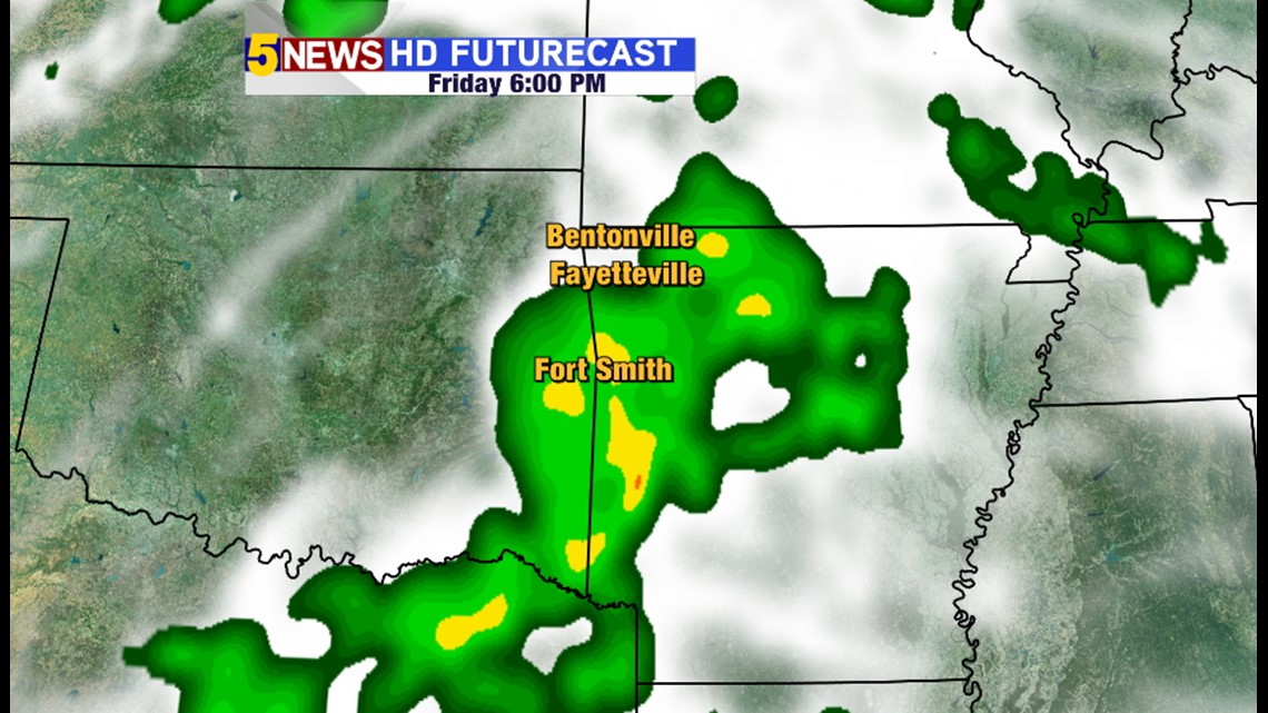
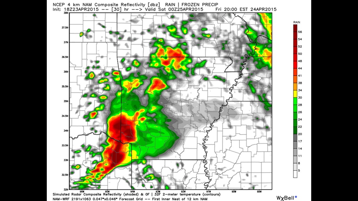
6pm: If severe weather is able to materialize in our area it would be between 4-6pm. Rain is likely at 6pm.

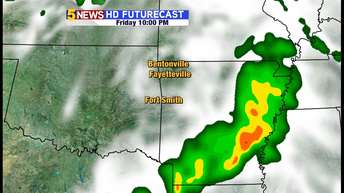
10pm: Everything moves out, weekend look good.
It's also worth noting that most of the short range models have not been handling the location of the convection very well. Here is the NAM4k Noon Thursday Model Run.

7am Friday: Scattered thunderstorms, minimal risk of hail

11:00am: Scattered storms & cloudy

7pm: Severe storms in SE Okla and SW Arkansas.
The forecast will be updated throughout the day on Friday. It's trending for the worst storms to be out of our area but if the atmosphere is able to recover, supercells with tornadoes and very large hail will be possible late afternoon and early evening in our area.
-Garrett