
After a stretch of dry weather with lots of sunshine the rainy days of Spring are posed to return for much of the extended forecast.
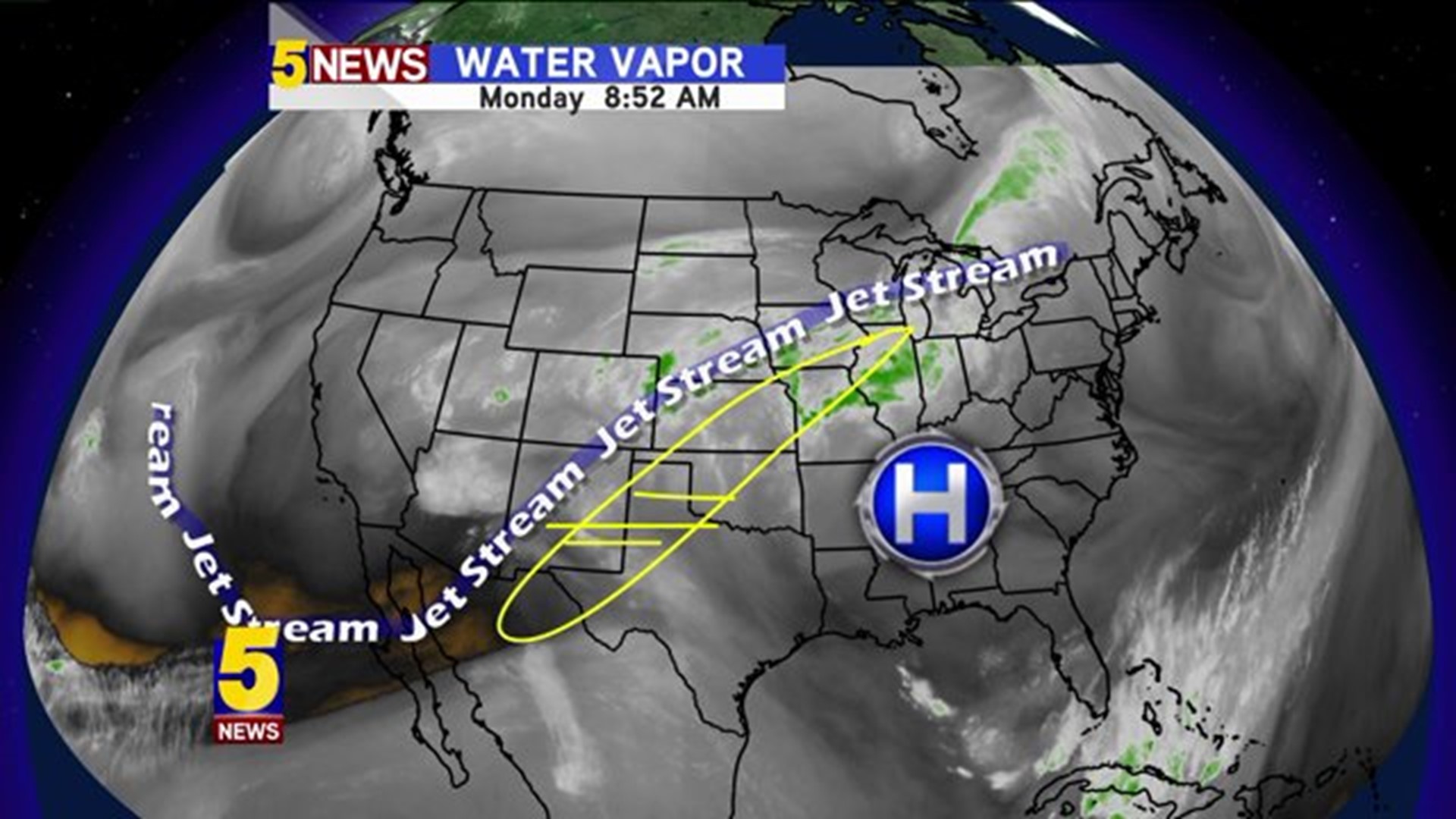
The bulk of the upper level winds and surface forcing features are actually going to remain just west of our area. The result will be showers and storms weakening as they move into our area throughout the week.
A few areas of rain will likely develop both tonight and tomorrow, but a larger area of rain should affect everyone coming up on Wednesday.

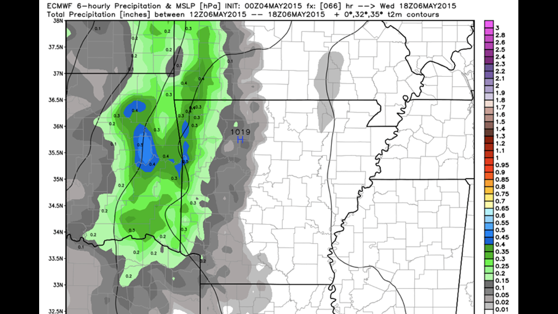
This model depicts storms from Oklahoma moving into our area on Wednesday morning.

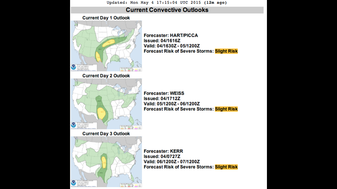
I wanted to show you a snapshot of the SPC Outlooks for the next several days. A large area of high pressure (the one that gave us all the beautiful weather) is located just east of us. The low pressure systems off the Baja of California are smashing up against the western side of the High.

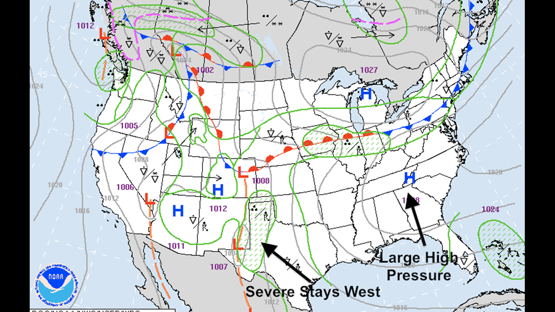
This will cause numerous rounds of severe weather for our neighbors to the north and west but will keep us out of the severe picture for most of the week.
Lots of uncertainty past day 5, but it looks like a surface front may move into the area on Friday or Saturday which could possibly be the next chance for severe storms; it would almost certainly mean a widespread rain for everyone heading into the weekend.
-Garrett