The NASA MODIS Satellite has captured images of the extensive flooding occurring along the Arkansas River and the major tributaries that flow into the river from across the area.

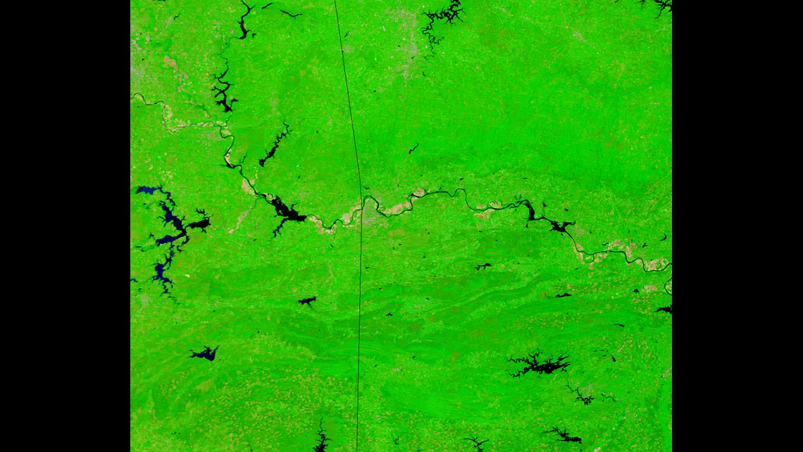
BEFORE: This image is May 14th, 2013.

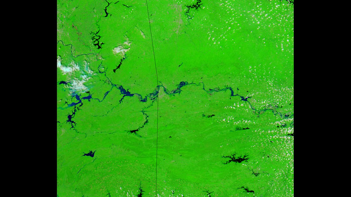
AFTER: This image was captured on May 26th, 2015 when the Arkansas River was cresting over 33ft.
The original images (including a before & after slider) is available on the NASA post.
-Garrett