This week, the warmth and heat will continue to build with highs returning into the low to mid 90s. Thunderstorm chances will remain limited on Monday & Tuesday with a few more scattered storms developing on Wednesday.
The Thursday – Saturday time frame will be the wettest with numerous showers and thunderstorms developing across the area. The heat ridge returns early next week.
It does look like Independence Day will feature widespread showers and thunderstorms. The exact timing will be uncertain but this time of year tends to favor late day and overnight. Rain totals may exceed 2″ since the storms will be slow movers without any major upper level winds. The severe risk will be low and confined to gusty winds with the stronger storms similar to what we experienced last week.
Here’s a look at what is causing the change in the weather pattern:

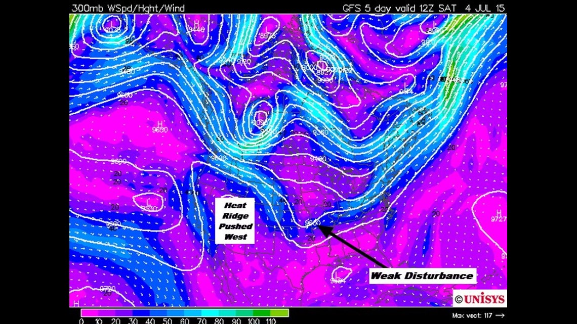
This image shows Saturday morning and you can see the ridge of high pressure backing up into the desert southwest. This allows weak disturbances to ride the southern extent of the boundary which will be draped across S Missouri and N. Arkansas.

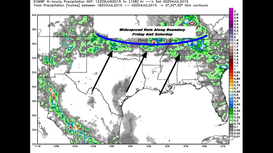
This image shows Friday night, July 3rd. Showers and thunderstorms will be focused along the boundary which is forecast to be over most of our area. The highest rain chances will occur in the Friday to Saturday time-frame.

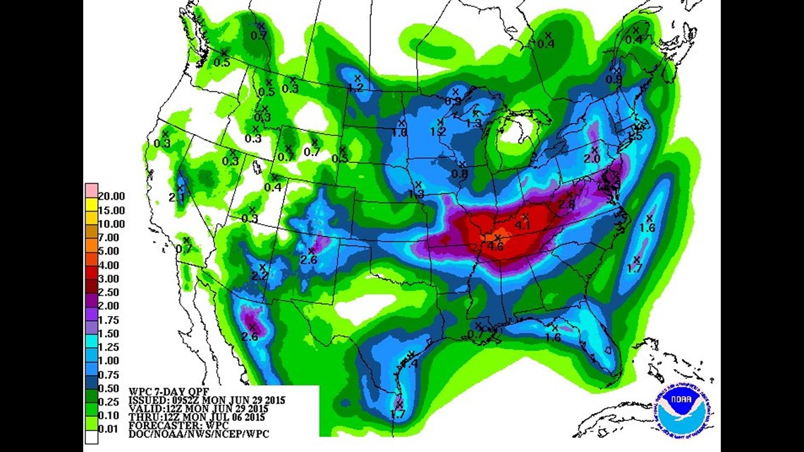
Rain totals for the next 7-days are forecast to be in the 2″ range with the highest totals across N Arkansas and S Missouri. Lesser amounts in SE Oklahoma and SW Arkansas.

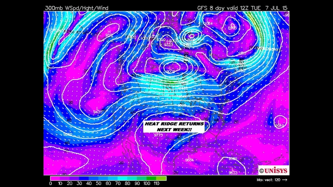
The big heat ridge of heat returns early next week. This image shows Tuesday July 7th. The upper ridge is building; temperatures will increase and rain chances will decrease. Looks really typical of what we could expect to see in July for our area.
-Garrett