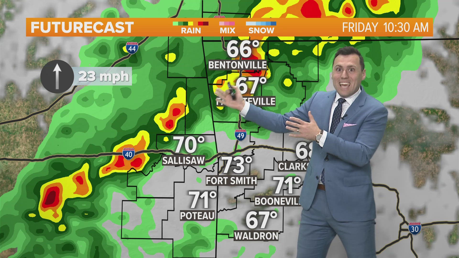

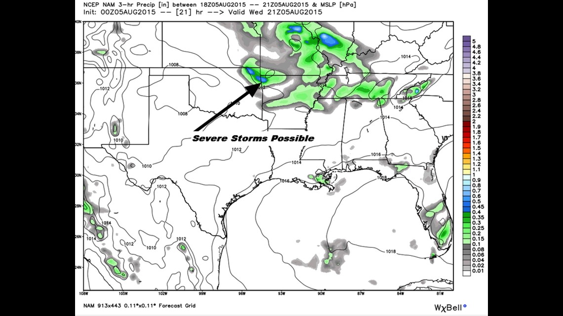
Thunderstorms, including some severe storms, will develop in the afternoon and evening on Wednesday.
Here’s a look at what to watch for:
- Showers will be ongoing early in the day across North Arkansas
- The highest severe storm risk is from 2pm-7pm
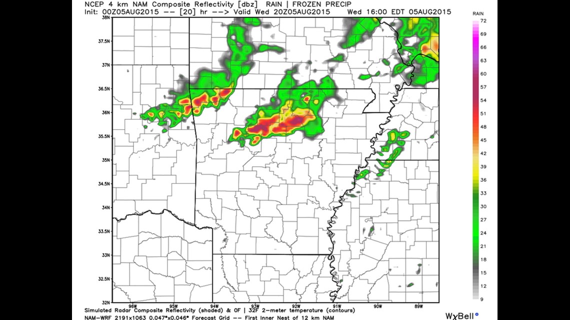
- Storms will take on a bowing shape and could contain winds from 60-70mph
- The storms will move from the northwest to the southeast at around 40mph
- Northwest Arkansas is more likely to experience the stronger storms than farther south in Fort Smith

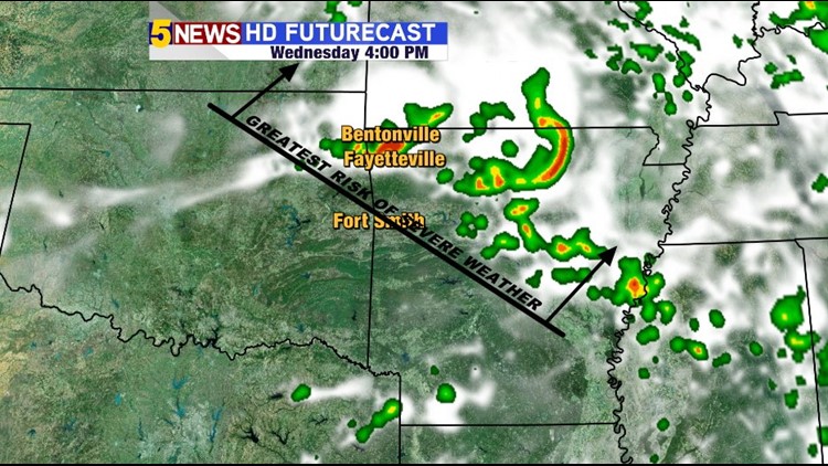
3pm Wednesday: Evening data shows storms already in the area and moving southeast.
After this round on Wednesday the severe risk will be much lower into Thursday and gone into the weekend.
-Garrett