A strong cold front will sweep across the area on Wednesday with scattered thunderstorms likely.
The storms will have the potential to be severe with wind damage as the main risk followed by at least a minimal risk of tornadoes.
Time: 10am-3pm.


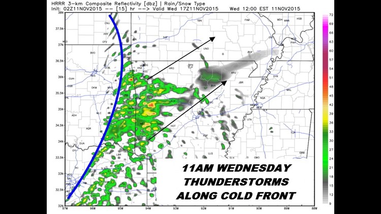
11am Thursday: Data shows the front causing showers and thunderstorms in the area moving NE. Some could be severe.

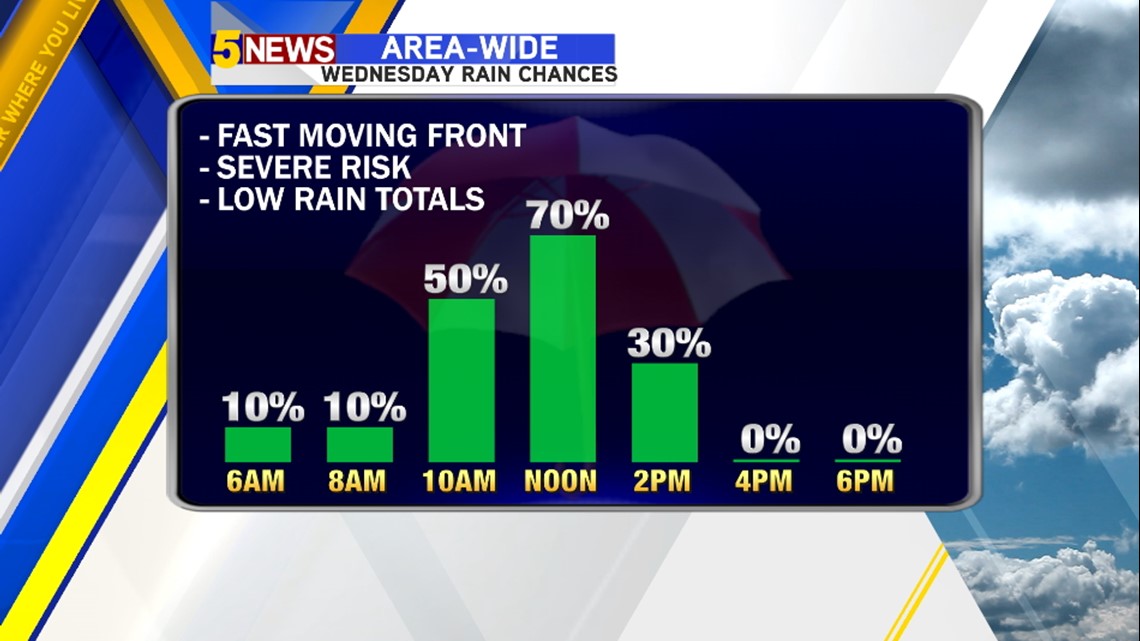
The best time for storms will be an hour or two on either side of lunchtime.

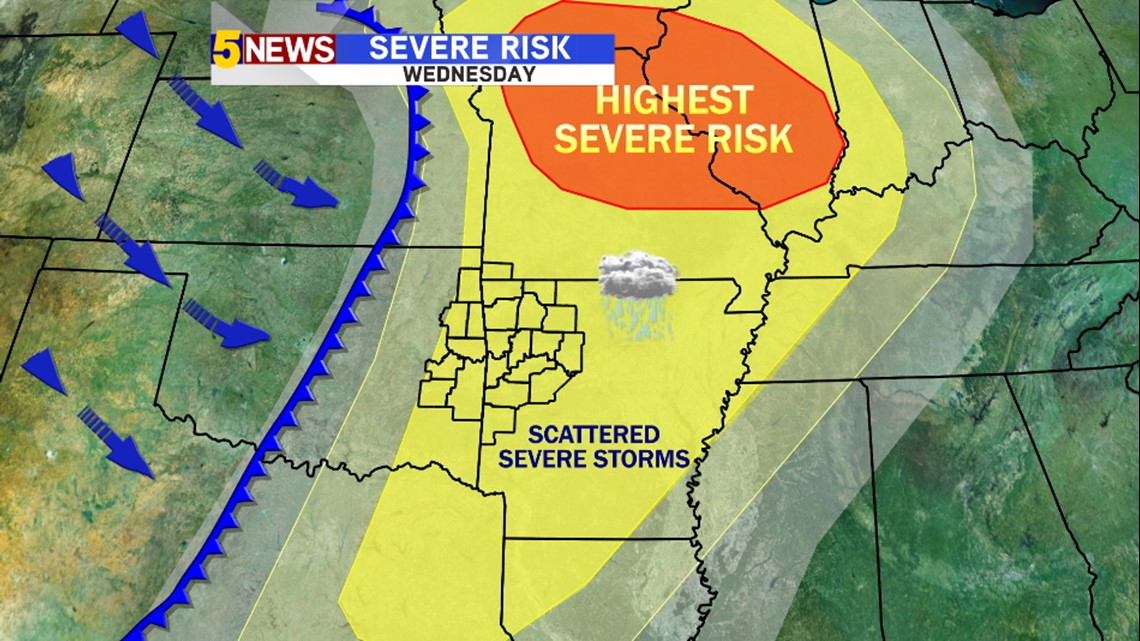
The highest risk may be closer to the low pressure across Northern Missouri.

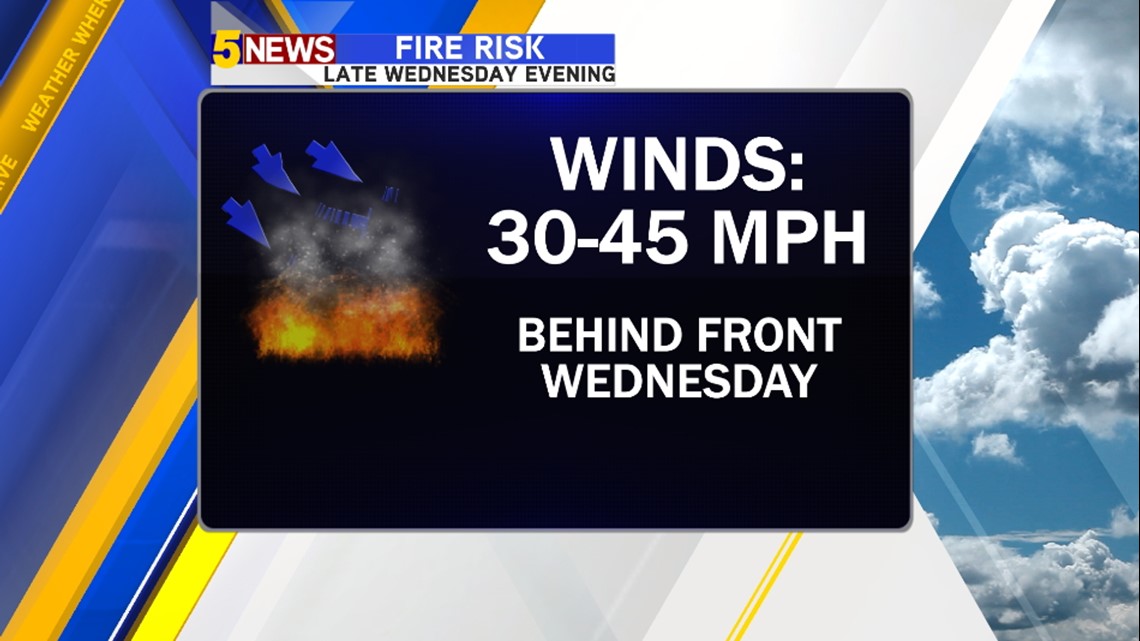
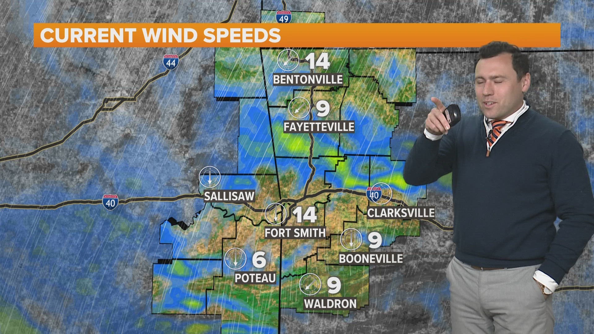
Behind the front, winds will gust over 30mph and any brush fires will rapidly spread. with the low humidity and the high winds.
-Garrett