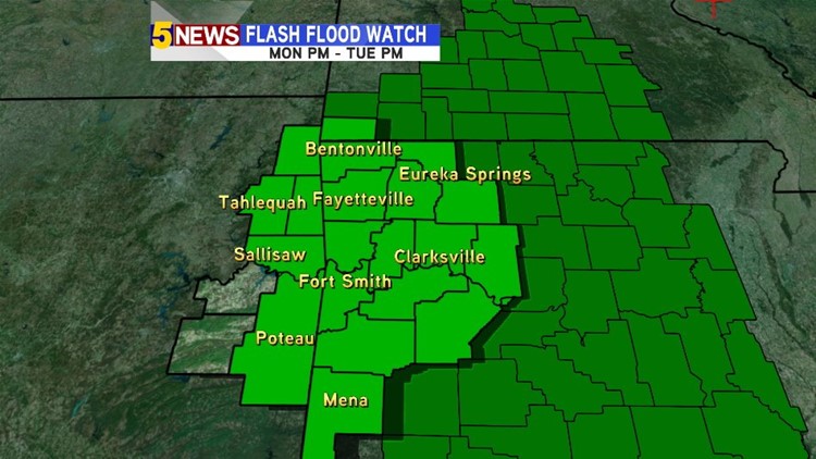
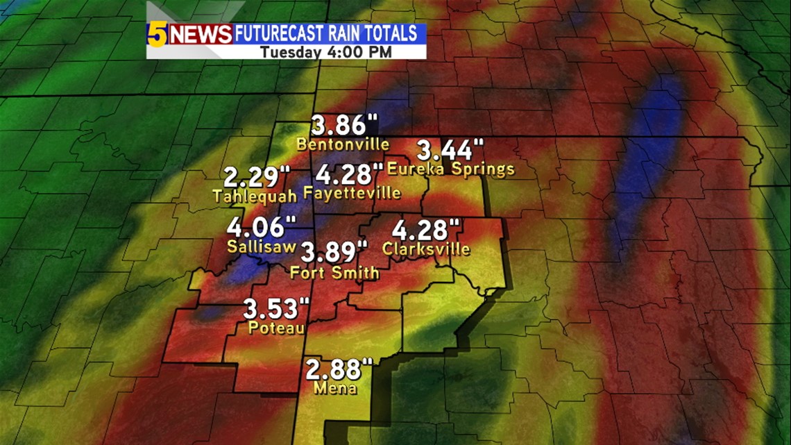
Wet weather will move in starting tonight, with heavy rains arriving Monday night into early Tuesday morning. The entire area could see 2 to 4 inches of rain, with locally higher amounts possibly near 6 inches.


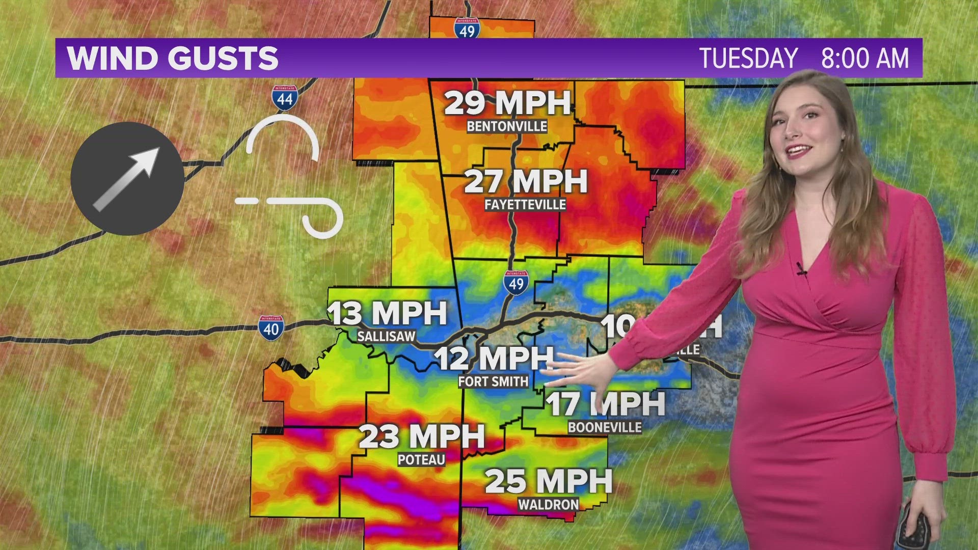
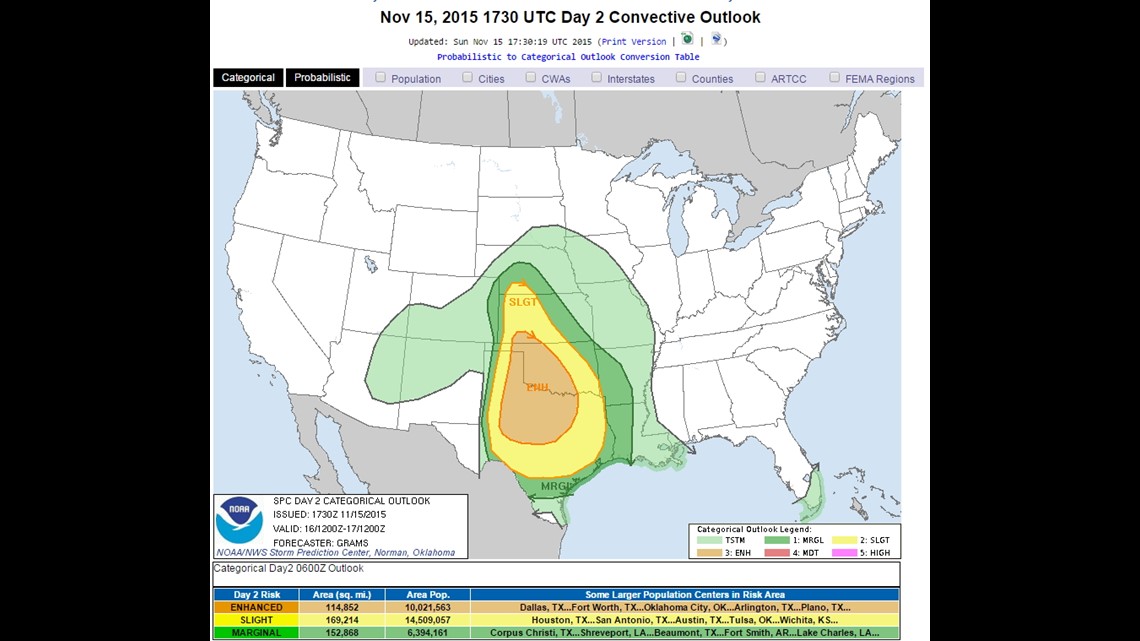
As for the Severe Weather Threat, the best chance of any stronger storms would be moving through Northwest Arkansas and the River Valley very early Tuesday morning.
Gusty winds appear to be the main threat. There is a chance for an isolated tornado, but the best chance of that would be in Western and Central Oklahoma Monday evening, with the threat staying south of NWA and the River Valley by Tuesday.

Breaking down timing of the wet weather where you live:
Tonight into Monday morning: Light to moderate rain showers begin. At times, there will be some breaks from the rain.

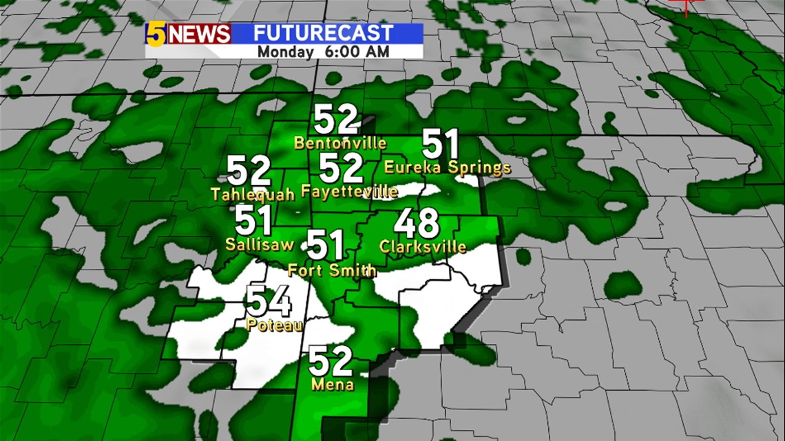
Monday Afternoon: Rain remains light to moderate, but becomes steadier into the evening

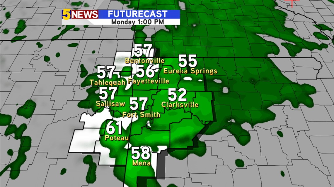
Monday Night: Heaviest rain begins to arrive. Storms are possible, with some having strong winds.

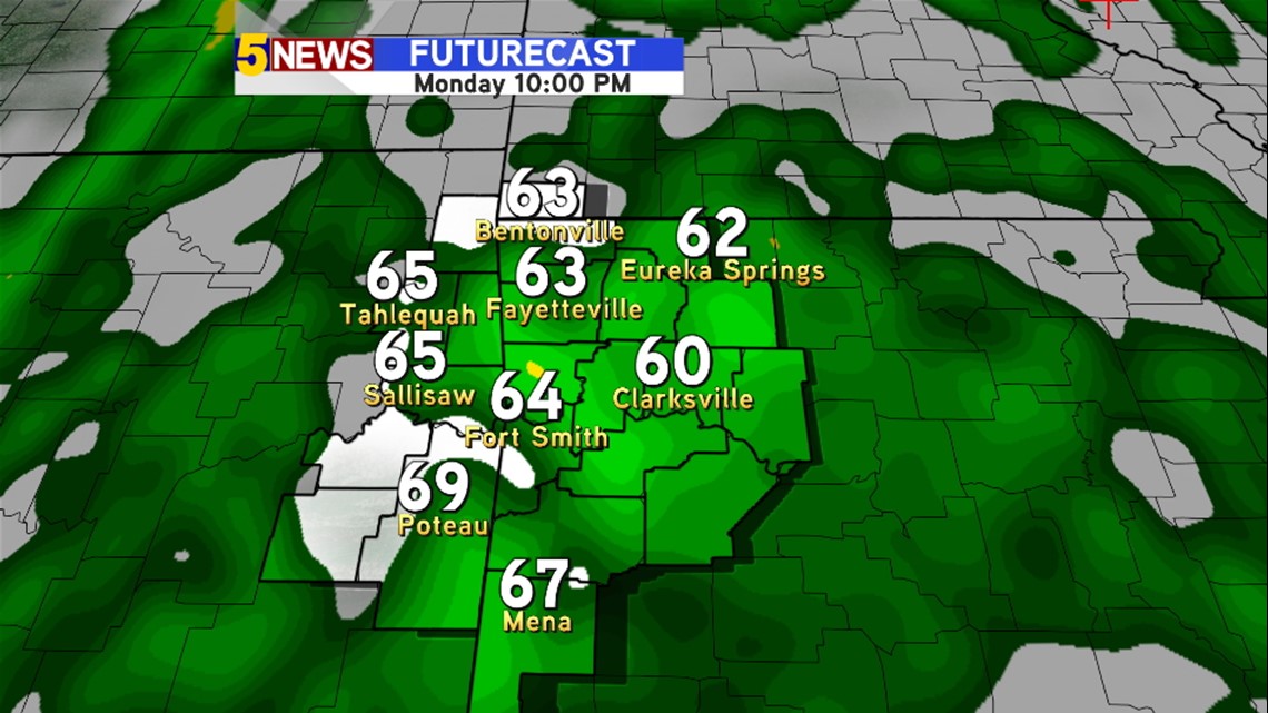
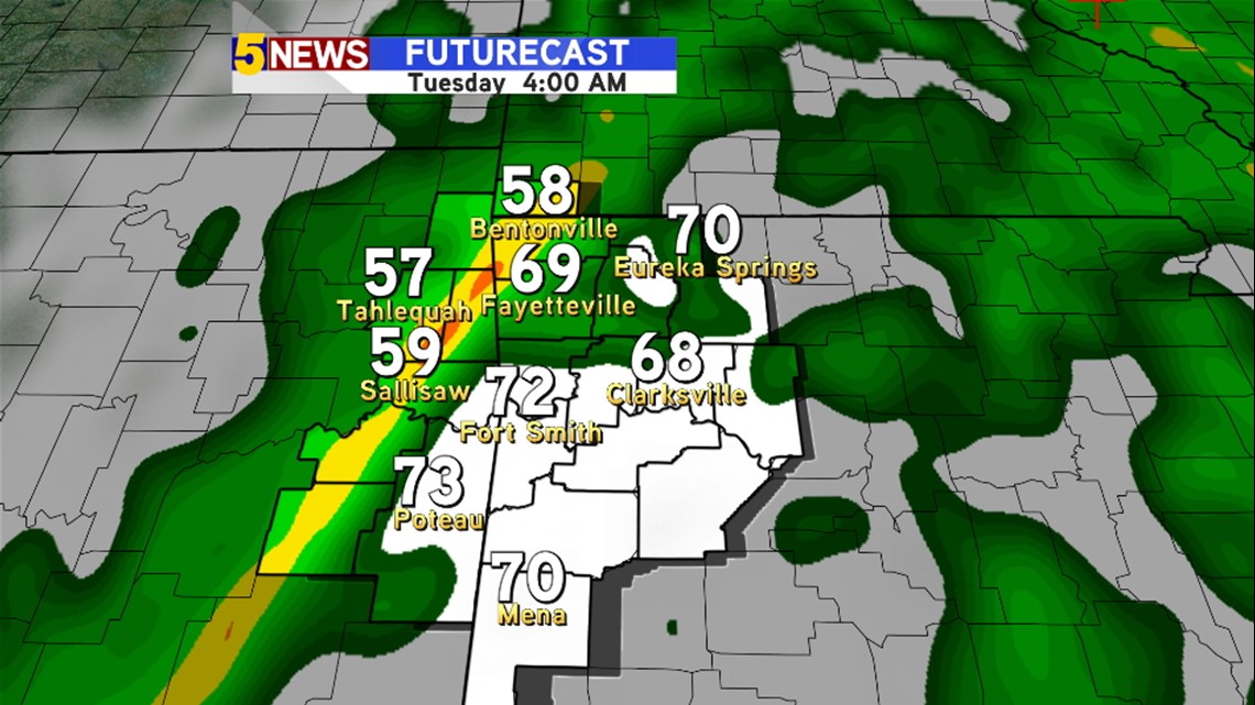
Tuesday Early Morning: Heavy rain with thunder through from midnight until about 9AM.

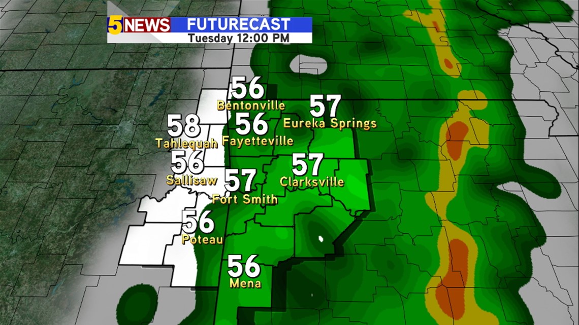
Tuesday afternoon: Rain begins to let up after noon, and we may see the sun come out by the mid afternoon!

Remember turn around don’t down if you see flooded roads. Stay safe!
-Sean