
A cold front arrives this evening with strong to severe thunderstorms developing along the front.
Here is the current situation:
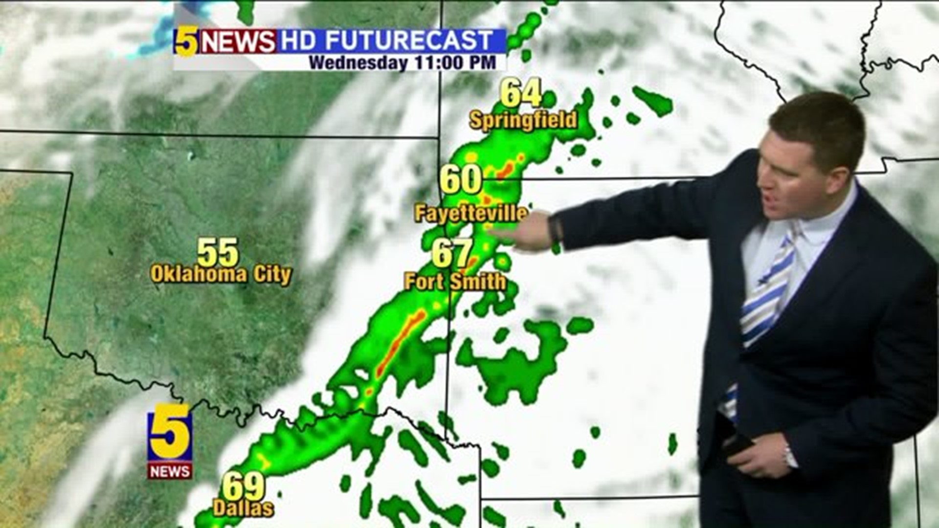
- Storms in NW Arkansas & Fort Smith from 8pm to 11pm
- Some storms will rotate with at least a minimal tornado risk
- Everything moves out by midnight

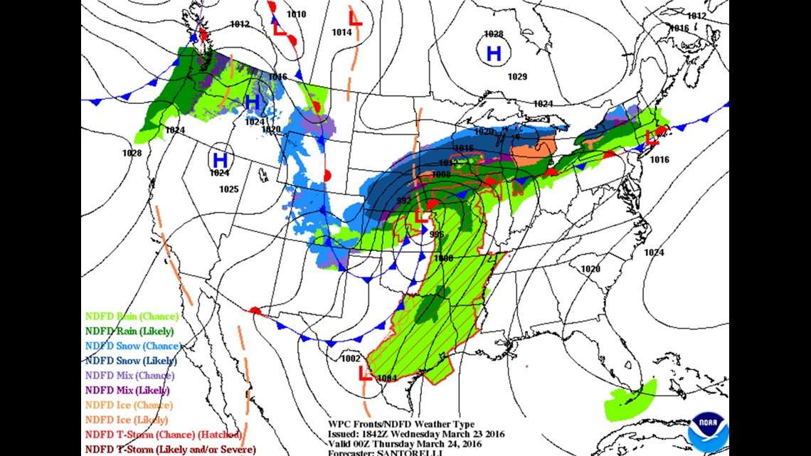
The cold front's arrival is causing the storms. Highs tomorrow will be 20-30º colder; only in the 50s.

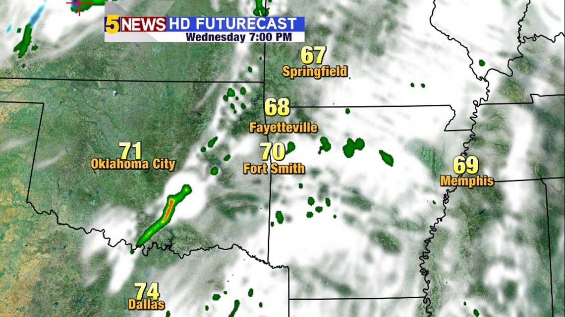
7PM WEDNESDAY: Thunderstorms develop in Eastern Oklahoma and begin moving towards us.

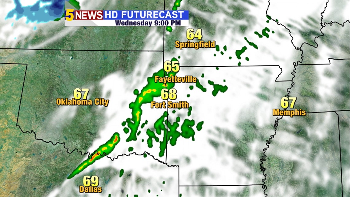
9PM WEDNESDAY: Storms will be affecting our area. First NW Arkansas and then the Fort Smith area.


11PM WEDNESDAY: Storms will continue marching east with the severe risk ending around midnight

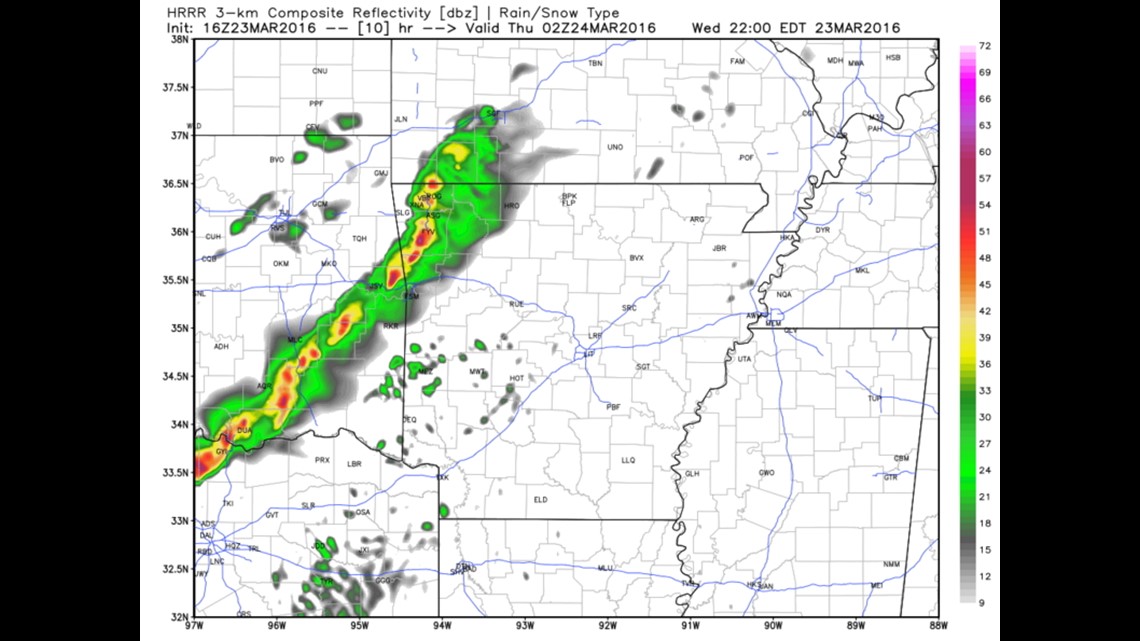
Hi-Res data continues to show the worst of the storms from 8-10pm. This is an image snapshot at 9pm.

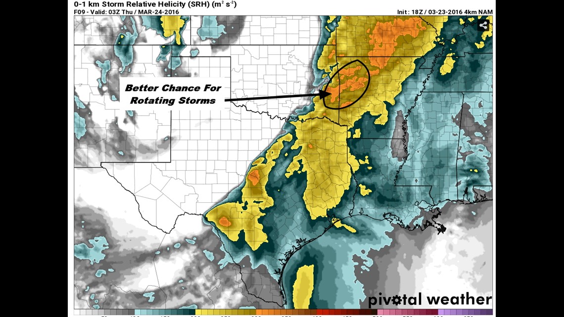
There will be a slightly better chance for rotating storms in the I40/Fort Smith area later this evening but any storms that develop could continue their intensity as they track northeast.
-Garrett