The next chance for severe thunderstorms will arrive on Wednesday with two rounds possible:
- Wednesday morning, scattered storms; low severe risk
- Wednesday night, widespread storms; higher severe risk

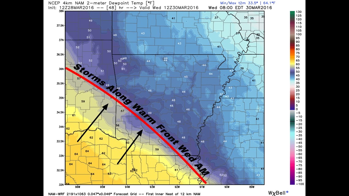
A warm front will be moving across the area early in the day on Wednesday with scattered showers and thunderstorms possible in the morning. These storms would pose mostly a risk of dime to quarter size hail.

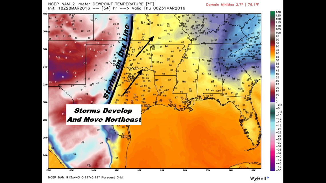
The dry line and associated cold front will arrive late in the day; likely in the late evening, with stronger thunderstorms possible. These storms would have a risk of damaging winds, isolated tornadoes, and larger hail.

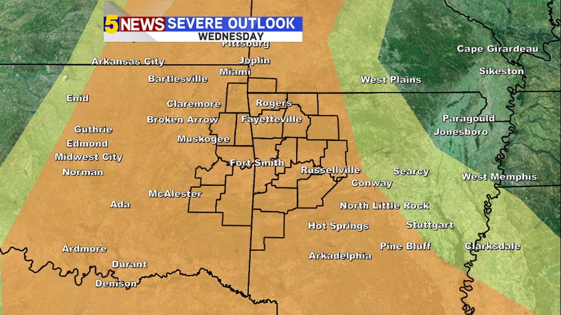
The current severe outlook takes up a lot of real estate and will be narrowed down by tomorrow depending on the timing of the front.
By Thursday morning, the cold front will have cleared the entire area with cool temperatures and comfortable weather for the upcoming weekend.
-Garrett