A weak upper level system will move across the area on Wednesday causing overcast skies a few showers during the day.

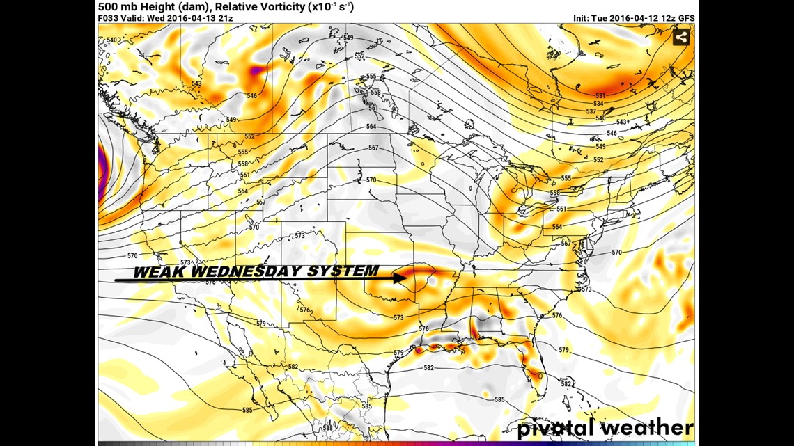
This is the upper low that will move across the area on Wednesday. It’s disconnected from the main jet stream to the north so severe thunderstorms are not expected.

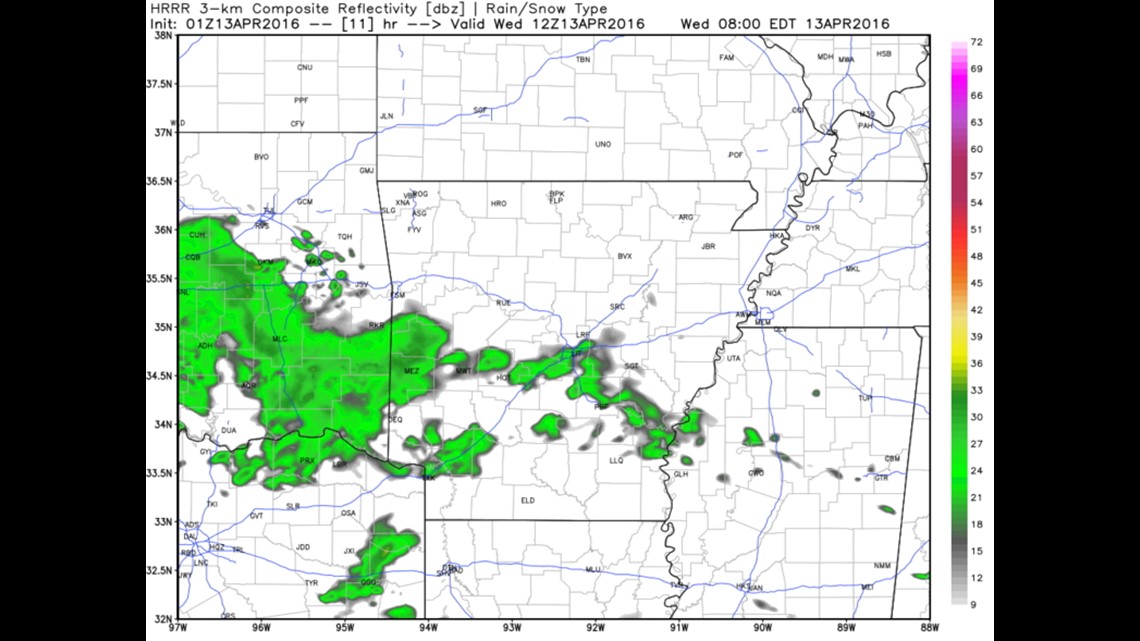
For the morning drive at 7am on Wednesday, we’ll see some light rain moving across SE Oklahoma and SW Arkansas


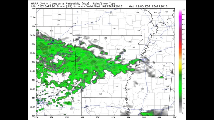
The heaviest looks to be around lunchtime. This is 11am Wednesday.

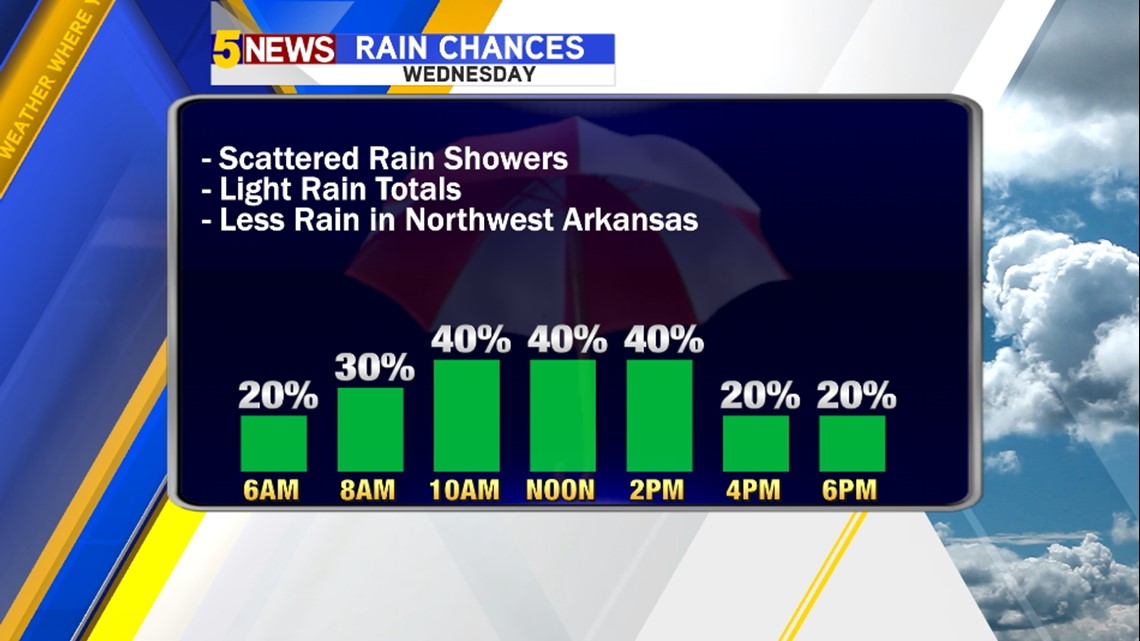
Not everyone will see rain, in fact Northwest Arkansas will see lesser amounts than farther south.
The next chance for rain for the entire area will be a few hours on either side of Noon.

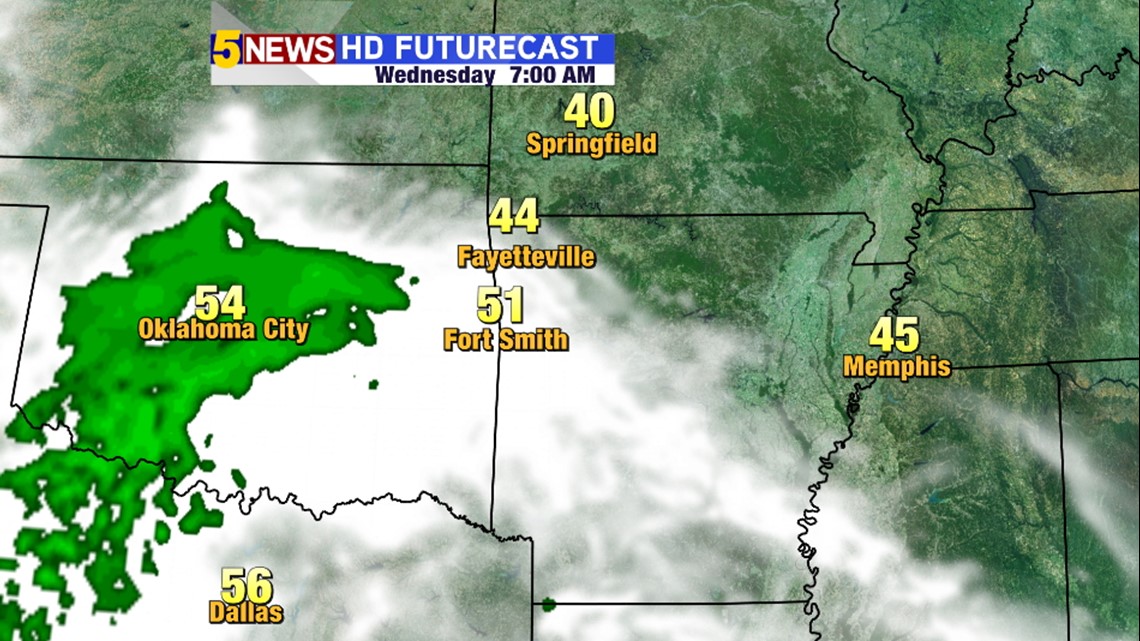
7AM Wednesday. Futurecast shows the heaviest rain in Central Oklahoma but it’s likely there will be a least a few rain showers under the thicker clouds in our area as shown from the Hi-Res data above.

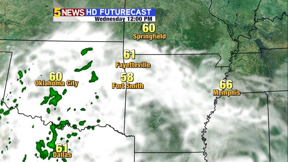
Noon Wednesday. We’ll see increasing clouds and rain from the west. Again, I feel like it’ll be more that Futurecast currently depicts but all rain is expected to be in the light to moderate variety so it may not be showing all of the area where rain is falling.

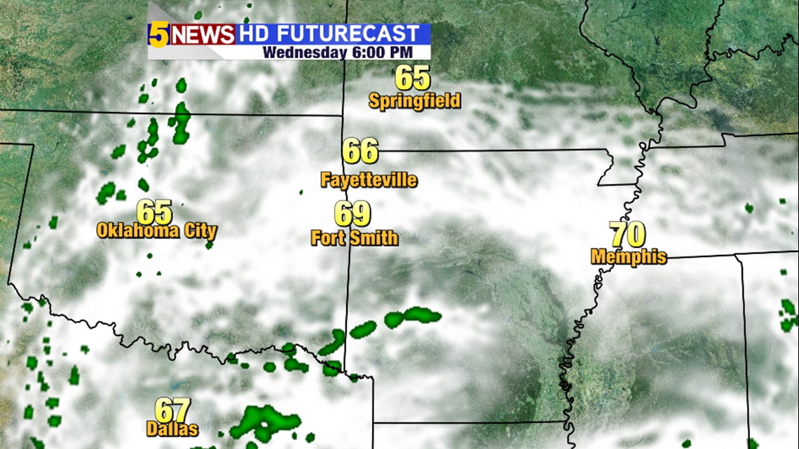
6PM Wednesday: As the low shifts east the rain chances will decrease but clouds will be thick for much of the day.
The next chance for showers and thunderstorms will arrive late weekend into next week.
-Garrett