Hot and humid summer-like weather will continue for the next several days with daily rain chances returning to the area by the early part of next week.

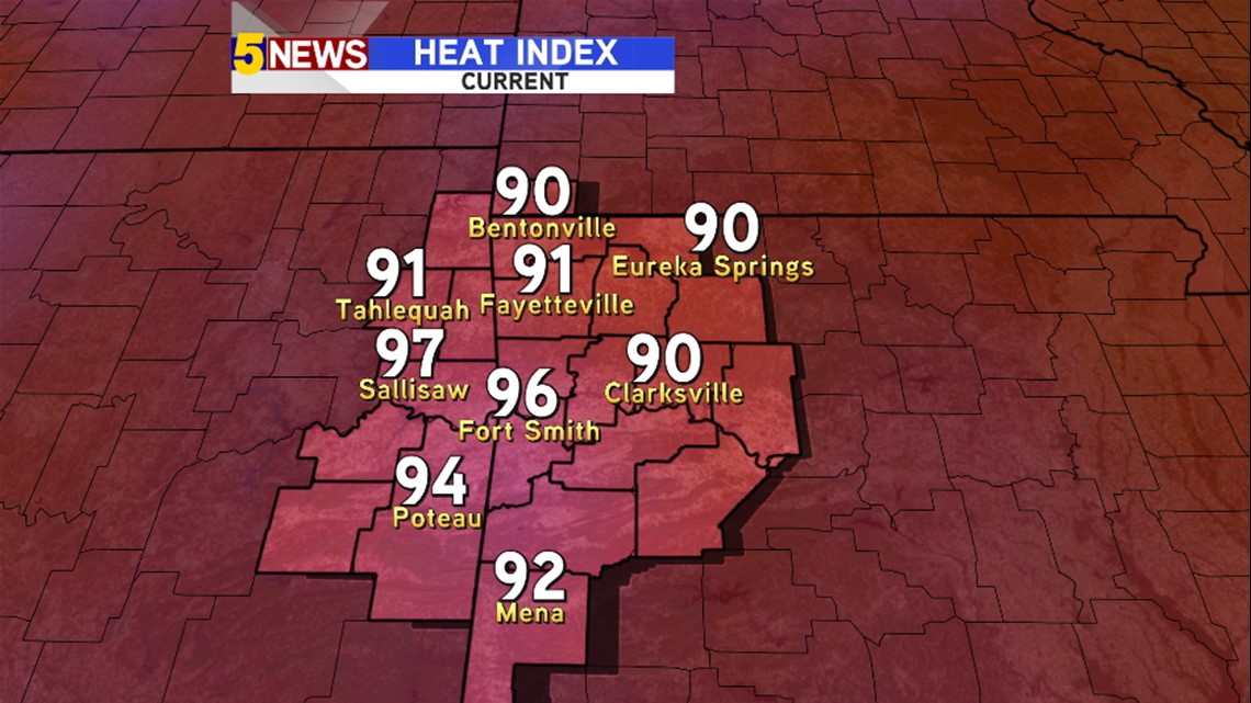
Heat Index values have climbed into the mid and upper 90s and southern winds nudge temperatures and humidity higher across most of the area.

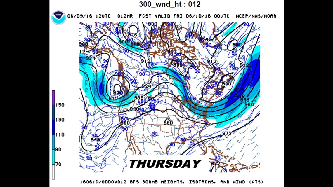
This is the upper level pattern for today (Thursday). A large ridge of high pressure is anchor across the southern plains with most of the major storm systems being deflected to our west or north.

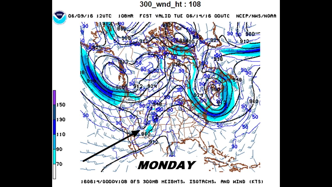
This pattern changes late weekend into next week. You can see a ripple in the jet stream moving east and separated from the main jet stream to the north.
This energy is weak and doesn’t favor organized severe weather.
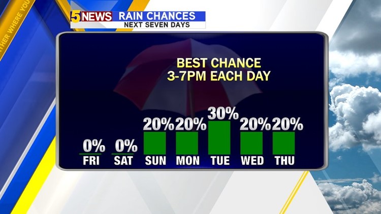
The trough will pull across the central and southern plains during the week with repeated rain chances in the afternoon and evening. The best chance for rain will be with the highest instability and that will likely occur with peak heating in the 3pm-7pm time frame.
The trough is closest to our area on Tuesday so there should be a higher concentration of showers Tuesday afternoon.


This is an early look at how rain chances should play out next week.
Overall coverage of showers should be low with scattered daily afternoon heating type storms.
-Garrett