Hot weather will continue for most of the week with scattered showers and thunderstorms adding rain cooled air and clouds to the region each day which will work to prevent extreme heat in the afternoon. The big temperature drop is expected by the weekend.
Rain chances this week are greatest from 2pm-7pm each afternoon.
Late this week, a stronger cold front will arrive from the north with the best rain chances across the area on Friday.
Here’s a look at how the upper level pattern chances.


This is the jet stream early in the week. You can see the main west to east flow is farther north of our area near Canada. There appears to be a weak trough situated over Texas and Eastern Oklahoma. This is the reason we’ve see scattered showers in the afternoon lately.


This is the jet stream by the weekend. A large longwave trough will be moving across the plains with cooler air spilling into the area by the weekend. Temperatures will likely fall into the 80s for much of the area this weekend.


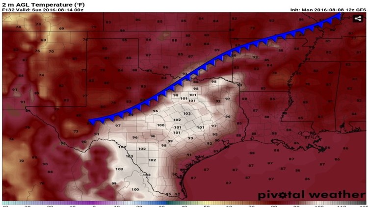
By late Saturday, Temperatures in Texas will be in the low 100s while in NW Arkansas temperatures are in the 80s to upper 70s.

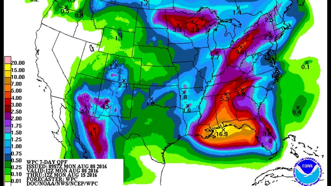
In the next week, expect around 1-2″ of rainfall from scattered afternoon rain and also the rain event on Friday.
Take note of the gulf coast near the Florida panhandle… near 17″ of rain is possible this week!!
-Garrett