Temperatures continue to be above normal across the are with highs in the upper 80s to near 90º Breezy south winds will continue into the overnight with another warm day on Tuesday although the winds shouldn’t be as strong.

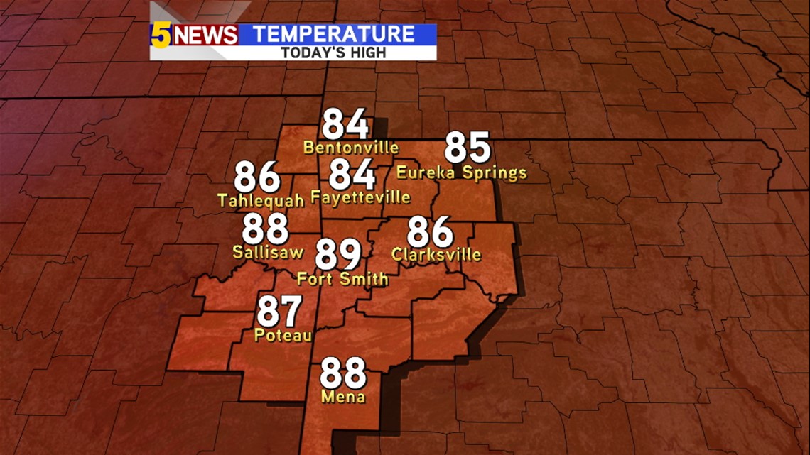
High temperatures on Monday were in the upper 80s to near 90.
The record in NWA was 86º in Fort Smith it was 91º; we missed the record by a mere 2º today.

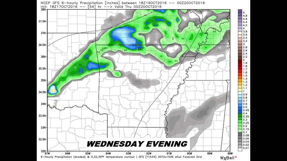
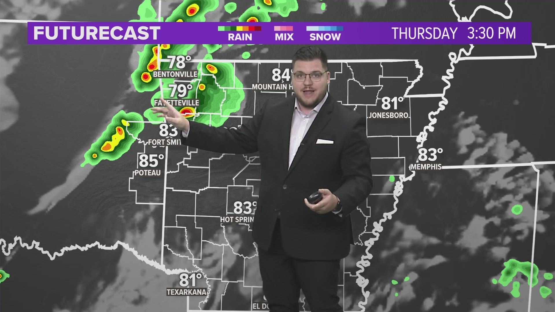
The cold front arrives on Wednesday evening and we’ll see an increase in showers and thunderstorms during the overnight Wednesday into Thursday morning.

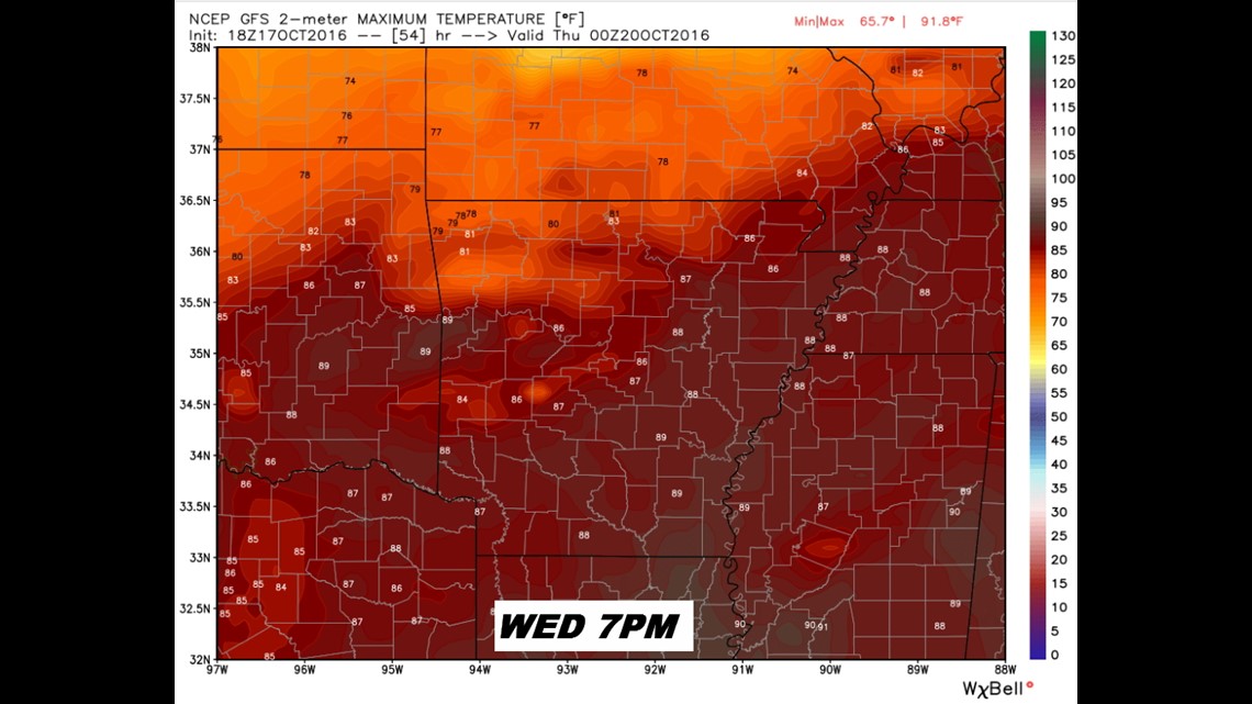
Wednesday will be warm again with highs in the 80s to near 90.

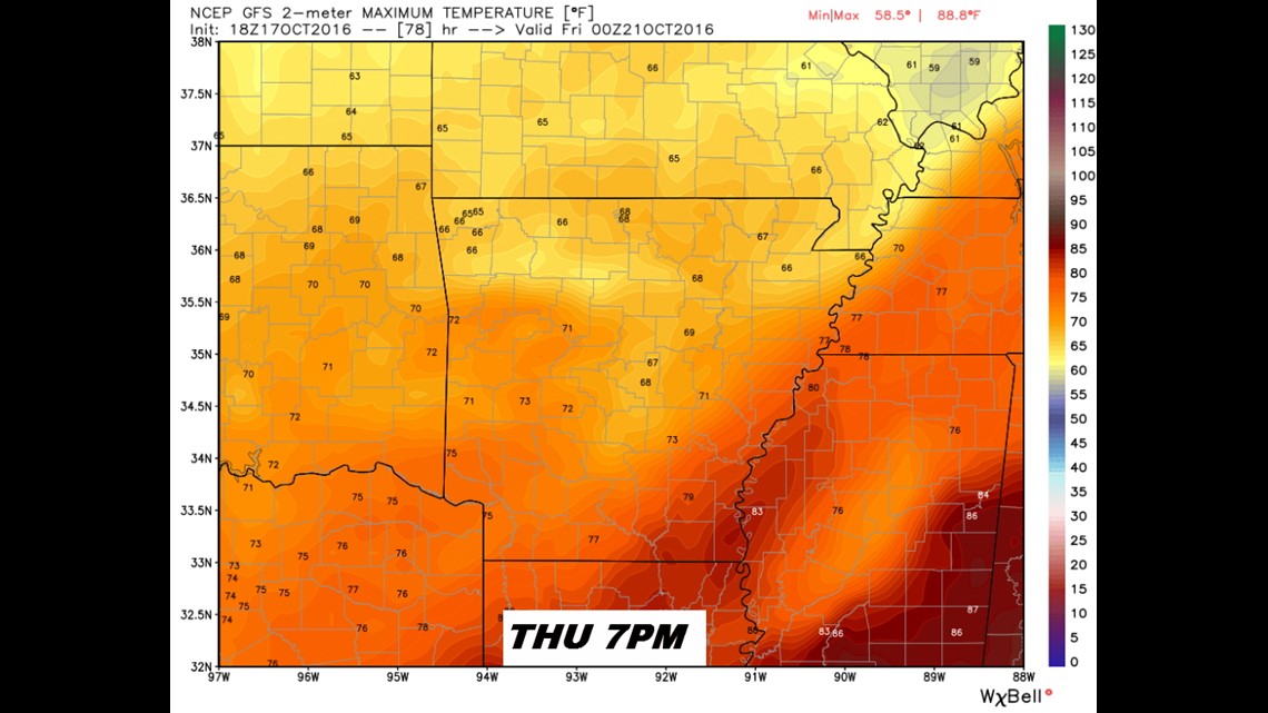
By 24 hours later, on Thursday, the cool air will have pushed across the entire area.

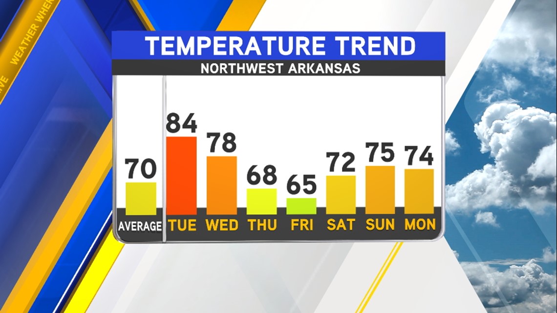
The trend for the next week will be near or below normal temperatures.

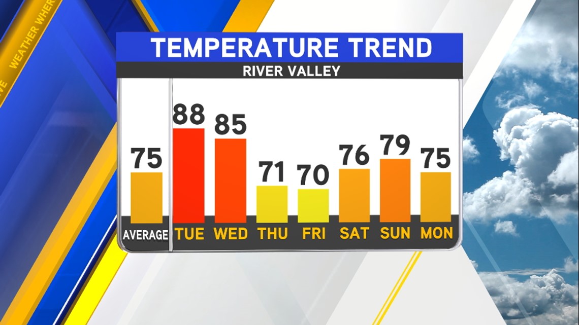
In the River Valley, temperatures recover some by the weekend but great weather is in store for this upcoming weekend with plenty of sunshine.
-Garrett