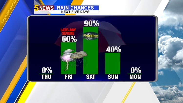
After a round of severe thunderstorms and flash flooding this morning, our area is primed for more severe weather and even worse flash flooding later this week into the weekend.


Severe weather is most likely late Friday evening into the overnight.

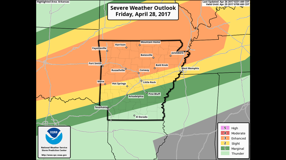
The entire area is under an Enhanced Risk of severe weather as the warm front lifts to the north across the region.
Storms north of the warm are typically prolific hail producers and hail will be a major concern. Tornadoes will also be possible along and south of the warm front on Friday evening into the overnight.


HD Futurecast has the storms breaking out late in the day Friday with storms underway by 6pm.


In addition to the rain we’ve already received we’ll see an additional 4-6″ of rainfall which could put some of the area near 1ft of rain in a week. This will lead to widespread flash flooding on Saturday.
-Garrett