The cold front continues to make slow progress to the south with scattered showers and thunderstorms developing along and ahead from the front.
The best chance for rain on Friday evening will be from Fort Smith and south with the rain chances ended from north to south overnight.

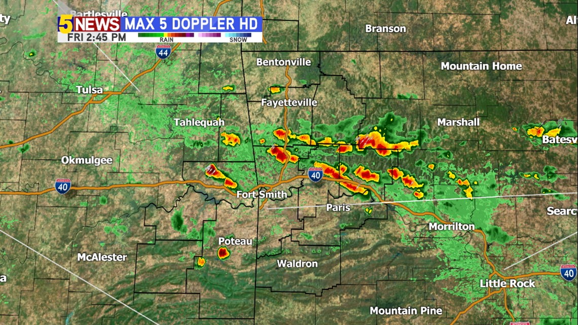
As of Friday afternoon a cluster of showers and thunderstorms were located across the Ozarks moving southeast.
Where is the so-called ‘drier air’?

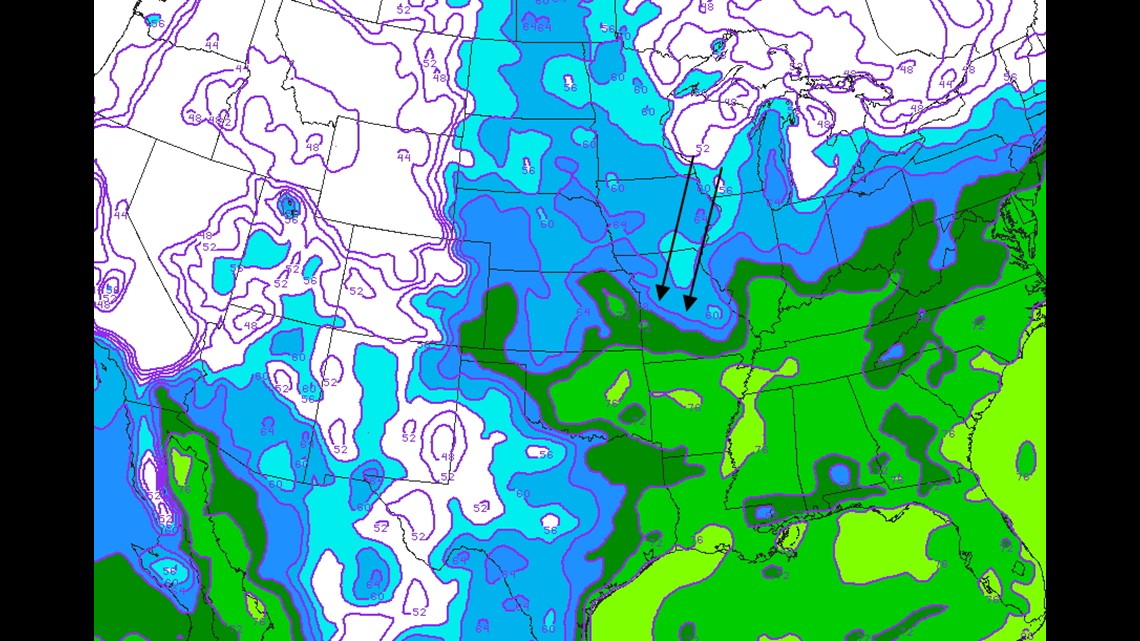
The dry air is lagging behind the front. On Friday afternoon, the more comfortable air with the lower dewpoints was located across central and south Missouri.

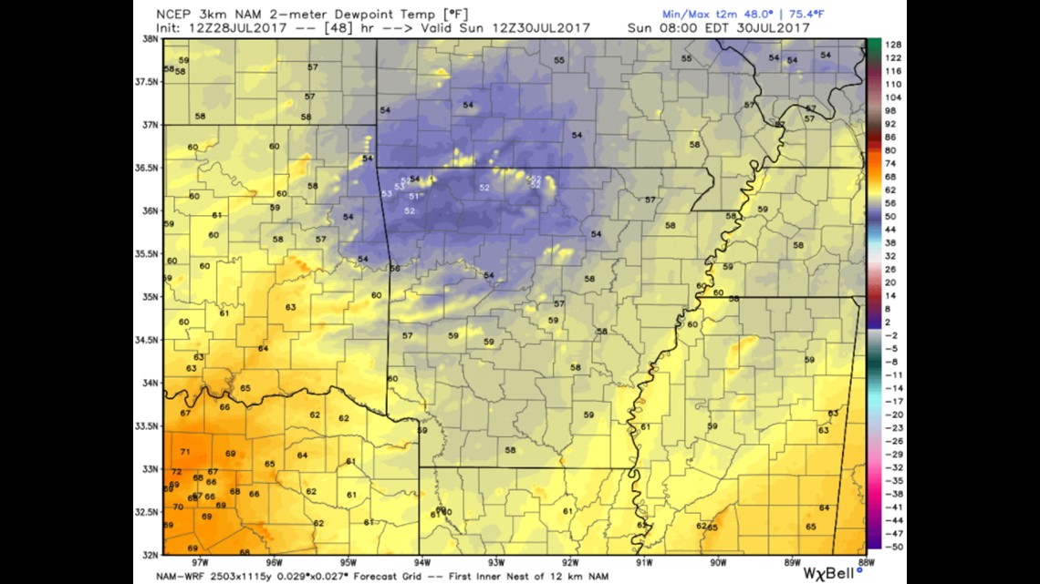
This is a look at the dewpoint for Sunday morning. SUPER dry air will be arriving from the north with dewpoints in the low 50s!
Both Saturday and Sunday will be two of the most comfortable weekend days we’ve had in some time.
-Garrett