
It’s been a while since we’ve seen a heavy rain locally. The last time we picked up over 1″ of rain was in the middle of August.
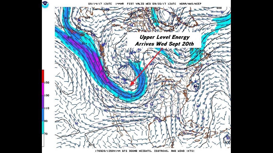
The upper level pattern will bring us a strong front sometime on Tuesday and Wednesday of next week.
It doesn’t appear the cold front will bring us significantly cooler temperatures because the jet stream winds stop just short of making it into our area.
The front will cause showers and storms due to higher humidity.


7PM TUESDAY: Scattered showers should break-out in advance of a cold front with the warm air moving from south to north across our area.

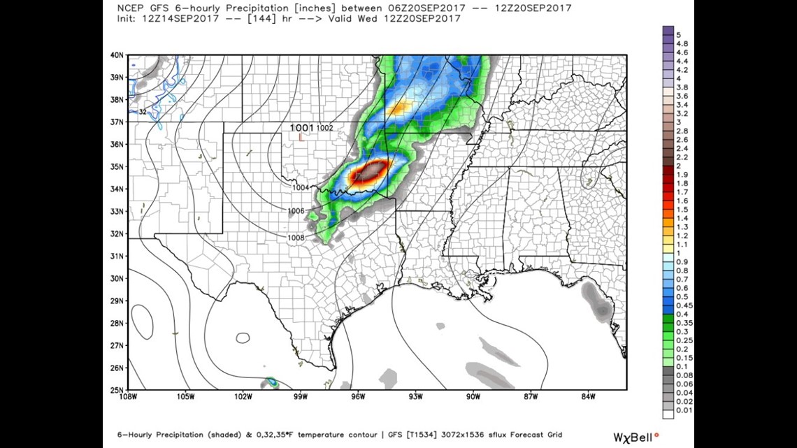
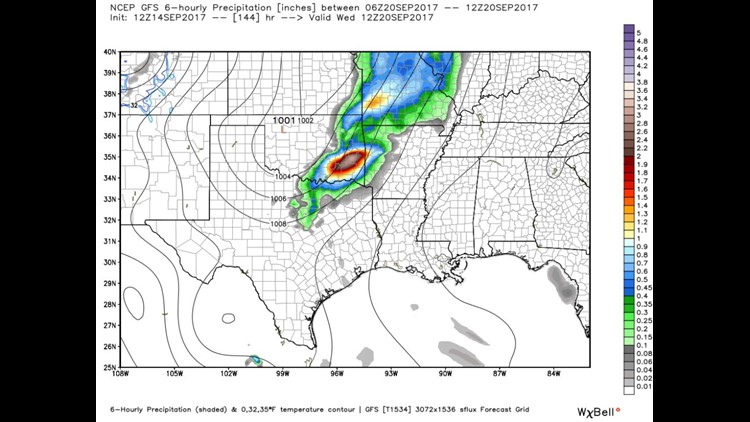
7AM WEDNESDAY: The best chance for rain (and yes, even severe weather) appears to be on Wednesday of next week with a line of showers and thunderstorms.
This should end the recent dry trend we’ve experienced for the last month.
-Garrett