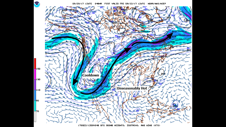


Unusually warm weather will continue for the next several days and into the weekend as a large ridge of high pressure remains anchored across the SE United States.
The trough of low pressure that will eventually bring us the cooler weather won’t arrive until early next week. The slower movement and lack of significant moisture means minimal rain chances are expected but a widespread area-wide soaking is unlikely at the moment.

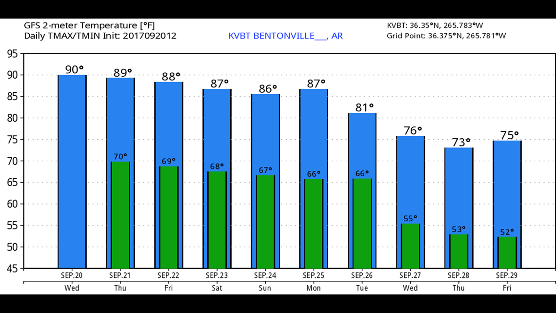


Graphically, here’s the trend for the next 10-days with substantially cooler temperatures arriving by the end of the month.
-Garrett