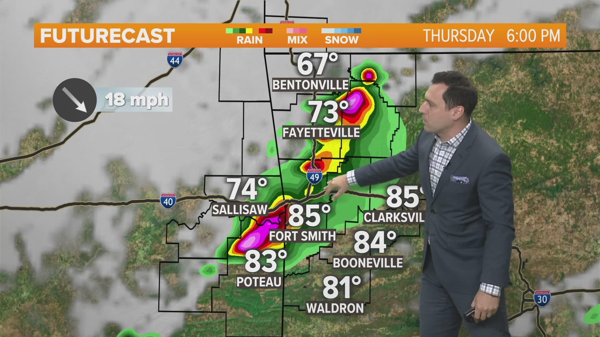
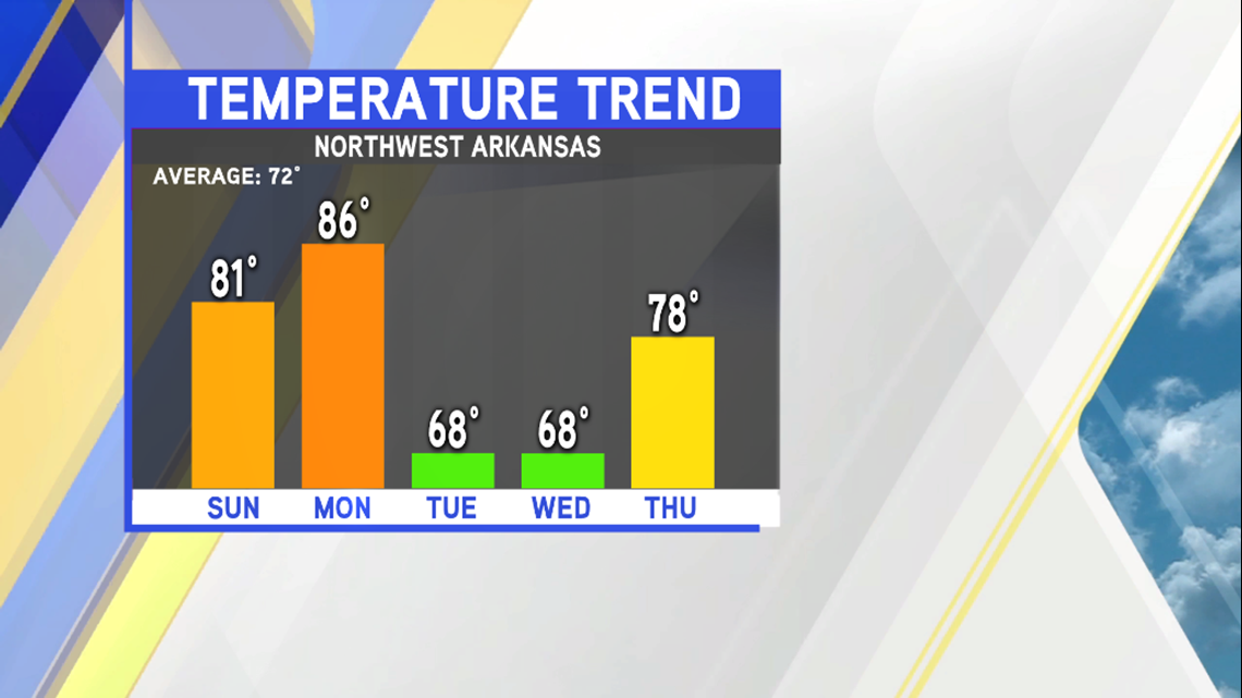
Even with the weak cold front that moved through earlier today, we have seen our afternoon temperatures remain above our seasonal averages. That will change early next week as a fairly strong cold front will move through NW Arkansas and the River Valley. Along with the wind shift and cooler temperatures, we’ll also have a some scattered showers/T-storms move through the area.
Timing: The cold front will move through Monday night into Tuesday.


Rain chances look best during this time as well, with rain tapering off as we head into Tuesday afternoon.

Don’t expect a drought buster with the showers we see. They’ll be scattered and not everyone will see rain. Those who do see it will most likely receive anywhere from a few hundredths to about a quarter inch of rain.

Temperatures will cool off quite a bit as well with this front with most of us seeing almost a 20° difference between Monday highs and Tuesday highs.


-Chris