The Storm Prediction Center has upgraded the severe risk for western Arkansas from “Marginal” to “Slight”.
Here is a detailed look at the timing and threat from the storms this evening from Meteorologist Matt Standridge

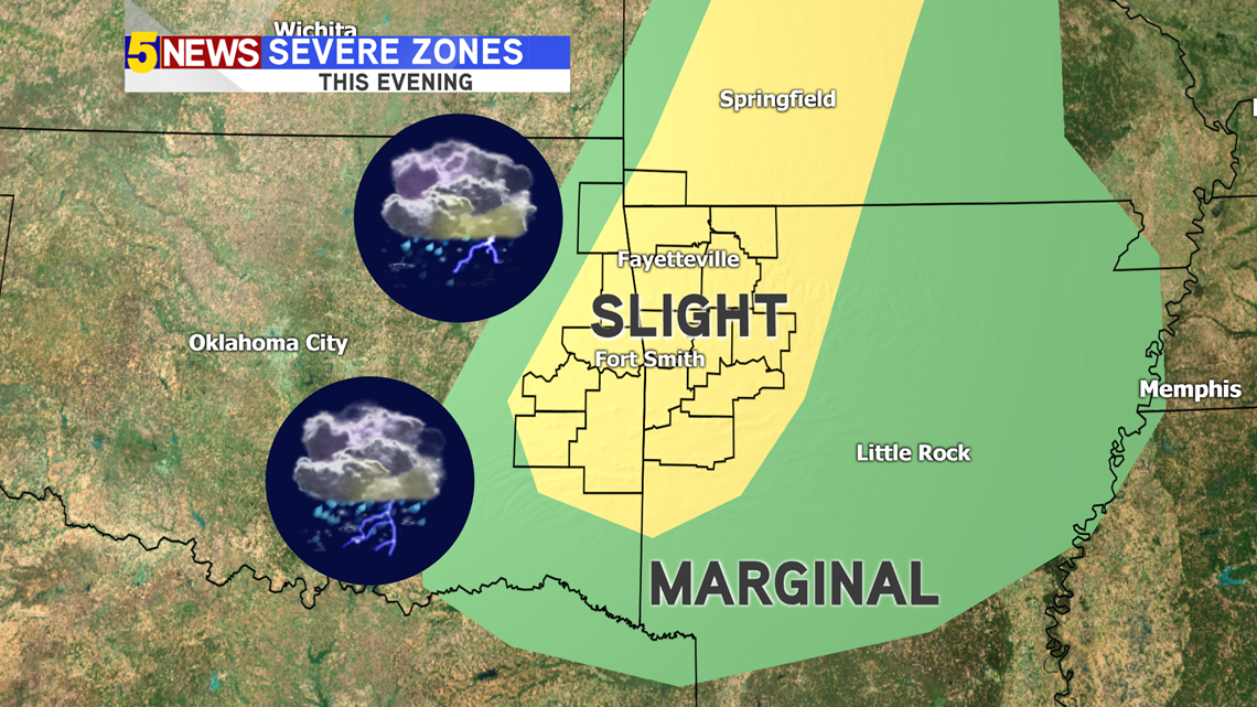
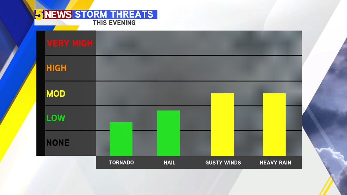
The severe threat still remains fairly low, but we may see the storms produce a bit more gusty winds and some hail, especially as they move into Washington County and Crawford County where the storms will feed into a bit more energy from warmer temperatures and more moisture. The tornado chance is LOW.

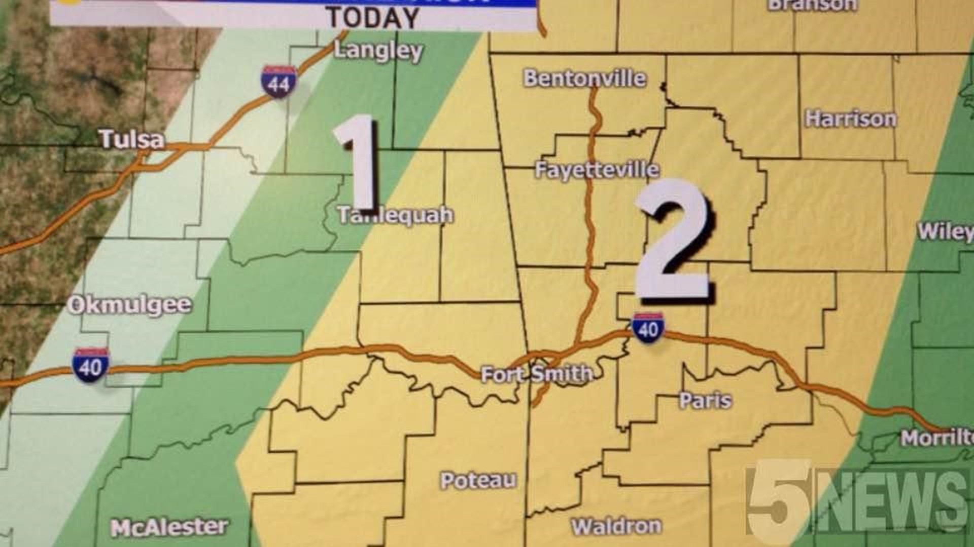
This is a breakdown of what you can expect today.
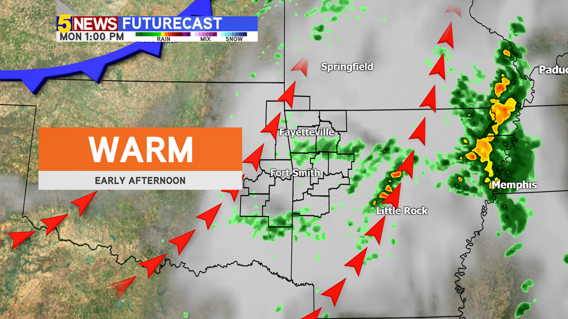
EARLY AFTERNOON: Warm air pushing north, with a chance for a light shower or sprinkle.

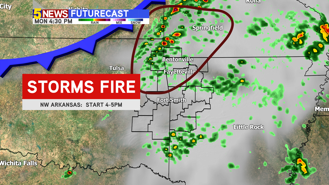
LATE AFTERNOON 4-5PM: The majority of the storms should start to fire in NW Arkansas and push their way south.

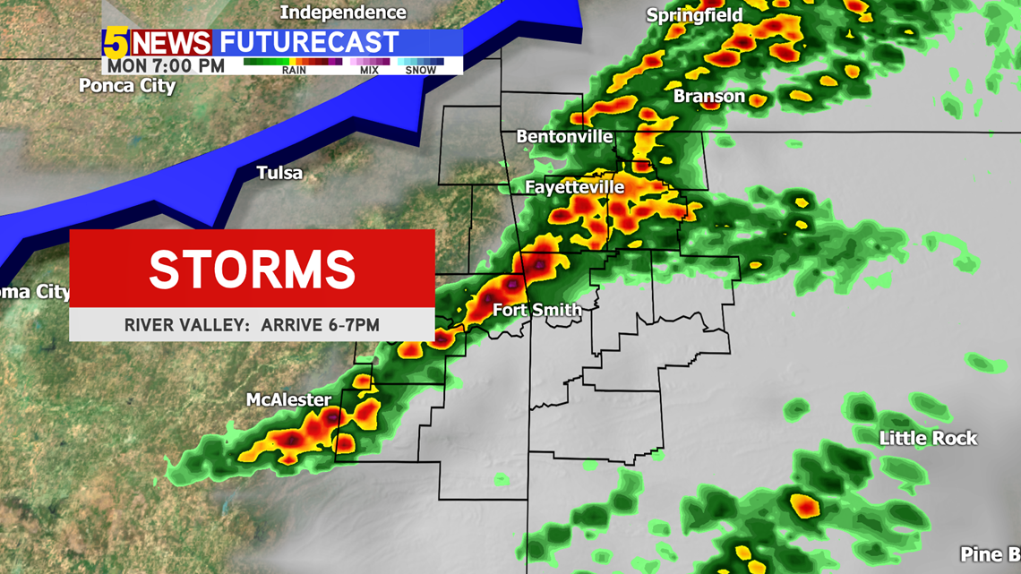
EVENING 6-8PM: Storms will start to leave NW Arkansas and arrive into the River Valley.

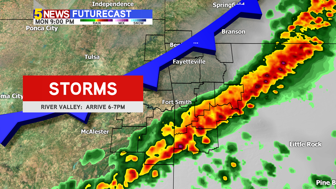
LATE EVENING 7-8PM: Storms should be completely out of NW Arkansas and continue moving south.

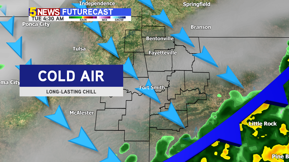
OVERNIGHT: Colder air will arrive overnight, dropping temperatures quickly.

-Joe and Matt