
The next arctic front will arrive Thursday afternoon with scattered areas of rain followed by a brief changeover from rain to snow as the cold air filters in from the northwest.
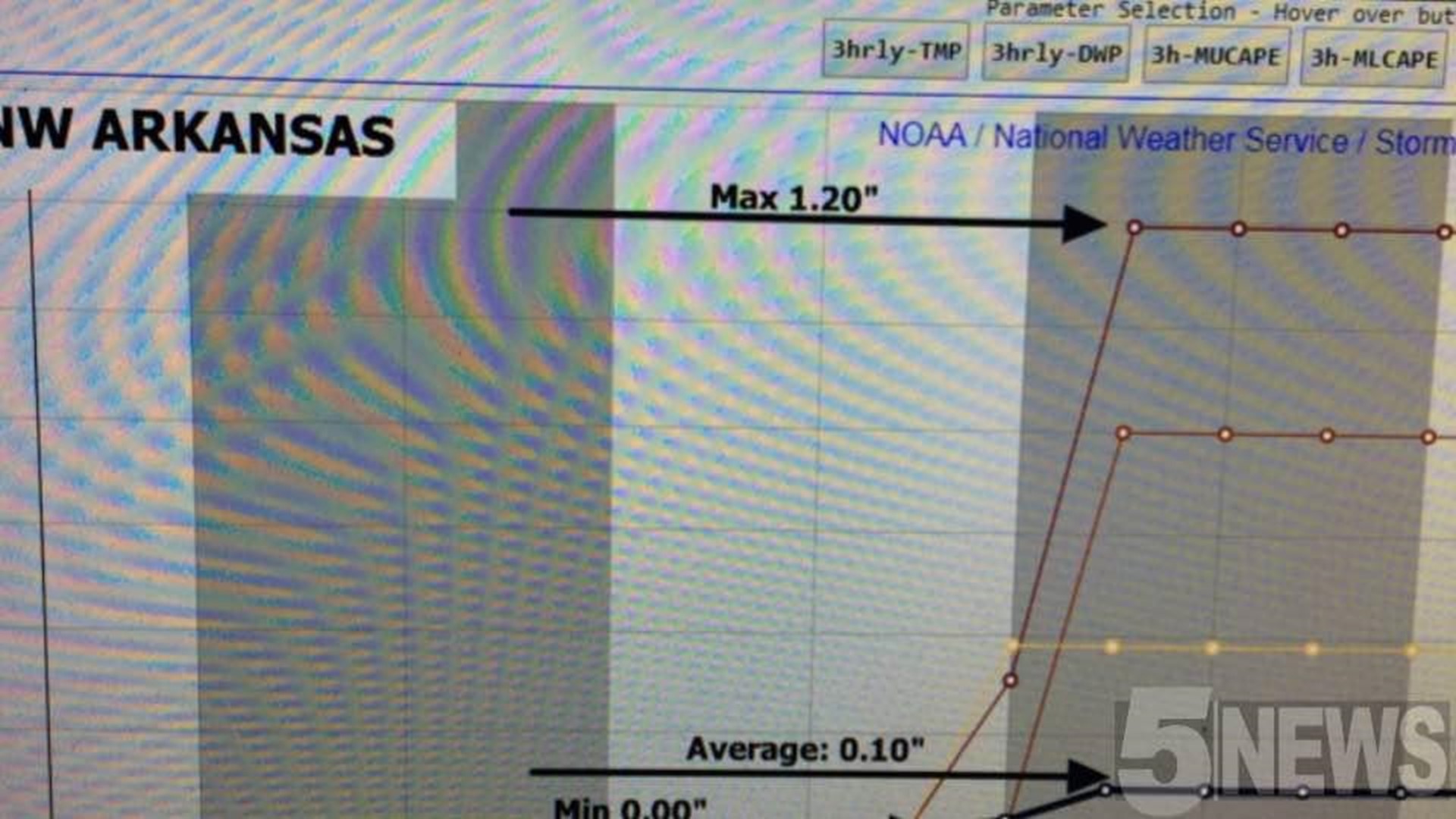
Snow amounts continue to trend very small for both NW Arkansas & the River Valley.
The timeline to see any wintry weather hasn't really changed much. Snow in small amounts could be possible from 3pm-10pm Thursday evening.
Road issues should be confined to bridges and overpasses after dark on Thursday.

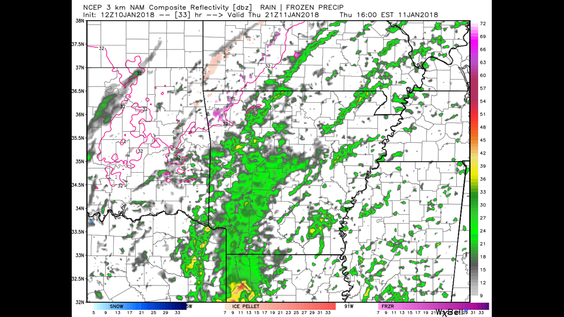
This shows the latest data for 3pm on Thursday with the freezing line through NW Arkansas but not into the River Valley until closer to Sunday.

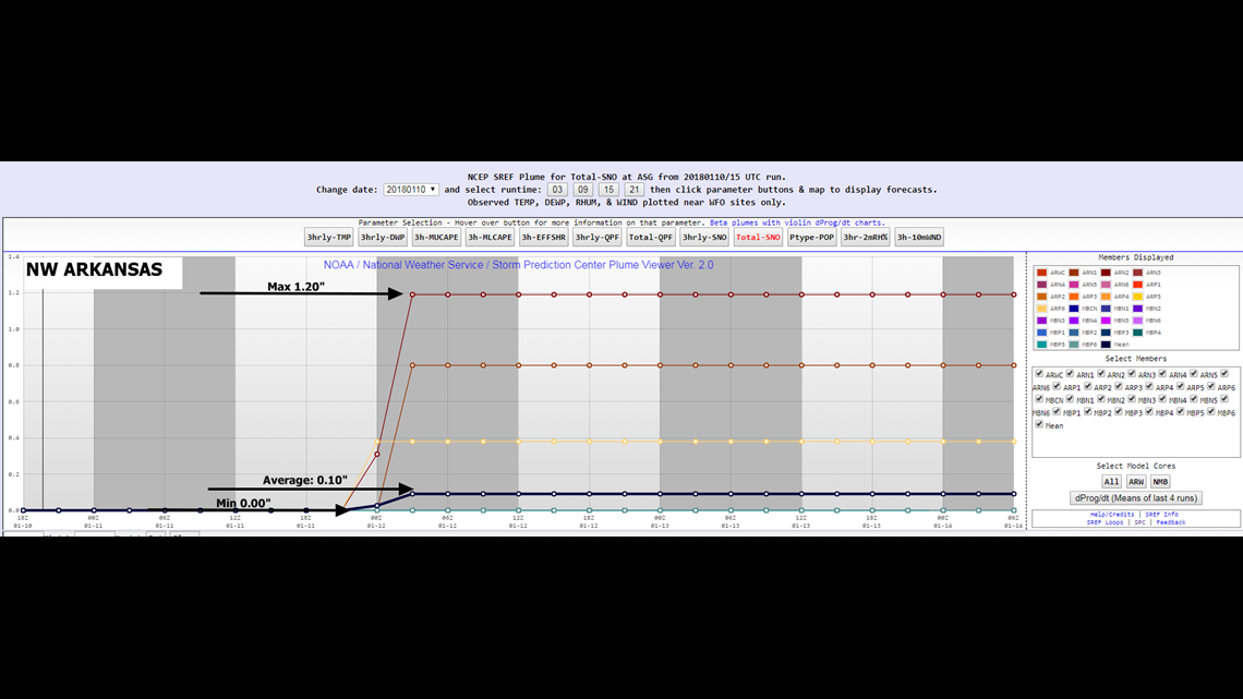
The model spread in NW Arkansas ranges from 0.00"-1.20" with the average around 0.10".

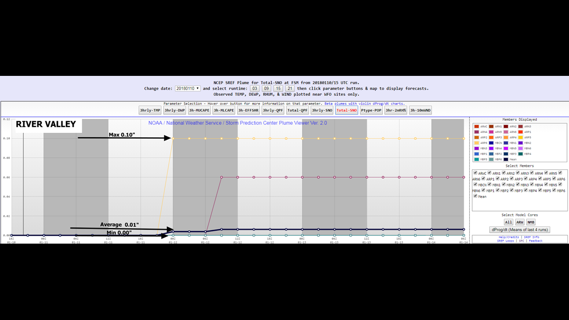
The model spread in the River Valley is even smaller, from 0.00"-0.10" with the average around 0.01".
I'll post another video blog later this evening. The new evening data starts coming in around 8pm so plan on it hitting the website somewhere between 9-10pm tonight with any changes and updates to the ongoing forecast.
Bottom line: This isn't your snowman/sled/winter storm event that you've been waiting for; go easy on the bread & milk.
-Garrett