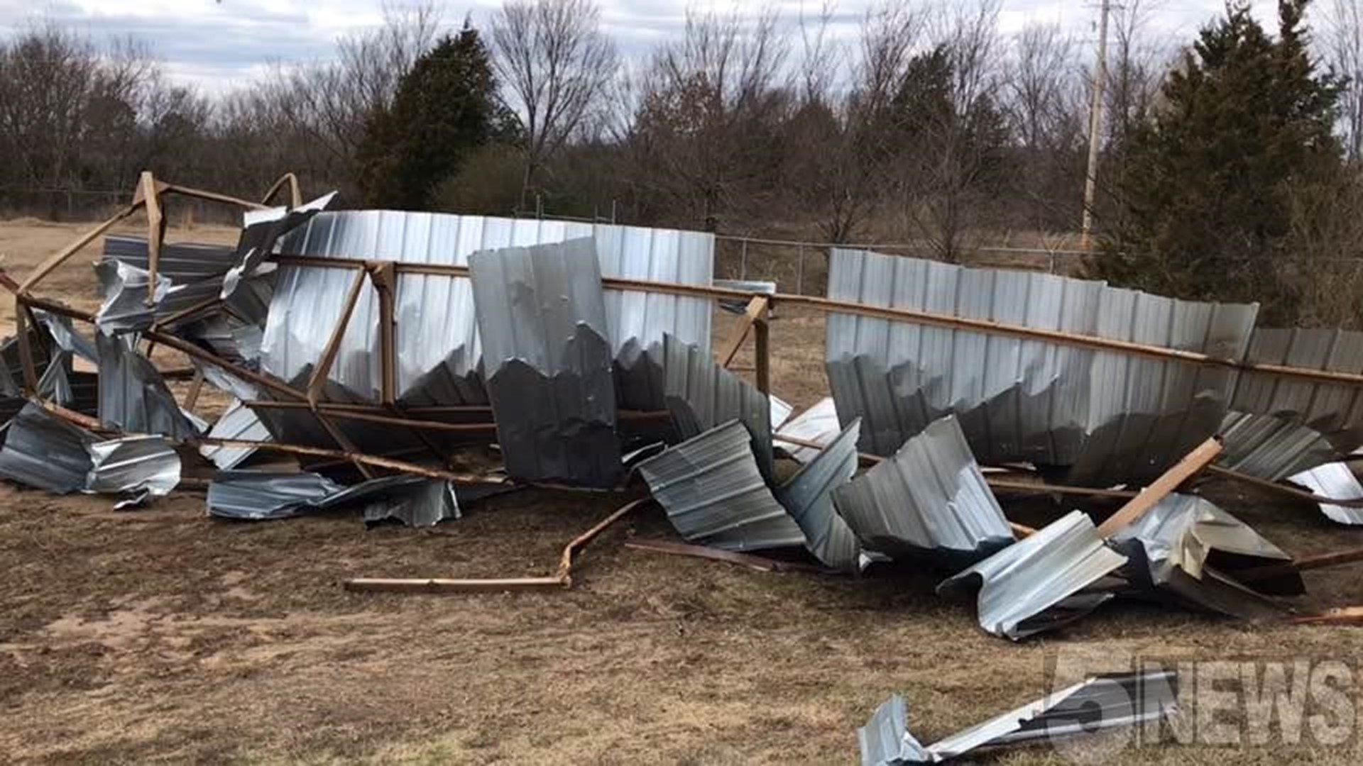
Updated: The National Weather Service has confirmed at least two tornadoes from storms late on Sunday night.
Below is the new Public Information Statement released late Monday evening.
-Garrett
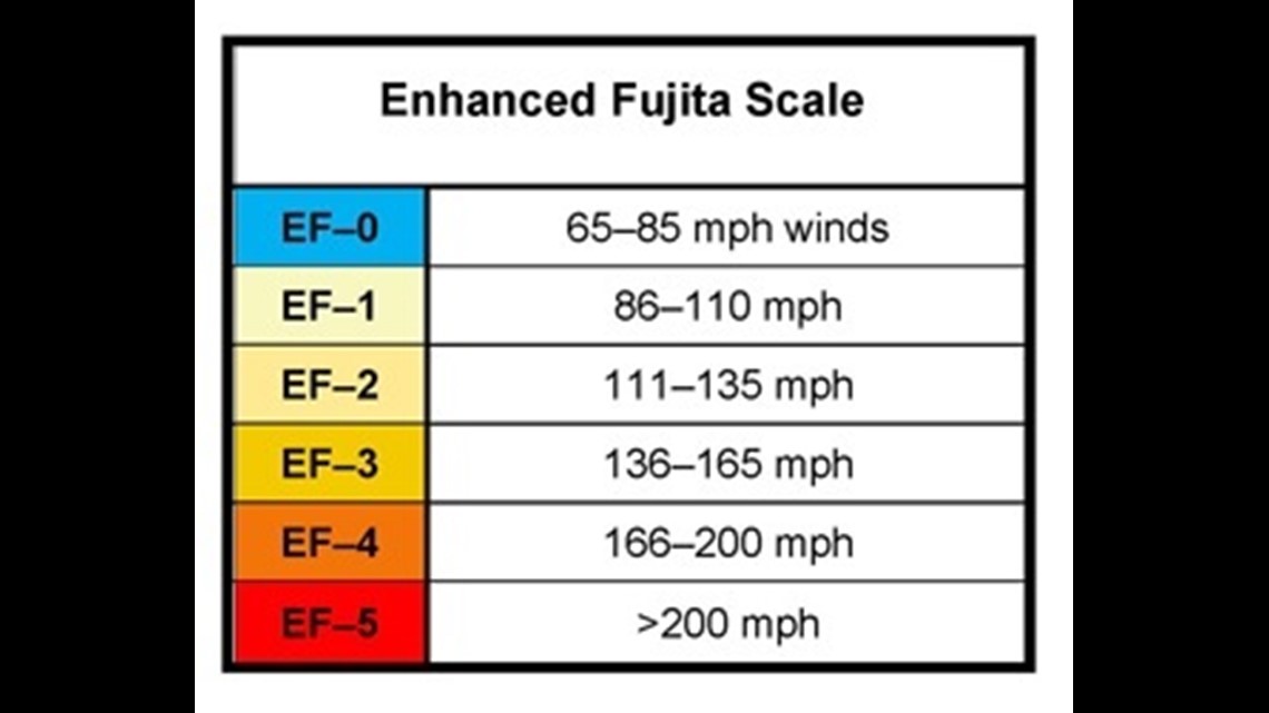
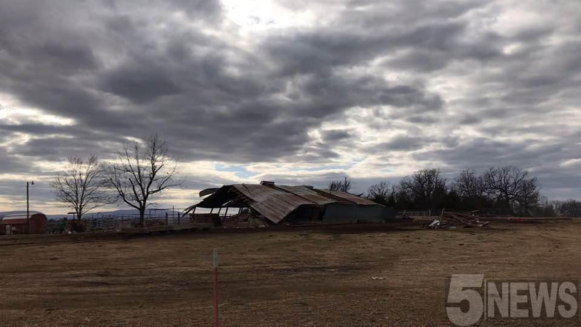
Public Information Statement
National Weather Service Tulsa OK
926 PM CST Mon Jan 22 2018

...NWS DAMAGE SURVEY FOR 01/21/18 TORNADO EVENT...

.OVERVIEW...NWS Tulsa meteorologists surveyed two tornadoes that
developed Sunday evening in west central Arkansas. Their findings are
summarized below.

.Huntington Arkansas Tornado...

Rating:                 EF-1
Estimated Peak Wind:    85 to 95 mph
Path Length /Statute/:  5.2 miles
Path Width /Maximum/:   350 yards
Fatalities:             0
Injuries:               0

Start Date:             January 21 2018
Start Time:             656 pm CST
Start Location:         Huntington / Sebastian County / AR
Start Lat/Lon:          35.0823 / -94.2695

End Date:               January 21 2018
End Time:               703 pm CST
End Location:           4.9 NE Huntington / Sebastian County / AR
End Lat/Lon:            35.1407 / -94.2124

Survey Summary: This tornado developed on the northwest side of
Huntington Arkansas near the water treatment plant where it uprooted
trees and destroyed a metal-framed structure. The tornado moved
northeast damaging the roof of a mobile home, damaging a couple
chicken houses, and uprooting more trees.

.Cecil Arkansas Tornado...

Rating:                 EF-1
Estimated Peak Wind:    85 to 90 mph
Path Length /Statute/:  4.3 miles
Path Width /Maximum/:   400 yards
Fatalities:             0
Injuries:               0

Start Date:             January 21 2018
Start Time:             740 pm CST
Start Location:         3.3 S Cecil / Franklin County / AR
Start Lat/Lon:          35.3909 / -93.9501

End Date:               January 21 2018
End Time:               745 pm CST
End Location:           2.6 E Cecil / Franklin County / AR
End Lat/Lon:            35.4397 / -93.9022

Survey Summary: This tornado snapped the trunks of a few softwood
trees, snapped large tree limbs, and damaged a home.

EF Scale: The enhanced Fujita scale classifies tornadoes into the
following categories.

EF0...weak......65 To 85 mph
EF1...weak......86 to 110 mph
EF2...strong....111 to 135 mph
EF3...strong....136 to 165 mph
EF4...violent...166 to 200 mph
EF5...violent...>200 mph

Note:
The information in this statement is preliminary and subject to
change pending final review of the events and publication in NWS
Storm Data.