I wanted share images with you that show the current forecast for freezing rain probabilities. The forecast is always dynamic and changing and these maps reflect the current thinking as of 6pm Monday. Check back for updates.


Light ice of .01″ is typically not enough for power outages (usually that .25″+) but the exact change-over time and the winds speeds will ultimately determine whether or not this becomes more than just a travel issue.

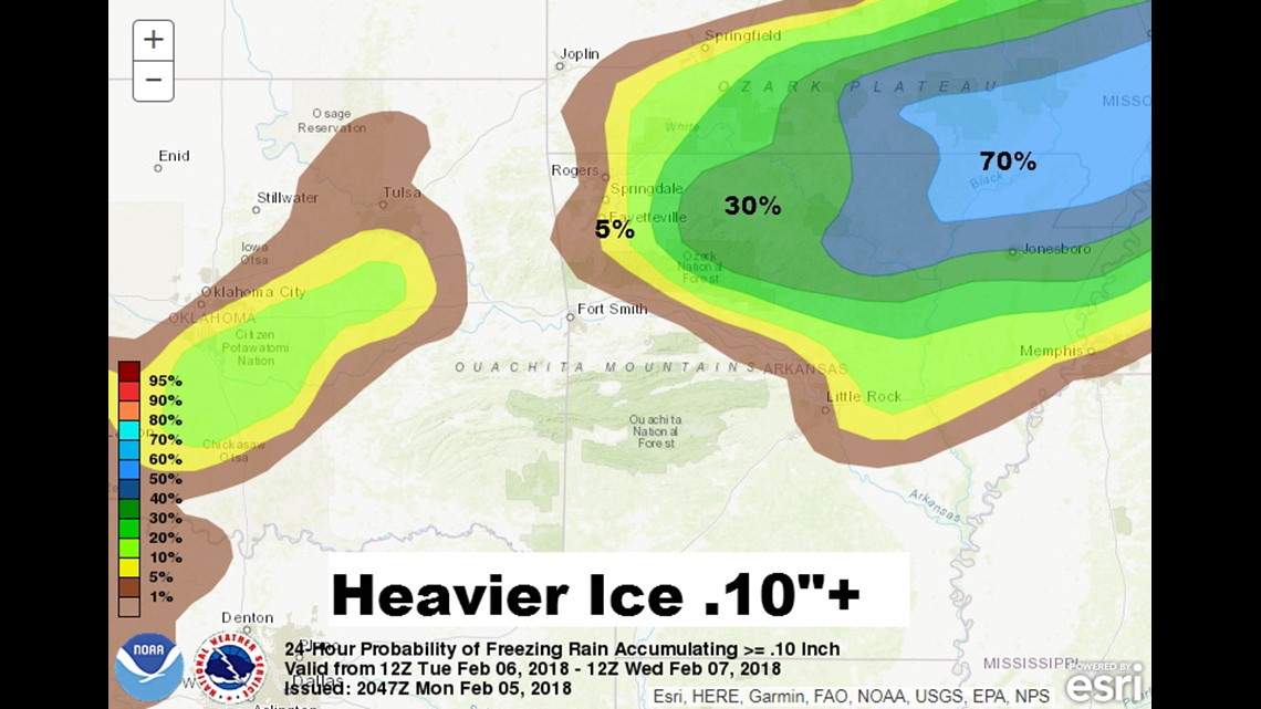
As far as heavier ice is concerned I think NE Arkansas will have a better chance for more accumulation and power problems as compared to a lower risk of power outages in our area.
This appears to be mostly a travel affected event (at the moment) check back for the latest forecast as new data comes in.
This forecast will change as new data arrives and the event becomes clearer.
-Garrett