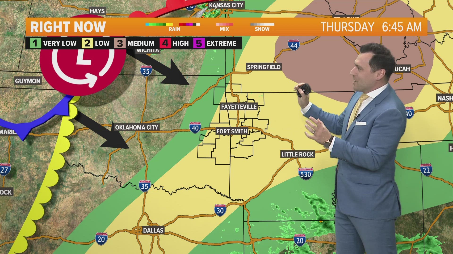
What can you expect for road conditions, possible school delays/closing?
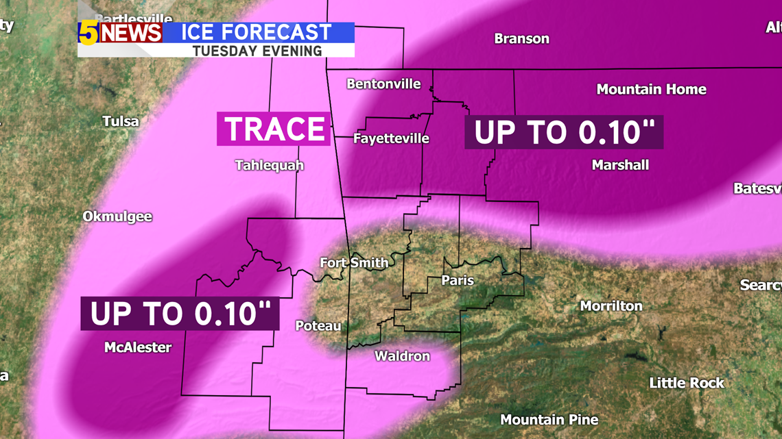
Our best guess is that ice accumulations will be light, but enough to cause some travel issues, especially in :
- Northwest Arkansas
- I-49 through the mountains
- Western Sequoyah and LeFlore Counties
There should be a pocket of warmer air in the Fort Smith, Greenwood, Booneville area, that should keep the forecast to just light rain showers, but some spots could get slick on ridges and the Ouachitas.
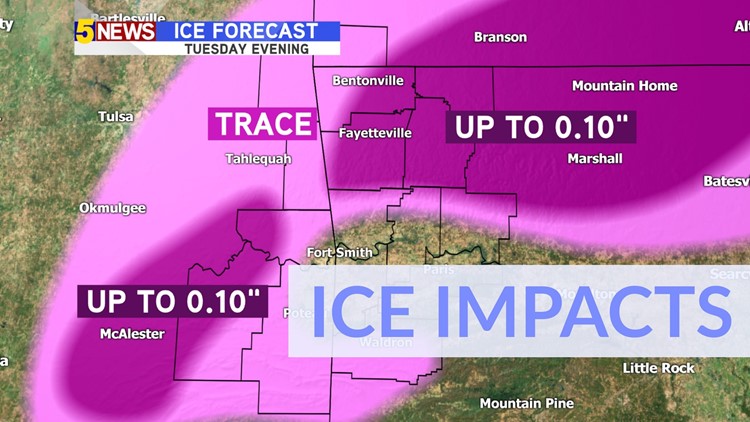
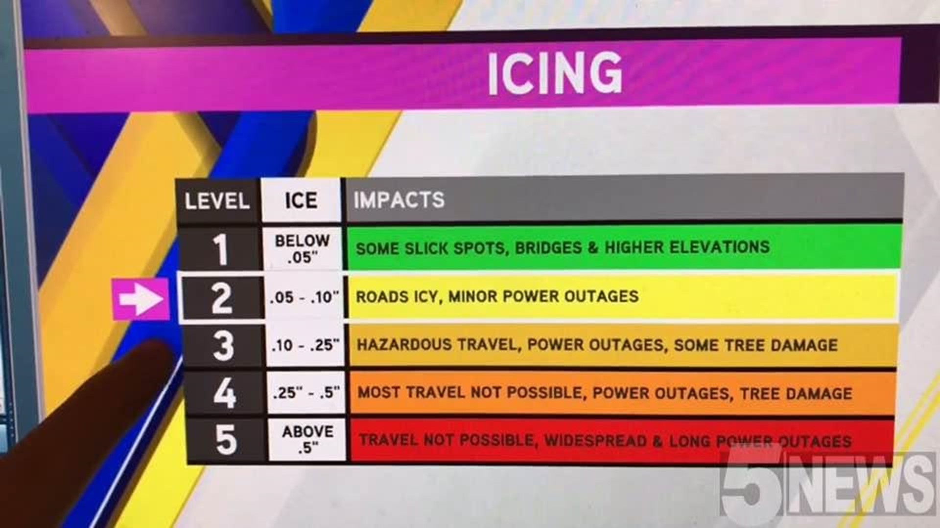
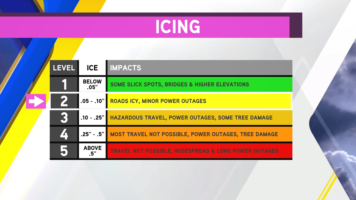
Northwest Arkansas: LEVEL 2
River Valley: LEVEL 1
E. Oklahoma and Ouachitas: LEVEL 2

Schools: Any ice accumulation will melt after 10AM Wednesday, so there might be some icy spots lasting into the morning hours. Stay with 5NEWS for School Closing Updates.
One glimmer of hope about impacts will be the lack of gusty winds. Light Northeast winds will keep temperatures cool Tuesday Evening. Strong winds over 10-15 MPH would cause many more problems with even light ice accumulations. Winds should stay below 10 MPH throughout Tuesday and early Wednesday.
Here are the estimated Ice Accumulations Tuesday 3PM - Wednesday 2AM.

-Garrett & Matt