
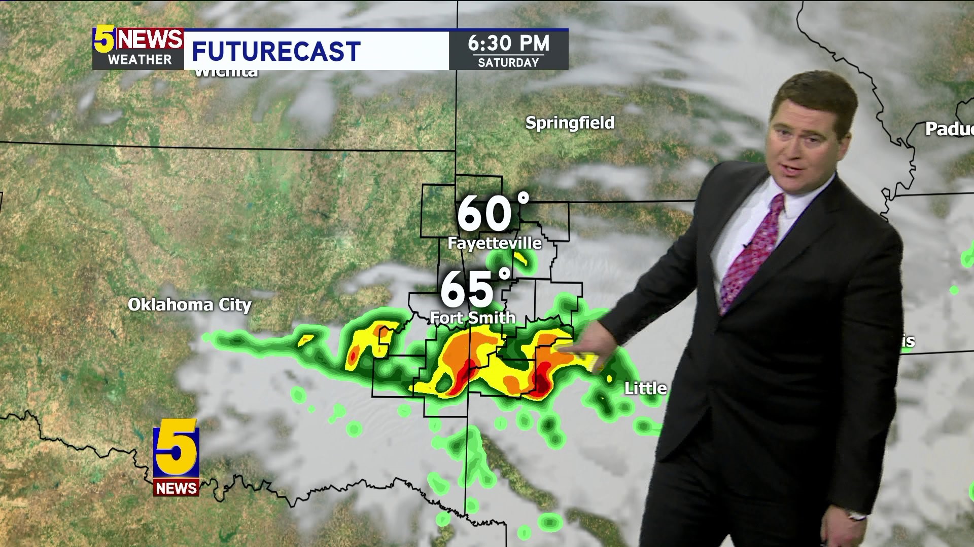
Scattered showers with a few thunderstorms are most likely on Saturday with a cold front sweeping across the area Saturday night into Sunday morning.
A few lingering showers are possible early Sunday with clearing skies by afternoon. Strong north winds combined with chilly temperatures will make for a cold afternoon despite any returning sunshine.

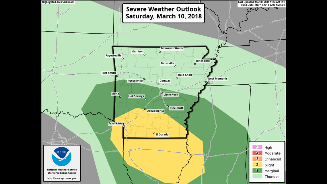
The highest severe risk on Saturday is across Louisiana and South Arkansas closer to the warm front boundary.

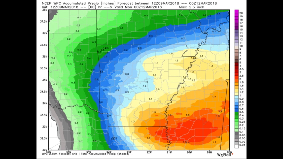
Rain totals will be highest to our south but we should average around 1/2" in the River Valley with around 1/4" in NW Arkansas.

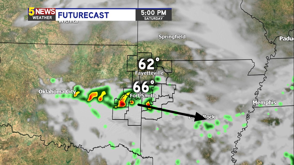
The heavier area of showers should develop around 4/5pm and track southeast with rain favoring the Fort Smith area more than NW Arkansas.
-Garrett