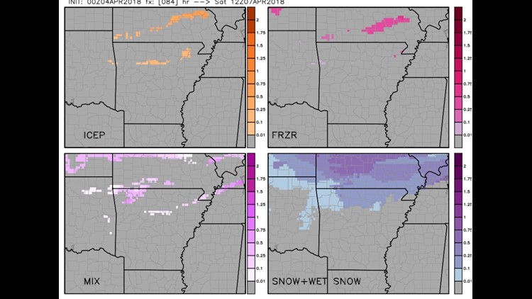

The dominant type should be snow/wet-snow after the changeover around midnight late Friday into Saturday. Thankfully, the trend continues to be away from ice accumulation (at least for now).
There probably will be enough for slick spots on roads on Saturday morning. Accumulation is only in the 1/10th range so don’t expect to build Frosty out of this.Travel issues will be temperature dependent. Under 30º it’s slick. That time frame is from 12am to around 10am Saturday.
The timing, temperatures, and amounts will likely change some in the coming days. Stay tuned for updates.
-Garrett