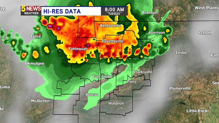
A line of strong storms will be diving south into Arkansas and eastern Oklahoma early on Tuesday morning. Tap HERE for current radar.
The strongest storms will be in Northwest Arkansas as this complex weakens on its southward journey. Our best guess on timing is below.


Here is what you can expect for timing on these storms (alphabetical):
NORTHWEST ARKANSAS (Start Time — End Time, estimated within +/- 30min)
- Bella Vista (5:30AM — 8:00AM)
- Bentonville (5:35AM — 8:05AM)
- Fayetteville (6:00AM — 8:30AM)
- Greenland (6:10AM — 8:40AM)
- Huntsville (6:00AM — 8:30AM)
- Prairie Grove (6:10AM — 8:40AM)
- Rogers (5:40AM — 8:10AM)
- Siloam Springs (5:30AM — 8:00AM)
- Springdale (5:45AM — 8:15AM)
- West Fork (6:30AM — 9:00AM)
RIVER VALLEY (Start Time — End Time, estimated within +/- 30min)
*STORMS WILL BE WEAKENING AS THEY REACH THE RIVER VALLEY AND THERE IS A POSSIBILITY SOME WILL FADE AWAY.*
- Alma (7:00AM — 9:30AM)
- Booneville (7:45AM — 10:15AM)
- Clarksville (7:30AM — 10:00AM
- Fort Smith (7:15AM — 9:45AM)
- Greenwood (7:25AM — 9:55AM)
- Ozark (7:10AM — 9:40AM)
- Mountainburg (6:40AM — 9:10AM)
- Paris (7:30AM — 10:00AM)
- Poteau, OK (7:30AM — 10:00AM)
- Sallisaw, OK (7:00AM — 9:30AM)
- Van Buren (7:00AM — 9:30AM
- Waldron (7:45AM — 10:15AM)
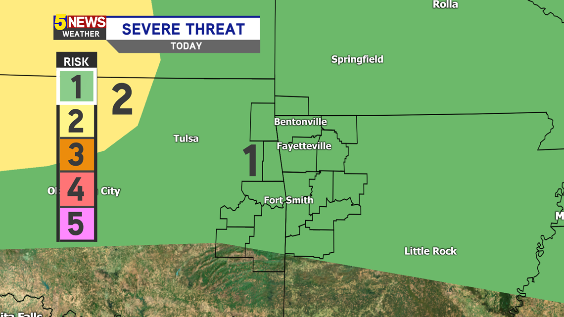
A Level 1 severe risk is in store for us Tuesday morning, thanks to gusty winds that are possible.

-Matt