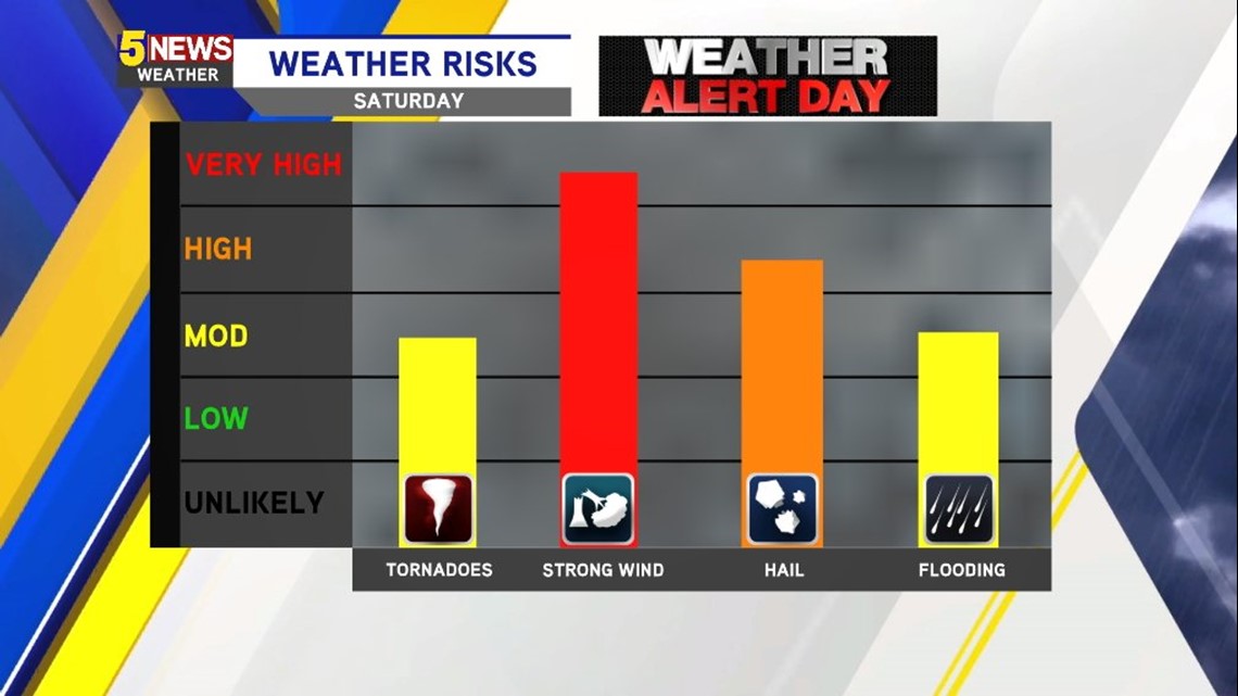
Complicated weather pattern playing out for the next 24 hours. There are two key time-frames to watch for strong to severe thunderstorms. A complex that’s currently underway in Oklahoma will roll east into our area late tonight and into the morning. These storms will mostly pose a risk of damaging winds. As the boundary stalls, the atmosphere will become increasingly unstable with strong to severe thunderstorms redeveloping along a stalled boundary in Eastern Oklahoma and Western Arkansas.

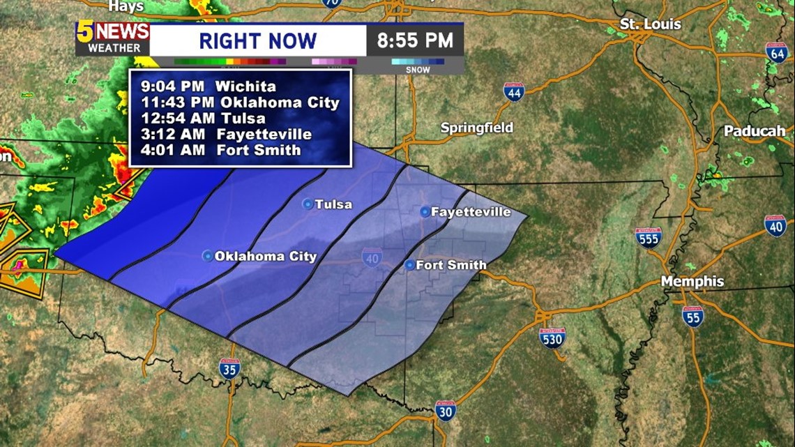
The storms late Friday should arrive in NW Arkansas and the Greater Fort Smith area between 3-4am on Saturday morning. Some of these storms could be on the strong to severe side with damaging winds the main threat.

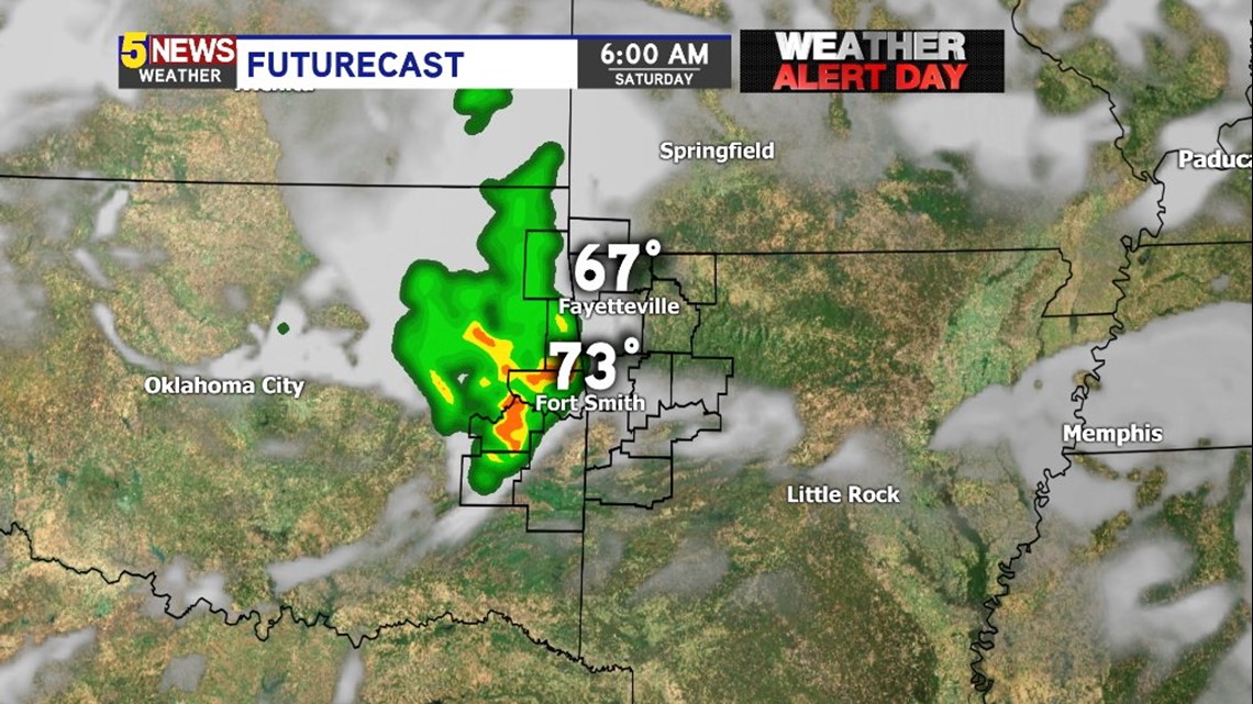
Storms should be ongoing at 6am as the complex weakens moving east into our area.

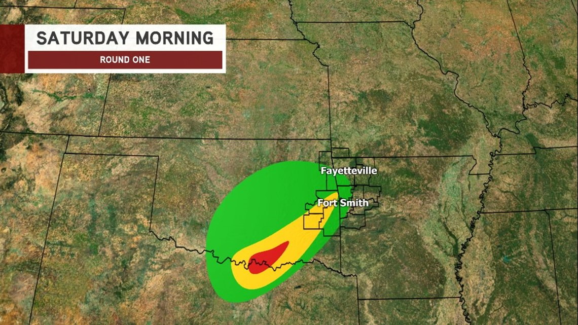
The worst severe weather on Saturday morning should be in SE and South Central Oklahoma; however, a few strong storms will still be possible in our area.

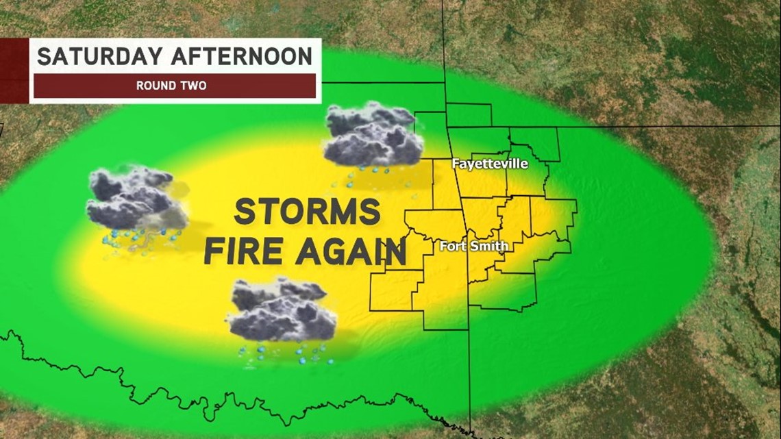
Round two on Saturday afternoon is expected to be stronger as a disturbance moves in from our northwest combined with strong daytime heating along a boundary likely located around I40. These storms are expected to be stronger.

This is a look at the threats for tomorrow on Saturday afternoon and evening.
Stay tuned for updates at the situation evolves and unfolds.
-Garrett