
WEATHER ALERT DAY CANCELLED
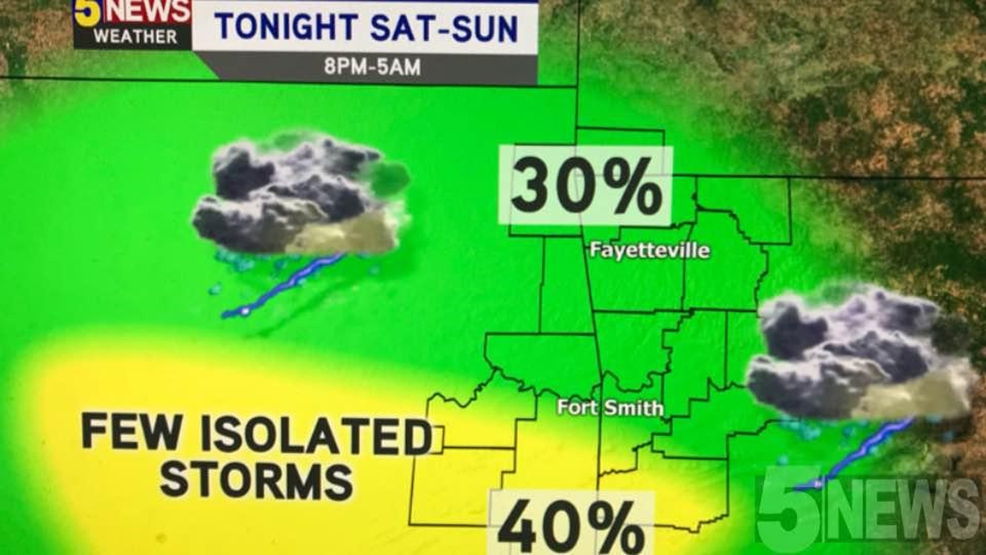
What a tricky forecast it has been for the weekend! Friday night's storms pushed a major surface boundary further south, closer to the Red River. In addition, they left quite a few clouds for the River Valley Saturday morning and afternoon. These are the reasons why the firing zone for storms has moved to our south and west. There is only about a 10-20% chance for an isolated shower or storm until sunset on Saturday. More storms are expected tonight, but will not be as severe.
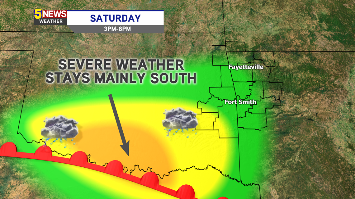
SATURDAY AFTERNOON: Our storm chances will remain low, as the surface boundary was pushed too far south from Friday night's storms.

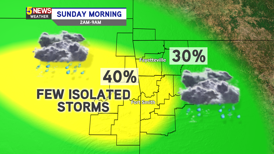
SATURDAY NIGHT - SUNDAY MORNING:
The low-level jet will intensify tonight, bringing more warm and humid air to fuel a few thunderstorms. A couple may be severe, with some isolated hail and gusty winds. These do NOT look as gnarly as earlier predicted, as this wave will move in most likely overnight and as you're waking up Sunday morning.

This forecast has been quickly changing. We will continue to provide updates as more information comes in. Until then, expect an isolated shower or storm throughout the weekend and into early Monday morning.
-Matt