The first round of severe weather moved through early this morning. This complex shifted further south and dumped 0.5″ to 1.5″ of rain in Sebastian, Logan, Scott, and Le Flore counties. Damaging and gusty winds also occurred within the leading edge of the storm. Most of the rain has fizzled out, but a second round of severe weather is on the way.
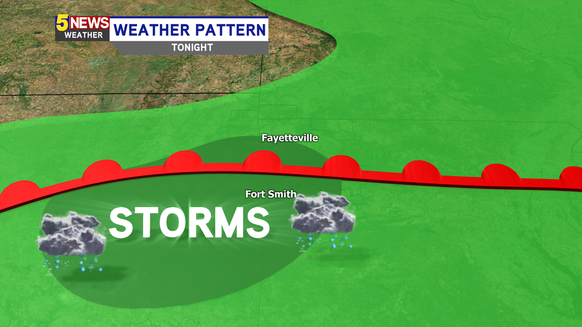
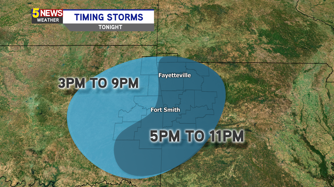
The second key time-frame to watch is later this afternoon into this evening. The boundary has since stalled over Eastern Oklahoma and Western Arkansas providing an increasingly unstable environment. Strong to severe thunderstorms will redevelop along this boundary (near I-40).

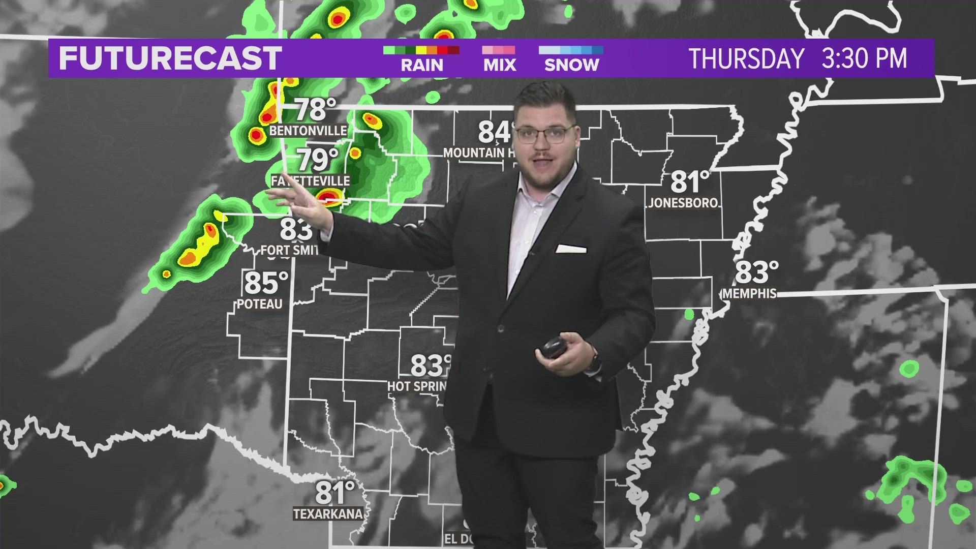
The storms this afternoon should begin to pop-up in the River Valley, and parts of Northwest Arkansas, as early as 3PM.

The severity of the storms will increase into the evening, with the greatest threat after 7PM.

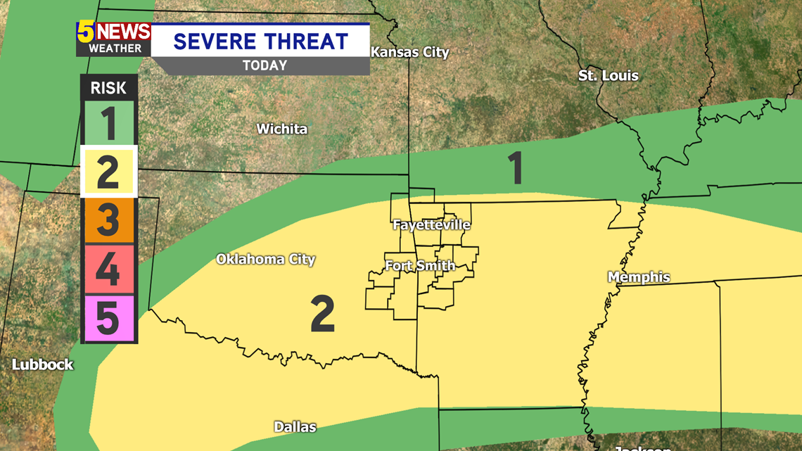
The greatest risk for severe weather is a Level 2 out of 5. This indicates there will be a greater risk for these storms to turn severe. This second round of storms will be stronger than the complex this morning.

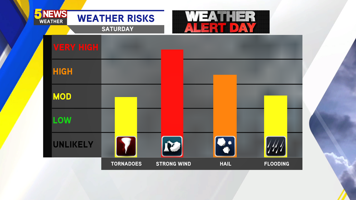
These are the threats for this afternoon into this evening.

Stay tuned for updates as the situation evolves.
-Sabrina