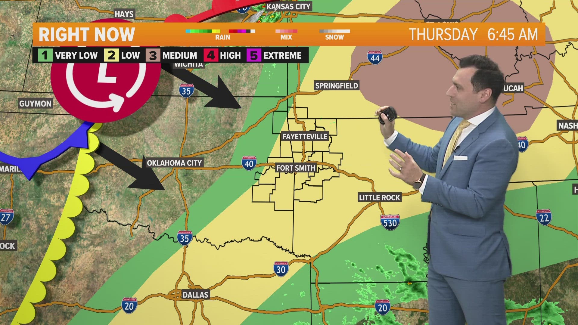
As conditions destabilize in the region, more showers and storms are expected to spark in eastern Oklahoma and eventually move through western Arkansas.

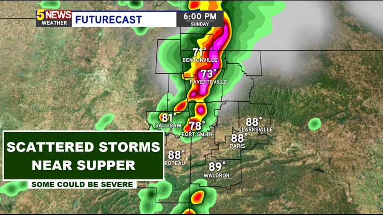
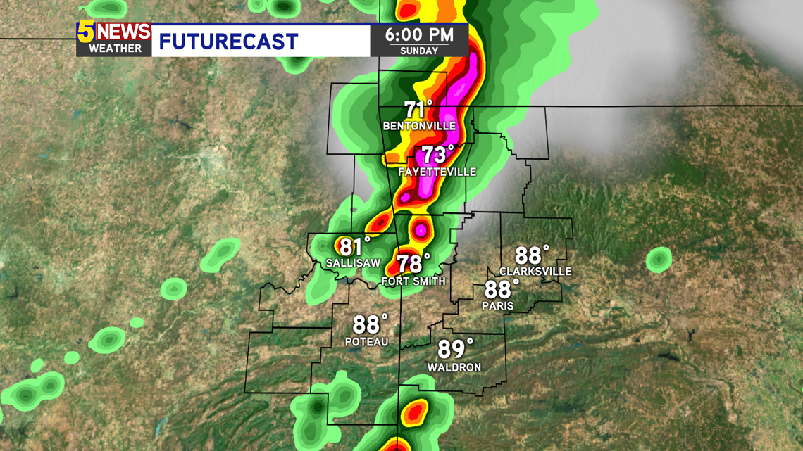
Best timing will be from 5PM to 9PM. After that, storm chances reduce significantly.
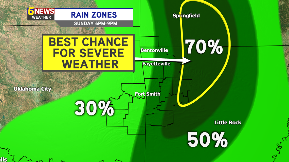
WORSE CASE SCENARIO: A line of severe storms will march through, especially Northwest Arkansas.
BEST CASE SCENARIO: Showers may strengthen with a few rumbles of thunder as they sweep through. Not everyone may get wet, with better prospects north of I-40.
Futurecast 6PM

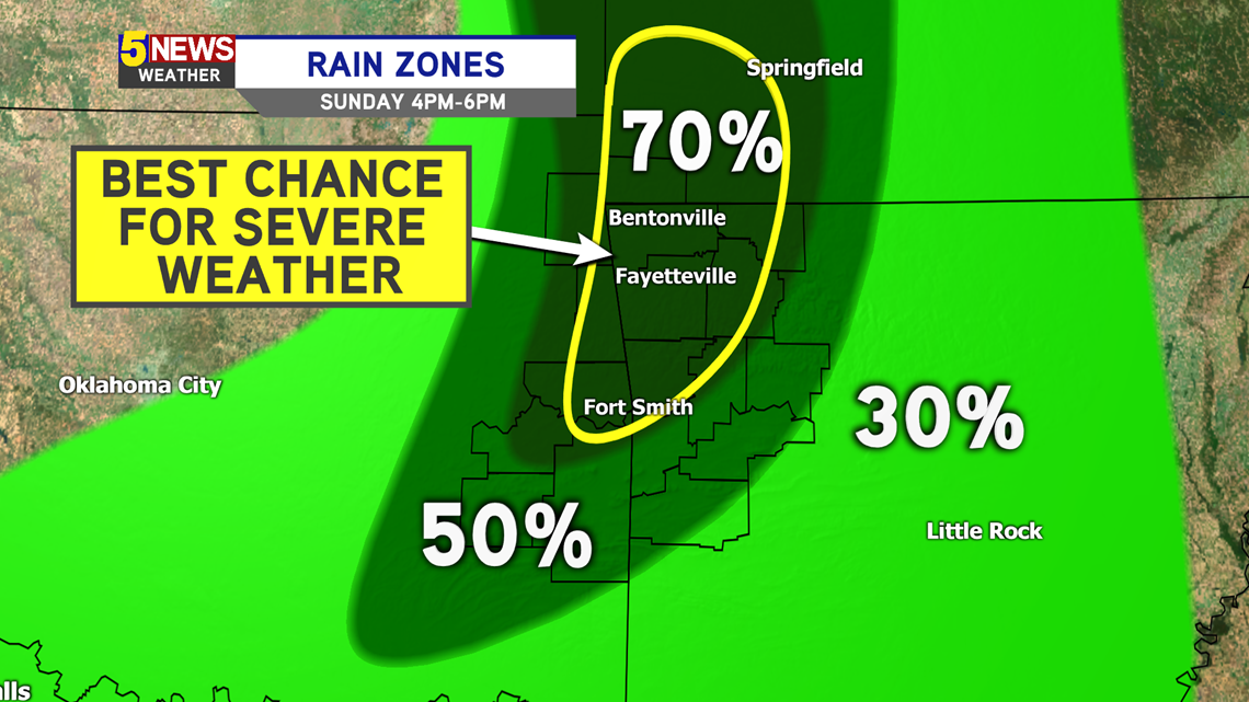
Rain Zones 4PM-6PM

Rain Zones 6PM-9PM

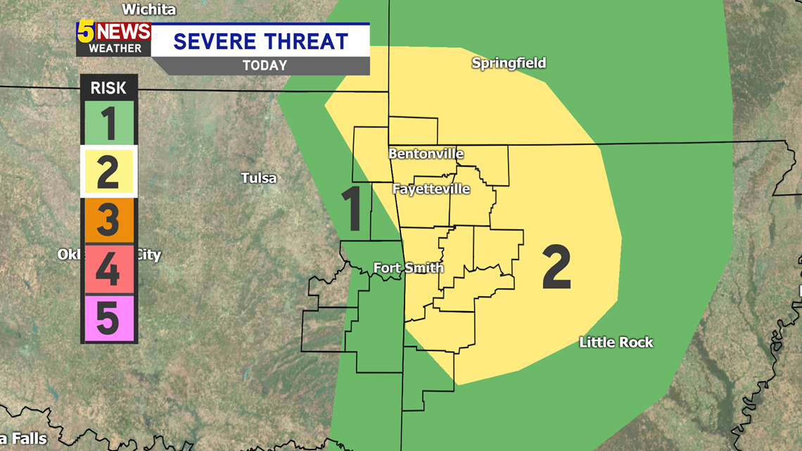
A Level 2 (out of 5) Severe Risk has been issued for much of Northwest Arkansas and in the River Valley mainly east of Fort Smith.

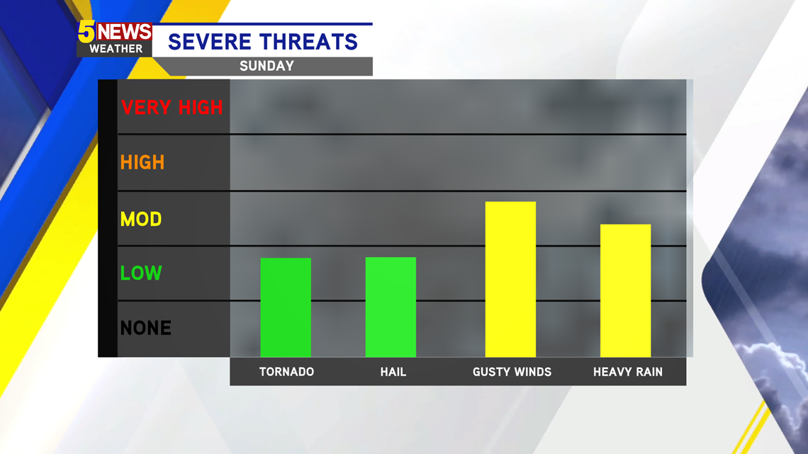
We will have to look out for mainly gusty winds. Any heavy rain in a small period of time could cause some localized flash flooding. Tornado chances are not zero, but still fairly unlikely. There is some spin to the atmosphere, but it's mainly in the mid-levels.

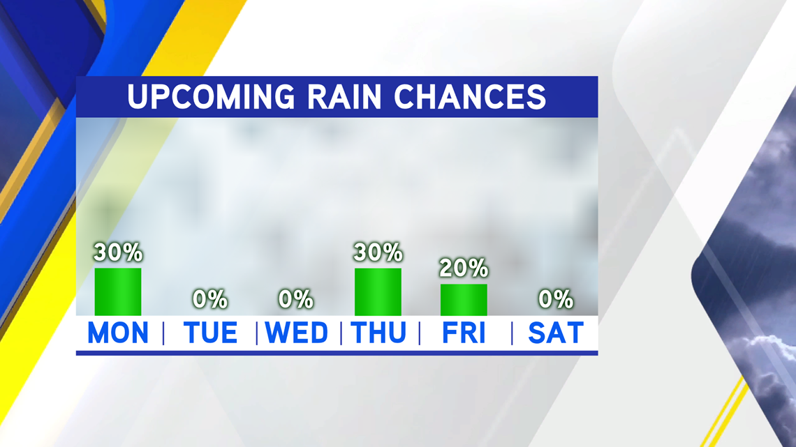
Expect much drier conditions this upcoming week. There could be a lingering sprinkle Monday. In addition, a weak system may pass through Thursday, giving us the chance for a few showers and a rumble of thunder.

-Matt