
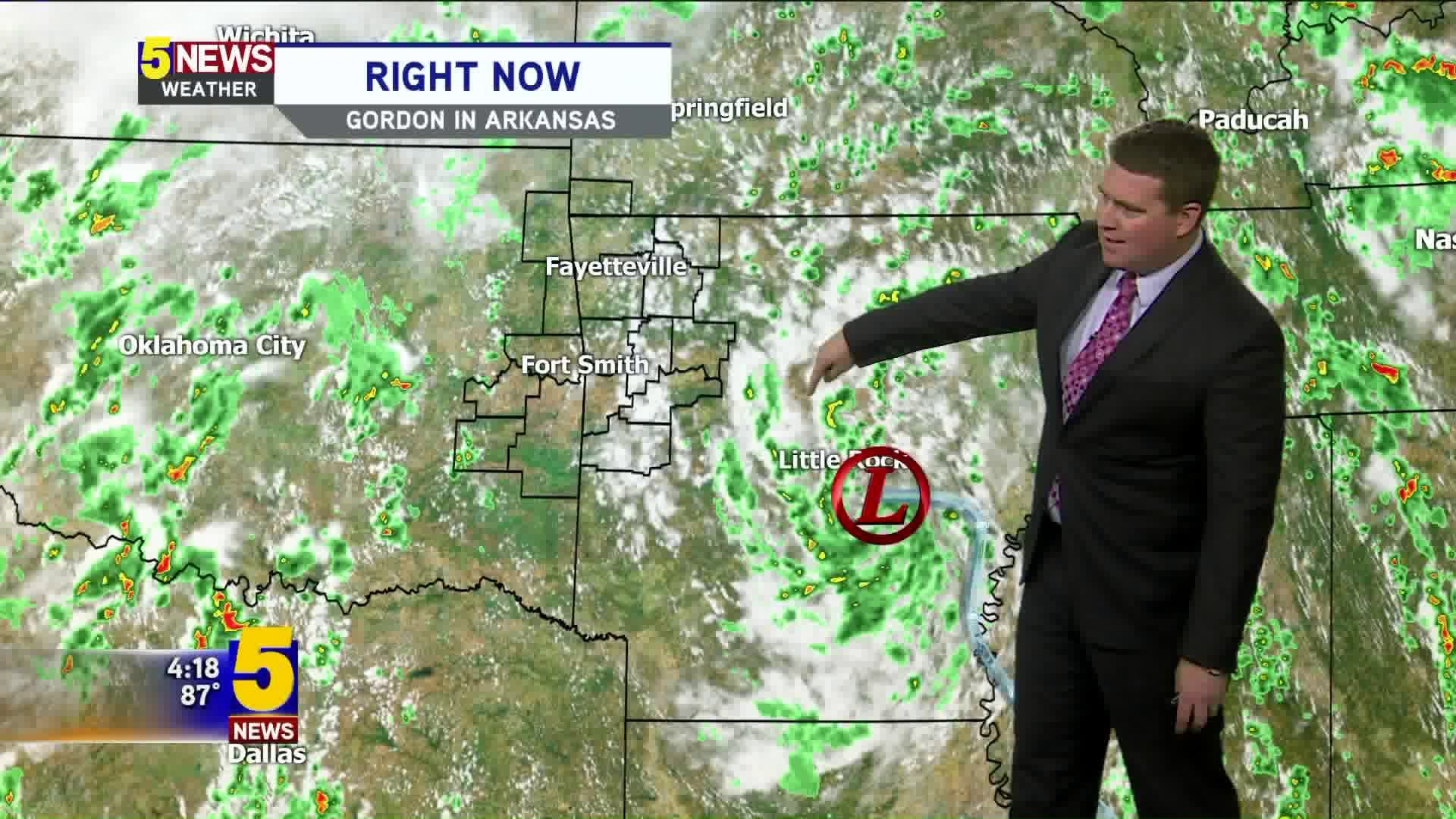
The remnants of Tropical Storm Gordon will bring scattered showers to our area on Friday into Saturday. The highest rainfall totals will the system will occur east of our area and closer to central and northeast Arkansas.

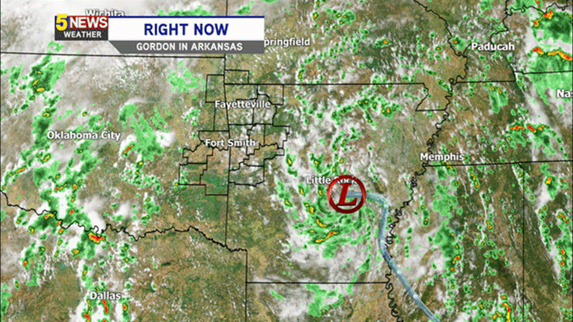
This is how Gordon's remnants looks on Thursday. Expect a similar scenario for Friday with intermittent showers during the afternoon and evening. It will not be a washout and won't be a nonstop rain event. Flash Flooding is unlikely in our area but will be possible to our east.

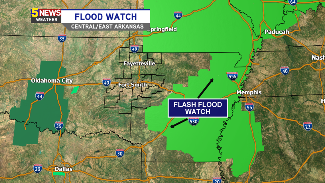
A Flash Flood Watch has been issued for Central/Eastern Arkansas.

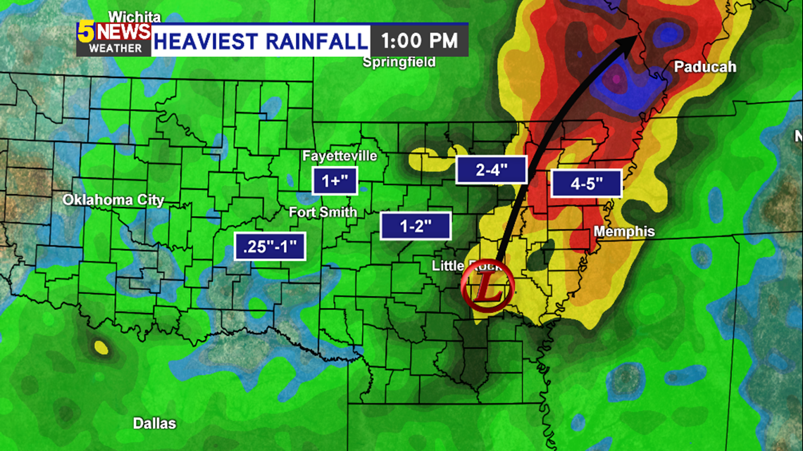
Through 1pm on Saturday, the highest rainfall totals will occur in the central and northeast part of the state.
Locally, many of us will pick up around 1" of rain.

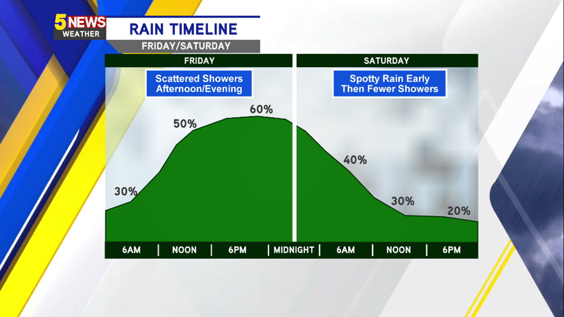
As far as the timeline goes... The best chance for rain will be from around Noon Friday to 10pm Friday. This is when the rain will be most widespread. We expect some of the coverage to diminish with the loss of daytime heating late Friday however a few spotty showers will be possible.
Spotty rain should continue into Saturday but will gradually come to an end as the low moves northeast and out of our area.

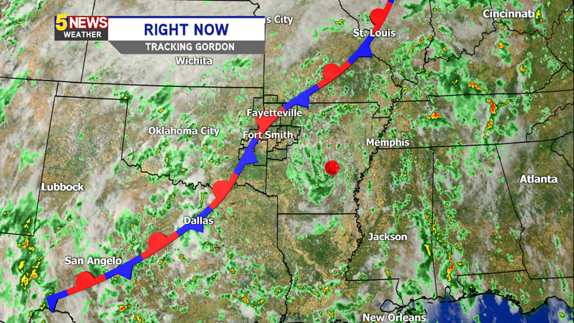
A stationary front has been located across Oklahoma for the last several days. It will gradually get a nudge to the east and move across our area. It's this front which is causing Gordon to lift to the northeast.
The front will also bring seasonable temperatures to the area for next week with highs in the 70s and lows in the 50s to near 60.
-Garrett